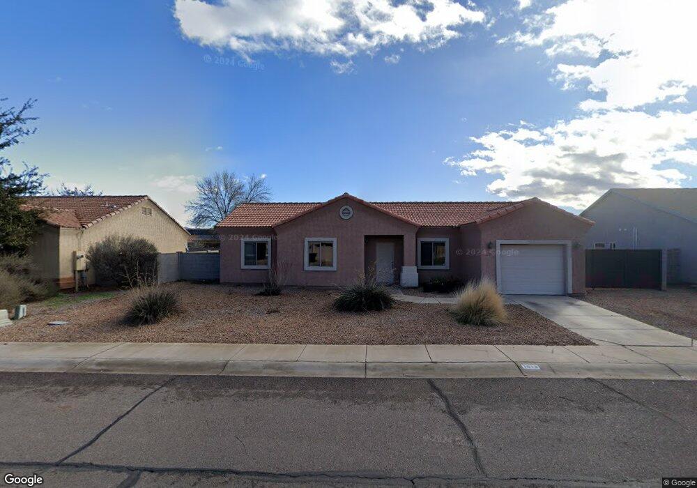
1513 N Cota Ln Thatcher, AZ 85552
Estimated Value: $255,777 - $304,000
--
Bed
--
Bath
1,268
Sq Ft
$224/Sq Ft
Est. Value
About This Home
This home is located at 1513 N Cota Ln, Thatcher, AZ 85552 and is currently estimated at $283,444, approximately $223 per square foot. 1513 N Cota Ln is a home located in Graham County with nearby schools including Jack Daley Primary School, Thatcher Elementary School, and Thatcher Middle School.
Ownership History
Date
Name
Owned For
Owner Type
Purchase Details
Closed on
Aug 30, 2018
Sold by
Moore Jeffrey R and Moore Nicole N
Bought by
Dusty Ridge Llc
Current Estimated Value
Purchase Details
Closed on
Jul 26, 2011
Sold by
Clark Gordon and Clark Evelyn
Bought by
Moore Jeffrey Reed and Moore Nicole Nelson
Home Financials for this Owner
Home Financials are based on the most recent Mortgage that was taken out on this home.
Original Mortgage
$88,000
Interest Rate
4.46%
Mortgage Type
New Conventional
Purchase Details
Closed on
Sep 23, 2008
Sold by
Clark Gordon
Bought by
Clark Gordon and Clark Evelyn
Home Financials for this Owner
Home Financials are based on the most recent Mortgage that was taken out on this home.
Original Mortgage
$147,947
Interest Rate
6.49%
Mortgage Type
FHA
Create a Home Valuation Report for This Property
The Home Valuation Report is an in-depth analysis detailing your home's value as well as a comparison with similar homes in the area
Home Values in the Area
Average Home Value in this Area
Purchase History
| Date | Buyer | Sale Price | Title Company |
|---|---|---|---|
| Dusty Ridge Llc | -- | None Available | |
| Moore Jeffrey Reed | -- | Pioneer Title Agency | |
| Clark Gordon | -- | Pioneer Title Agency | |
| Clark Gordon | $149,900 | Pioneer Title Agency | |
| Clark Gordon | -- | Pioneer Title Agency |
Source: Public Records
Mortgage History
| Date | Status | Borrower | Loan Amount |
|---|---|---|---|
| Previous Owner | Moore Jeffrey Reed | $88,000 | |
| Previous Owner | Clark Gordon | $147,947 |
Source: Public Records
Tax History Compared to Growth
Tax History
| Year | Tax Paid | Tax Assessment Tax Assessment Total Assessment is a certain percentage of the fair market value that is determined by local assessors to be the total taxable value of land and additions on the property. | Land | Improvement |
|---|---|---|---|---|
| 2026 | $1,051 | -- | -- | -- |
| 2025 | $1,051 | $17,419 | $1,774 | $15,645 |
| 2024 | $1,035 | $17,705 | $1,795 | $15,910 |
| 2023 | $1,035 | $14,707 | $1,795 | $12,912 |
| 2022 | $1,014 | $13,197 | $1,794 | $11,403 |
| 2021 | $1,119 | $0 | $0 | $0 |
| 2020 | $1,365 | $0 | $0 | $0 |
| 2019 | $1,404 | $0 | $0 | $0 |
| 2018 | $1,335 | $0 | $0 | $0 |
| 2017 | $1,080 | $0 | $0 | $0 |
| 2016 | $1,095 | $0 | $0 | $0 |
| 2015 | $1,006 | $0 | $0 | $0 |
Source: Public Records
Map
Nearby Homes
- 3541 Barbara Ln
- 1532 N Porter Ln
- 1672 N Eloisa Ln
- 1867 N Eloisa Ln
- 3996 W Main St
- 508 Eagle Meadow Loop
- 4087 Cotton Valley Cir
- 417 N 1st Ave
- 2926 Joshua
- 2889 Eagle Dr
- 2925 Eagle Dr
- 2913 Eagle Dr
- 2901 Eagle Dr
- 2914 W Johnny Dr
- 2926 W Johnny Dr
- 2889 W Johnny Dr
- 2901 W Johnny Dr
- 2913 W Johnny Dr
- 0 Tbd Parcels 104-23-032l & 032k Unit 22514614
- 395 S Coleman Ln
- 1493 N Cota Ln
- 1533 N Cota Ln
- 1493 Cota Ln
- 1512 N Eloisa Ln
- 1532 N Eloisa Ln
- 1492 N Eloisa Ln
- 1512 N Cota Ln
- 1555 N Cota Ln
- 1532 N Cota Ln
- 1492 Cota Ln
- 1554 N Eloisa Ln
- 1554 N Cota Ln
- 3555 Barbara Ln
- 1573 N Cota Ln
- 1513 N Eloisa Ln
- 1533 N Eloisa Ln
- 1493 N Eloisa Ln
- 1572 N Eloisa Ln
- 3555 W 2nd St
- 1555 N Eloisa Ln