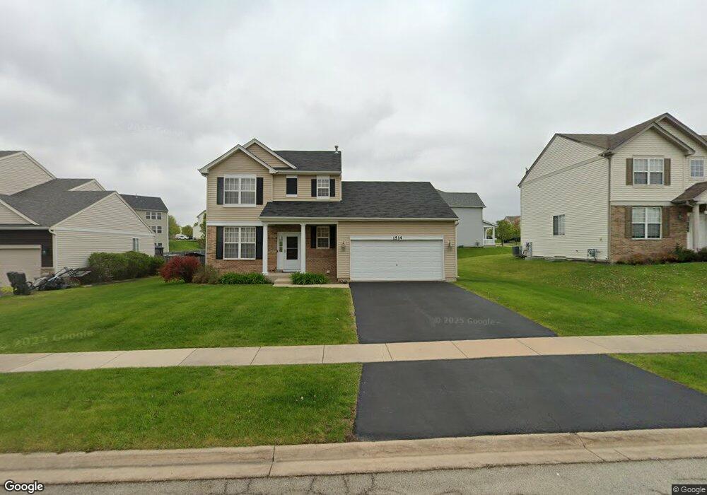
1514 Balboa Dr Minooka, IL 60447
North Minooka NeighborhoodEstimated Value: $335,517 - $361,000
Studio
1
Bath
1,760
Sq Ft
$198/Sq Ft
Est. Value
About This Home
This home is located at 1514 Balboa Dr, Minooka, IL 60447 and is currently estimated at $349,172, approximately $198 per square foot. 1514 Balboa Dr is a home located in Kendall County with nearby schools including Jones Elementary School, Minooka Junior High School, and Minooka Intermediate School.
Ownership History
Date
Name
Owned For
Owner Type
Purchase Details
Closed on
Aug 27, 2007
Sold by
Summerfield Venture Llc
Bought by
Ruebensam Edward G and Rubino Lynn M
Current Estimated Value
Home Financials for this Owner
Home Financials are based on the most recent Mortgage that was taken out on this home.
Original Mortgage
$220,001
Outstanding Balance
$140,852
Interest Rate
6.79%
Mortgage Type
FHA
Estimated Equity
$208,320
Create a Home Valuation Report for This Property
The Home Valuation Report is an in-depth analysis detailing your home's value as well as a comparison with similar homes in the area
Home Values in the Area
Average Home Value in this Area
Purchase History
| Date | Buyer | Sale Price | Title Company |
|---|---|---|---|
| Ruebensam Edward G | $223,500 | North American Title Co |
Source: Public Records
Mortgage History
| Date | Status | Borrower | Loan Amount |
|---|---|---|---|
| Open | Ruebensam Edward G | $220,001 |
Source: Public Records
Tax History
| Year | Tax Paid | Tax Assessment Tax Assessment Total Assessment is a certain percentage of the fair market value that is determined by local assessors to be the total taxable value of land and additions on the property. | Land | Improvement |
|---|---|---|---|---|
| 2024 | $8,249 | $105,199 | $15,425 | $89,774 |
| 2023 | $6,627 | $96,213 | $14,690 | $81,523 |
| 2022 | $6,627 | $83,943 | $13,990 | $69,953 |
| 2021 | $6,493 | $80,229 | $14,203 | $66,026 |
| 2020 | $6,432 | $76,630 | $13,566 | $63,064 |
| 2019 | $6,477 | $75,230 | $13,318 | $61,912 |
| 2018 | $6,257 | $73,588 | $13,027 | $60,561 |
| 2017 | $6,137 | $69,321 | $13,027 | $56,294 |
| 2016 | $5,708 | $64,413 | $12,866 | $51,547 |
| 2015 | $5,433 | $61,130 | $12,210 | $48,920 |
| 2014 | -- | $59,235 | $12,210 | $47,025 |
| 2013 | -- | $59,235 | $12,210 | $47,025 |
Source: Public Records
Map
Nearby Homes
- 1510 Balboa Dr
- 1308 Kettleson Dr
- 2050 Isabella Ln
- 194 acres W Holt Rd
- Lot 1 Minooka Ridge & Jones Rd
- 2041 Isabella Ln
- 2200 Holt Rd
- LOT 1 Bob Blair Rd
- 701 Davidson Dr Unit B
- 300 Arrowhead Dr
- 405 W Mondamin St
- 214 Deerpath Dr
- 204 N Wabasso St
- 105 Blackhawk Dr
- 2037 Isabella Ln
- 1133 Coneflower Ct
- 6010-6060 E Minooka Rd
- 706 O Toole Dr
- LOT 28 O Toole Dr
- 517 Rivers Edge Dr
- 1518 Balboa Dr
- 712 Avalon Way Unit 2A
- 1522 Balboa Dr
- 708 Avalon Way
- 1513 Balboa Dr
- 1523 Elysium Dr Unit 2B
- 1517 Balboa Dr
- 1509 Balboa Dr
- 1526 Balboa Dr
- 1521 Balboa Dr
- 721 Avalon Way
- 717 Avalon Way
- 1527 Elysium Dr
- 1519 Elysium Dr Unit 2B
- 704 Avalon Way
- 725 Avalon Way
- 713 Avalon Way
- 1525 Balboa Dr
- 1530 Balboa Dr
- 729 Avalon Way
Your Personal Tour Guide
Ask me questions while you tour the home.