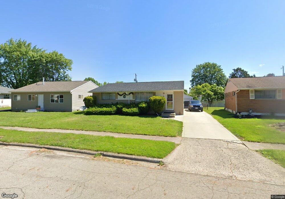
1514 Picard Rd Columbus, OH 43227
Linwood NeighborhoodEstimated Value: $197,264 - $251,000
3
Beds
1
Bath
1,100
Sq Ft
$196/Sq Ft
Est. Value
About This Home
This home is located at 1514 Picard Rd, Columbus, OH 43227 and is currently estimated at $215,066, approximately $195 per square foot. 1514 Picard Rd is a home located in Franklin County with nearby schools including Scottwood Elementary School, Johnson Park Middle School, and Walnut Ridge High School.
Ownership History
Date
Name
Owned For
Owner Type
Purchase Details
Closed on
Jan 5, 2022
Sold by
Nitin Chhoda
Bought by
Chhoda Nitin and Gulrajani Ritika
Current Estimated Value
Purchase Details
Closed on
Jan 8, 2019
Sold by
Cth Group Llc
Bought by
Chhoda Nitin
Home Financials for this Owner
Home Financials are based on the most recent Mortgage that was taken out on this home.
Original Mortgage
$78,750
Interest Rate
4.8%
Mortgage Type
New Conventional
Purchase Details
Closed on
Nov 14, 2018
Sold by
Billing Jay and Billing Judy
Bought by
Cth Group Llc
Home Financials for this Owner
Home Financials are based on the most recent Mortgage that was taken out on this home.
Original Mortgage
$78,750
Interest Rate
4.8%
Mortgage Type
New Conventional
Purchase Details
Closed on
Sep 27, 2013
Sold by
B J Peterson Realty Inc
Bought by
Biling Jay
Purchase Details
Closed on
Jun 2, 1988
Create a Home Valuation Report for This Property
The Home Valuation Report is an in-depth analysis detailing your home's value as well as a comparison with similar homes in the area
Home Values in the Area
Average Home Value in this Area
Purchase History
| Date | Buyer | Sale Price | Title Company |
|---|---|---|---|
| Chhoda Nitin | -- | Barile Franco M | |
| Chhoda Nitin | $105,000 | Pm Title Box | |
| Cth Group Llc | $73,000 | Pm Ttitle Box | |
| Biling Jay | $22,500 | None Available | |
| -- | $14,100 | -- |
Source: Public Records
Mortgage History
| Date | Status | Borrower | Loan Amount |
|---|---|---|---|
| Previous Owner | Chhoda Nitin | $78,750 | |
| Previous Owner | Cth Group Llc | $80,000 |
Source: Public Records
Tax History Compared to Growth
Tax History
| Year | Tax Paid | Tax Assessment Tax Assessment Total Assessment is a certain percentage of the fair market value that is determined by local assessors to be the total taxable value of land and additions on the property. | Land | Improvement |
|---|---|---|---|---|
| 2024 | $2,777 | $60,590 | $13,270 | $47,320 |
| 2023 | $2,742 | $60,585 | $13,265 | $47,320 |
| 2022 | $1,864 | $35,070 | $7,000 | $28,070 |
| 2021 | $2,022 | $35,070 | $7,000 | $28,070 |
| 2020 | $1,870 | $35,070 | $7,000 | $28,070 |
| 2019 | $1,402 | $22,550 | $5,850 | $16,700 |
| 2018 | $1,335 | $22,550 | $5,850 | $16,700 |
| 2017 | $1,399 | $22,550 | $5,850 | $16,700 |
| 2016 | $1,396 | $20,550 | $5,040 | $15,510 |
| 2015 | $1,271 | $20,550 | $5,040 | $15,510 |
| 2014 | $1,274 | $20,550 | $5,040 | $15,510 |
| 2013 | $698 | $22,820 | $5,600 | $17,220 |
Source: Public Records
Map
Nearby Homes
- 3566 Seabrook Ave
- 3325 E Deshler Ave
- 1664 Barnett Rd
- 3246 E Deshler Ave
- 1624 Miltwood Rd
- 1304 Byron Ave
- 1836 Penfield Ct S
- 1271 S Weyant Ave
- 3861 Gilroy Rd
- 3084 Clermont Rd
- 1721 Bostwick Rd
- 3563 Astor Ave
- 1252 Carolwood Ave
- 1294 Dellwood Ave
- 1656 Vilardo Ln
- 3598 Astor Ave
- 3325 Towers Ct S
- 1778 Quigley Rd
- 3339 Towers Ct N
- 1640 Striebel Rd