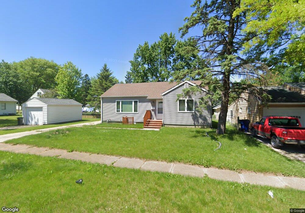
1515 E Mitchell Ave Waterloo, IA 50702
Liberty Park NeighborhoodEstimated Value: $137,636 - $171,000
2
Beds
1
Bath
982
Sq Ft
$156/Sq Ft
Est. Value
About This Home
This home is located at 1515 E Mitchell Ave, Waterloo, IA 50702 and is currently estimated at $153,159, approximately $155 per square foot. 1515 E Mitchell Ave is a home located in Black Hawk County with nearby schools including Kittrell Elementary School, Hoover Middle School, and West High School.
Ownership History
Date
Name
Owned For
Owner Type
Purchase Details
Closed on
May 21, 2013
Sold by
Iowa Heartland Habitat For Humanity
Bought by
Parkes Jazzmen M
Current Estimated Value
Home Financials for this Owner
Home Financials are based on the most recent Mortgage that was taken out on this home.
Original Mortgage
$10,000
Outstanding Balance
$4,222
Interest Rate
3.38%
Mortgage Type
Purchase Money Mortgage
Estimated Equity
$148,937
Purchase Details
Closed on
May 2, 2012
Sold by
Hansen Blanche C
Bought by
Iowa Heartland Habitat For Humanity
Create a Home Valuation Report for This Property
The Home Valuation Report is an in-depth analysis detailing your home's value as well as a comparison with similar homes in the area
Home Values in the Area
Average Home Value in this Area
Purchase History
| Date | Buyer | Sale Price | Title Company |
|---|---|---|---|
| Parkes Jazzmen M | $105,000 | None Available | |
| Iowa Heartland Habitat For Humanity | $62,500 | None Available |
Source: Public Records
Mortgage History
| Date | Status | Borrower | Loan Amount |
|---|---|---|---|
| Open | Parkes Jazzmen M | $10,000 | |
| Open | Parkes Jazzmen M | $95,000 |
Source: Public Records
Tax History
| Year | Tax Paid | Tax Assessment Tax Assessment Total Assessment is a certain percentage of the fair market value that is determined by local assessors to be the total taxable value of land and additions on the property. | Land | Improvement |
|---|---|---|---|---|
| 2025 | $2,494 | $137,290 | $20,790 | $116,500 |
| 2024 | $2,494 | $125,160 | $20,790 | $104,370 |
| 2023 | $2,006 | $125,160 | $20,790 | $104,370 |
| 2022 | $1,952 | $100,250 | $20,790 | $79,460 |
| 2021 | $1,880 | $100,250 | $20,790 | $79,460 |
| 2020 | $1,846 | $91,680 | $16,340 | $75,340 |
| 2019 | $1,846 | $91,680 | $16,340 | $75,340 |
| 2018 | $2,044 | $91,680 | $16,340 | $75,340 |
| 2017 | $2,106 | $91,680 | $16,340 | $75,340 |
| 2016 | $2,080 | $91,680 | $16,340 | $75,340 |
| 2015 | $2,080 | $91,680 | $16,340 | $75,340 |
| 2014 | $2,022 | $87,490 | $16,340 | $71,150 |
Source: Public Records
Map
Nearby Homes
- 1219 Hammond Ave
- 1433 Liberty Ave
- 2425 Randolph St
- 1181 E Mitchell Ave
- 1171 Liberty Ave
- 1416 Hawthorne Ave
- 1729 Liberty Ave
- 1746 Patton Ave
- 1141 E Mitchell Ave
- 1600 Forest Ave
- 1714 Easton Ave
- 1802 Easton Ave
- 1103 Easton Ave
- 803 Wisconsin St
- 1115 Hawthorne Ave
- 1811 Forest Ave
- 922 E Mitchell Ave
- 1611 E Ridgeway Ave
- Outlot C E Ridgeway Ave Unit Outlot C
- Outlot B E Ridgeway Ave Unit Outlot B
- 1455 W 11th St
- 1521 E Mitchell Ave
- 1520 E Mitchell Ave
- 1449 W 11th St
- 1527 E Mitchell Ave
- 1501 W 11th St
- 1008 Amherst Ave
- Lot E Mitchell Ave
- 1505 W 11th St
- 1514 Patton Ave
- 1520 Patton Ave
- 1443 W 11th St
- 1533 E Mitchell Ave
- 1511 W 11th St
- 1012 Amherst Ave
- 1526 Patton Ave
- 1433 W 11th St
- 1539 E Mitchell Ave
- 1001 Amherst Ave
- 1456 W 11th St
Your Personal Tour Guide
Ask me questions while you tour the home.