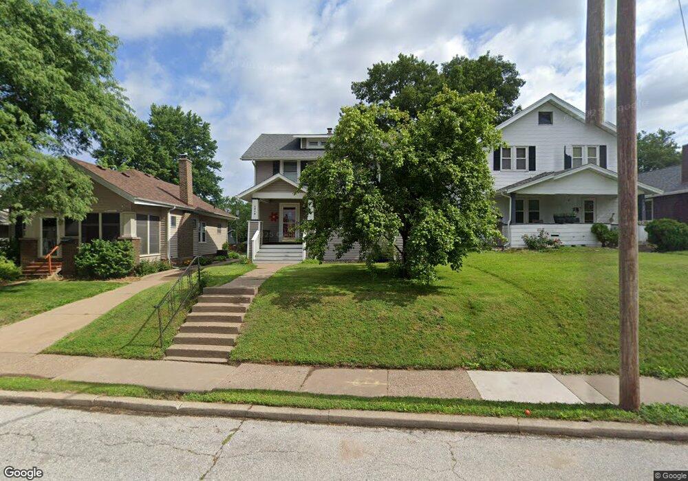
1516 E High St Davenport, IA 52803
Near North Side NeighborhoodEstimated Value: $170,000 - $186,000
3
Beds
2
Baths
1,560
Sq Ft
$112/Sq Ft
Est. Value
About This Home
This home is located at 1516 E High St, Davenport, IA 52803 and is currently estimated at $174,908, approximately $112 per square foot. 1516 E High St is a home located in Scott County with nearby schools including Caverna Elementary School, Casey County Middle School, and Hopkinsville Middle School.
Ownership History
Date
Name
Owned For
Owner Type
Purchase Details
Closed on
Oct 8, 2009
Sold by
Ramos Virginia A and Mcpherson William C
Bought by
Kelly David M
Current Estimated Value
Home Financials for this Owner
Home Financials are based on the most recent Mortgage that was taken out on this home.
Original Mortgage
$95,733
Outstanding Balance
$62,609
Interest Rate
5.19%
Mortgage Type
FHA
Estimated Equity
$112,299
Purchase Details
Closed on
Aug 22, 2005
Sold by
Maher Steven T and Maher Molly J
Bought by
Ramos Virginia A
Home Financials for this Owner
Home Financials are based on the most recent Mortgage that was taken out on this home.
Original Mortgage
$66,500
Interest Rate
7.75%
Mortgage Type
Adjustable Rate Mortgage/ARM
Create a Home Valuation Report for This Property
The Home Valuation Report is an in-depth analysis detailing your home's value as well as a comparison with similar homes in the area
Home Values in the Area
Average Home Value in this Area
Purchase History
| Date | Buyer | Sale Price | Title Company |
|---|---|---|---|
| Kelly David M | $97,500 | None Available | |
| Ramos Virginia A | $95,000 | None Available |
Source: Public Records
Mortgage History
| Date | Status | Borrower | Loan Amount |
|---|---|---|---|
| Open | Kelly David M | $95,733 | |
| Previous Owner | Ramos Virginia A | $66,500 |
Source: Public Records
Tax History Compared to Growth
Tax History
| Year | Tax Paid | Tax Assessment Tax Assessment Total Assessment is a certain percentage of the fair market value that is determined by local assessors to be the total taxable value of land and additions on the property. | Land | Improvement |
|---|---|---|---|---|
| 2025 | $3,219 | $171,350 | $24,120 | $147,230 |
| 2024 | $2,586 | $158,690 | $24,120 | $134,570 |
| 2023 | $3,380 | $158,690 | $24,120 | $134,570 |
| 2022 | $3,262 | $152,600 | $21,930 | $130,670 |
| 2021 | $2,956 | $146,750 | $21,930 | $124,820 |
| 2020 | $3,119 | $132,120 | $21,930 | $110,190 |
| 2019 | $2,818 | $127,240 | $21,930 | $105,310 |
| 2018 | $872 | $127,240 | $21,930 | $105,310 |
| 2017 | $681 | $122,370 | $21,930 | $100,440 |
| 2016 | $2,318 | $114,570 | $0 | $0 |
| 2015 | $2,318 | $113,190 | $0 | $0 |
| 2014 | $2,320 | $113,190 | $0 | $0 |
| 2013 | $2,276 | $0 | $0 | $0 |
| 2012 | -- | $117,490 | $18,110 | $99,380 |
Source: Public Records
Map
Nearby Homes
- 2116 Eastern Ave
- 2125 Eastern Ave
- 2030 Esplanade Ave
- 1626 Esplanade Ave
- 1616 Esplanade Ave
- 2103 E Lombard St
- 1920 Carey Ave
- 1310 Kirkwood Blvd
- 2440 Carey Ave
- 1501 Bridge Ave
- 1021 E Central Park Ave
- 2118 Arlington Ave
- 2438 Tremont Ave
- 1325 Mississippi Ave
- 11 Oak Ln
- 2316 E Pleasant St
- 2734 Bridge Ave
- 1020 E 15th St
- 1815 Belle Ave
- 916 Kirkwood Blvd
- 1514 E High St
- 1522 E High St
- 1526 E High St
- 1506 E High St
- 2111 Mississippi Ave Unit Avenue
- 2111 Mississippi Ave
- 1602 E High St
- 1502 E High St
- 1515 Elm St
- 1606 E High St
- 1511 Elm St
- 1519 Elm St
- 1509 Elm St
- 1523 Elm St
- 1511 E High St
- 1521 E High St
- 1509 E High St
- 1501 Elm St
- 1603 Elm St
- 1525 E High St