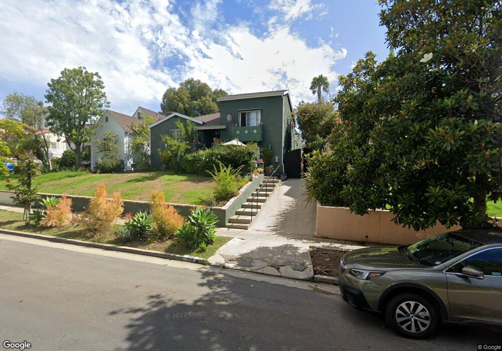
1516 Malcolm Ave Los Angeles, CA 90024
Westwood NeighborhoodEstimated Value: $2,114,000 - $2,757,000
5
Beds
8
Baths
2,400
Sq Ft
$977/Sq Ft
Est. Value
About This Home
This home is located at 1516 Malcolm Ave, Los Angeles, CA 90024 and is currently estimated at $2,345,861, approximately $977 per square foot. 1516 Malcolm Ave is a home located in Los Angeles County with nearby schools including Fairburn Avenue Elementary, Westwood Charter School, and Ralph Waldo Emerson Community Charter Middle School.
Ownership History
Date
Name
Owned For
Owner Type
Purchase Details
Closed on
Apr 8, 2023
Sold by
Lewis David and Lewis Deborah
Bought by
2023 Deborah Aldahl And David Lewis Revocable and Lewis
Current Estimated Value
Purchase Details
Closed on
Apr 1, 2015
Sold by
Lewis David
Bought by
Lewis David and Aldahl Deborah
Purchase Details
Closed on
Apr 5, 2002
Sold by
Creutz Mary G and Mccann Michael C
Bought by
Lewis David
Home Financials for this Owner
Home Financials are based on the most recent Mortgage that was taken out on this home.
Original Mortgage
$525,000
Interest Rate
4.9%
Create a Home Valuation Report for This Property
The Home Valuation Report is an in-depth analysis detailing your home's value as well as a comparison with similar homes in the area
Home Values in the Area
Average Home Value in this Area
Purchase History
| Date | Buyer | Sale Price | Title Company |
|---|---|---|---|
| 2023 Deborah Aldahl And David Lewis Revocable | -- | None Listed On Document | |
| Lewis David | -- | None Available | |
| Lewis David | $760,000 | Equity Title |
Source: Public Records
Mortgage History
| Date | Status | Borrower | Loan Amount |
|---|---|---|---|
| Previous Owner | Lewis David | $525,000 |
Source: Public Records
Tax History Compared to Growth
Tax History
| Year | Tax Paid | Tax Assessment Tax Assessment Total Assessment is a certain percentage of the fair market value that is determined by local assessors to be the total taxable value of land and additions on the property. | Land | Improvement |
|---|---|---|---|---|
| 2025 | $13,470 | $1,122,727 | $816,645 | $306,082 |
| 2024 | $13,470 | $1,100,714 | $800,633 | $300,081 |
| 2023 | $13,212 | $1,079,133 | $784,935 | $294,198 |
| 2022 | $12,600 | $1,057,975 | $769,545 | $288,430 |
| 2021 | $12,440 | $1,037,231 | $754,456 | $282,775 |
| 2019 | $12,067 | $1,006,468 | $732,079 | $274,389 |
| 2018 | $11,971 | $986,734 | $717,725 | $269,009 |
| 2016 | $11,443 | $948,419 | $689,855 | $258,564 |
| 2015 | $11,274 | $934,174 | $679,493 | $254,681 |
| 2014 | $11,312 | $915,876 | $666,183 | $249,693 |
Source: Public Records
Map
Nearby Homes
- 1512 Glendon Ave
- 1645 Malcolm Ave Unit 302
- 10745 Ohio Ave
- 1551 Manning Ave Unit 101
- 10725 Ohio Ave Unit 301
- 10725 Ohio Ave Unit PH2
- 10721 Ohio Ave
- 10687 Wilkins Ave Unit 1
- 10671 Wilkins Ave Unit 5
- 1621 Manning Ave
- 1733 Malcolm Ave Unit 2
- 10633 Kinnard Ave Unit 1
- 10800 Wilshire Blvd Unit 502
- 10800 Wilshire Blvd Unit 1501
- 10800 Wilshire Blvd Unit 1901
- 1601 Hilts Ave Unit 3
- 10790 Wilshire Blvd Unit 1603
- 1440 Veteran Ave Unit 544
- 1440 Veteran Ave Unit 209
- 10750 Wilshire Blvd Unit 203
- 1522 Malcolm Ave
- 1510 Malcolm Ave
- 1506 Malcolm Ave
- 1515 Selby Ave Unit 2
- 1515 Selby Ave
- 1511 Selby Ave
- 1517 Selby Ave
- 1532 Malcolm Ave
- 1500 Malcolm Ave
- 1505 Selby Ave Unit 1509
- 1505 Selby Ave
- 1515 Malcolm Ave
- 1523 Malcolm Ave
- 1501 Selby Ave
- 1511 Malcolm Ave
- 1533 Selby Ave
- 1527 Malcolm Ave
- 1507 Malcolm Ave
- 1531 Malcolm Ave
- 10751 Holman Ave Unit 4