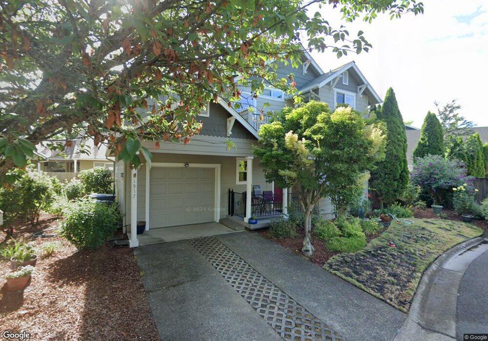
1517 Bogart Ln Eugene, OR 97401
Harlow NeighborhoodEstimated Value: $473,493 - $560,000
3
Beds
2
Baths
1,442
Sq Ft
$351/Sq Ft
Est. Value
About This Home
This home is located at 1517 Bogart Ln, Eugene, OR 97401 and is currently estimated at $506,123, approximately $350 per square foot. 1517 Bogart Ln is a home located in Lane County with nearby schools including Holt Elementary School, Monroe Middle School, and Sheldon High School.
Ownership History
Date
Name
Owned For
Owner Type
Purchase Details
Closed on
Aug 30, 2016
Sold by
Harper Mary Pat
Bought by
Harper Mary Pat and Mary Pat Harper Trust
Current Estimated Value
Purchase Details
Closed on
Jun 13, 2016
Sold by
Harper Mary Pat
Bought by
Harper Mary Pat
Purchase Details
Closed on
Nov 14, 1997
Sold by
Adkins Mark L
Bought by
Robison Charles W and Harper Mary Pat
Home Financials for this Owner
Home Financials are based on the most recent Mortgage that was taken out on this home.
Original Mortgage
$129,600
Outstanding Balance
$20,548
Interest Rate
7.3%
Estimated Equity
$485,575
Create a Home Valuation Report for This Property
The Home Valuation Report is an in-depth analysis detailing your home's value as well as a comparison with similar homes in the area
Home Values in the Area
Average Home Value in this Area
Purchase History
| Date | Buyer | Sale Price | Title Company |
|---|---|---|---|
| Harper Mary Pat | -- | None Available | |
| Harper Mary Pat | -- | None Available | |
| Robison Charles W | $162,000 | Cascade Title Co |
Source: Public Records
Mortgage History
| Date | Status | Borrower | Loan Amount |
|---|---|---|---|
| Open | Robison Charles W | $129,600 |
Source: Public Records
Tax History Compared to Growth
Tax History
| Year | Tax Paid | Tax Assessment Tax Assessment Total Assessment is a certain percentage of the fair market value that is determined by local assessors to be the total taxable value of land and additions on the property. | Land | Improvement |
|---|---|---|---|---|
| 2025 | $5,198 | $266,768 | -- | -- |
| 2024 | $5,133 | $258,999 | -- | -- |
| 2023 | $5,133 | $251,456 | $0 | $0 |
| 2022 | $4,809 | $244,133 | $0 | $0 |
| 2021 | $4,517 | $237,023 | $0 | $0 |
| 2020 | $4,533 | $230,120 | $0 | $0 |
| 2019 | $4,378 | $223,418 | $0 | $0 |
| 2018 | $4,036 | $210,593 | $0 | $0 |
| 2017 | $3,805 | $210,593 | $0 | $0 |
| 2016 | $3,624 | $204,459 | $0 | $0 |
| 2015 | $3,492 | $198,504 | $0 | $0 |
| 2014 | $3,430 | $192,722 | $0 | $0 |
Source: Public Records
Map
Nearby Homes
- 0 Sprig Ln Unit Lot 3
- 0 Sprig Ln Unit Lot 3 766109892
- 0 Sprig Ln Unit Lot 6 156455067
- 1491 Victorian Way
- 1395 Bogart Ln
- 3090 Willakenzie Rd
- 1755 Kings St N
- 3387 Winchester Way
- 3192 Queens East St
- 1683 Victorian Way
- 1794 Kings St N
- 2925 Van Ave
- 1270 Calvin St
- 1854 Cambridge Oaks Dr
- 3176 Kentwood Dr
- 1277 Arcadia Dr
- 1097 Leigh St
- 1927 Best Ln
- 1038 President St
- 3594 Sussex St
- 1519 Bogart Ln
- 3224 Willakenzie Rd
- 1515 Bogart Ln
- 3226 Willakenzie Rd
- 1465 Barrington Ave
- 1471 Barrington Ave
- 3228 Willakenzie Rd
- 1513 Bogart Ln
- 1459 Barrington Ave
- 3230 Willakenzie Rd
- 1544 Victorian Way
- 1522 Victorian Way
- 3222 Willakenzie Rd
- 1477 Barrington Ave
- 1511 Bogart Ln
- 3232 Willakenzie Rd
- 3220 Willakenzie Rd
- 1481 Barrington Ave
- 1453 Barrington Ave
- 3218 Willakenzie Rd