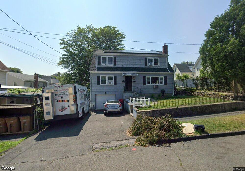
152 Maple Ave Unit 2ND F Stamford, CT 06902
The Cove NeighborhoodEstimated Value: $737,458 - $946,000
2
Beds
1
Bath
1,000
Sq Ft
$826/Sq Ft
Est. Value
About This Home
This home is located at 152 Maple Ave Unit 2ND F, Stamford, CT 06902 and is currently estimated at $825,615, approximately $825 per square foot. 152 Maple Ave Unit 2ND F is a home located in Fairfield County with nearby schools including Toquam Magnet School, Rippowam Middle School, and Stamford High School.
Ownership History
Date
Name
Owned For
Owner Type
Purchase Details
Closed on
Feb 12, 2021
Sold by
Palala Joseph Est and Margarone
Bought by
Islam Md A
Current Estimated Value
Home Financials for this Owner
Home Financials are based on the most recent Mortgage that was taken out on this home.
Original Mortgage
$538,074
Outstanding Balance
$480,831
Interest Rate
2.65%
Mortgage Type
FHA
Estimated Equity
$344,784
Purchase Details
Closed on
Mar 12, 2018
Sold by
Palaia Michael
Bought by
Palaia Josephine
Create a Home Valuation Report for This Property
The Home Valuation Report is an in-depth analysis detailing your home's value as well as a comparison with similar homes in the area
Home Values in the Area
Average Home Value in this Area
Purchase History
| Date | Buyer | Sale Price | Title Company |
|---|---|---|---|
| Islam Md A | $548,000 | None Available | |
| Islam Md A | $548,000 | None Available | |
| Palaia Josephine | -- | -- | |
| Palaia Josephine | -- | -- |
Source: Public Records
Mortgage History
| Date | Status | Borrower | Loan Amount |
|---|---|---|---|
| Open | Islam Md A | $538,074 | |
| Closed | Islam Md A | $538,074 |
Source: Public Records
Tax History Compared to Growth
Tax History
| Year | Tax Paid | Tax Assessment Tax Assessment Total Assessment is a certain percentage of the fair market value that is determined by local assessors to be the total taxable value of land and additions on the property. | Land | Improvement |
|---|---|---|---|---|
| 2025 | $10,212 | $426,940 | $192,920 | $234,020 |
| 2024 | $9,973 | $426,940 | $192,920 | $234,020 |
| 2023 | $10,776 | $426,940 | $192,920 | $234,020 |
| 2022 | $8,581 | $315,820 | $139,830 | $175,990 |
| 2021 | $8,508 | $315,820 | $139,830 | $175,990 |
| 2020 | $8,322 | $315,820 | $139,830 | $175,990 |
| 2019 | $8,322 | $315,820 | $139,830 | $175,990 |
| 2018 | $8,063 | $315,820 | $139,830 | $175,990 |
| 2017 | $6,410 | $238,390 | $109,440 | $128,950 |
| 2016 | $6,227 | $238,390 | $109,440 | $128,950 |
| 2015 | $6,062 | $238,390 | $109,440 | $128,950 |
| 2014 | $5,910 | $238,390 | $109,440 | $128,950 |
Source: Public Records
Map
Nearby Homes
- 78 Warren St
- 117 Maple Ave
- 53 William St Unit C
- 107 Lockwood Ave Unit 1B
- 8 Wardwell St Unit 6
- 21 Saint Benedict Cir
- 14 Park St
- 850 E Main St Unit 322
- 49 Glenbrook Rd Unit 108
- 22 Glenbrook Rd Unit 414
- 300 Broad St Unit 902
- 50 Glenbrook Rd Unit 4B
- 50 Glenbrook Rd Unit 9F
- 50 Glenbrook Rd Unit 4B
- 1046 E Main St Unit 4
- 87 Glenbrook Rd Unit 3D
- 87 Glenbrook Rd Unit 3D
- 60 Lawn Ave Unit 21
- 31 Wascussee Ln Unit 65
- 71 Lindale St
- 152 Maple Ave
- 53 Warren St
- 53 Warren St Unit 1ST F
- 47 Warren St
- 54 Frederick St
- 50 Frederick St
- 55 Warren St
- 58 Frederick St
- 57 Warren St
- 62 Frederick St
- 39 Warren St
- 42 Frederick St
- 67 Warren St
- 67 Warren St Unit 1
- 67 Warren St Unit 2
- 64 Frederick St
- 35 Warren St
- 36 Frederick St
- 136 Maple Ave
- 69 Warren St Unit 1