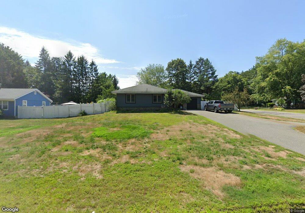
152 W Main St Georgetown, MA 01833
Estimated Value: $604,000 - $700,000
4
Beds
2
Baths
1,364
Sq Ft
$480/Sq Ft
Est. Value
About This Home
This home is located at 152 W Main St, Georgetown, MA 01833 and is currently estimated at $654,672, approximately $479 per square foot. 152 W Main St is a home located in Essex County with nearby schools including Perley Elementary School, Penn Brook School, and Georgetown High School.
Ownership History
Date
Name
Owned For
Owner Type
Purchase Details
Closed on
Apr 6, 2016
Sold by
Lynda M Slevoski T
Bought by
Slevoski Kurt M
Current Estimated Value
Purchase Details
Closed on
Jun 15, 2012
Sold by
Slevoski Lynda M
Bought by
Lynda M Slevoski T
Purchase Details
Closed on
Apr 29, 1992
Sold by
Drapeau Thomas C
Bought by
Slevoski Charles W and Slevoski Lynda M
Create a Home Valuation Report for This Property
The Home Valuation Report is an in-depth analysis detailing your home's value as well as a comparison with similar homes in the area
Home Values in the Area
Average Home Value in this Area
Purchase History
| Date | Buyer | Sale Price | Title Company |
|---|---|---|---|
| Slevoski Kurt M | -- | -- | |
| Lynda M Slevoski T | -- | -- | |
| Slevoski Charles W | $125,000 | -- |
Source: Public Records
Mortgage History
| Date | Status | Borrower | Loan Amount |
|---|---|---|---|
| Previous Owner | Slevoski Charles W | $304,000 | |
| Previous Owner | Slevoski Charles W | $271,400 | |
| Previous Owner | Slevoski Charles W | $263,000 |
Source: Public Records
Tax History Compared to Growth
Tax History
| Year | Tax Paid | Tax Assessment Tax Assessment Total Assessment is a certain percentage of the fair market value that is determined by local assessors to be the total taxable value of land and additions on the property. | Land | Improvement |
|---|---|---|---|---|
| 2025 | $7,436 | $672,300 | $233,100 | $439,200 |
| 2024 | $7,054 | $562,100 | $160,800 | $401,300 |
| 2023 | $6,643 | $511,800 | $160,800 | $351,000 |
| 2022 | $6,910 | $490,800 | $139,800 | $351,000 |
| 2021 | $6,373 | $401,100 | $139,800 | $261,300 |
| 2020 | $5,687 | $357,200 | $139,800 | $217,400 |
| 2019 | $5,594 | $354,500 | $137,100 | $217,400 |
| 2018 | $5,493 | $345,900 | $137,100 | $208,800 |
| 2017 | $5,361 | $330,700 | $137,100 | $193,600 |
| 2016 | $5,248 | $330,700 | $137,100 | $193,600 |
| 2015 | $5,134 | $320,300 | $137,100 | $183,200 |
| 2014 | $4,500 | $320,300 | $137,100 | $183,200 |
Source: Public Records
Map
Nearby Homes
- 206 W Main St Unit 3
- 206 W Main St Unit 5
- 206 W Main St Unit 6
- 206 W Main St Unit 4
- 51 W Main St Unit 6
- 231 W Main St
- 123 Pond St
- 79 Andover St
- 34 E Main St Unit 2
- 52 E Main St
- 6 Winter St
- 11 Canterbury Dr
- 18 Larch Rd
- 135 Central St
- 7 Yale St
- 503 Diane Cir
- 70 Uptack Rd
- 1 Atwood Ln
- 278 Central St
- Lot 9 Katie Ln