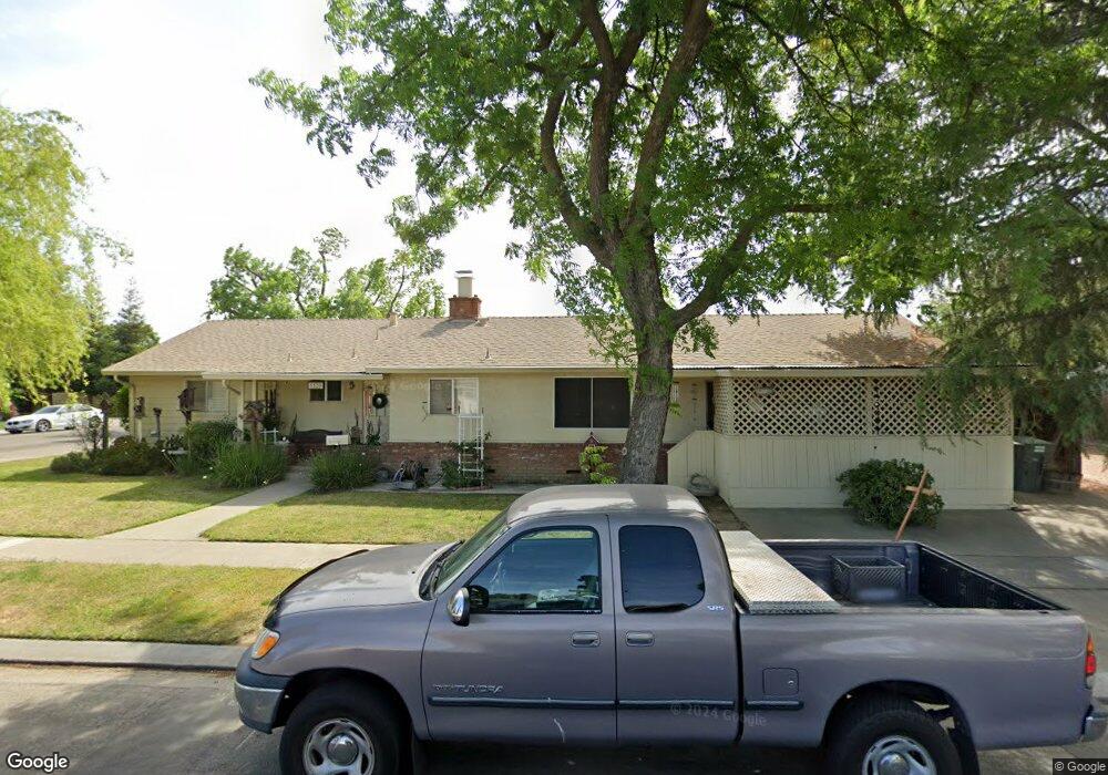
1520 Roosevelt Dr Modesto, CA 95350
Central Modesto NeighborhoodEstimated Value: $354,000 - $539,000
3
Beds
2
Baths
1,785
Sq Ft
$246/Sq Ft
Est. Value
About This Home
This home is located at 1520 Roosevelt Dr, Modesto, CA 95350 and is currently estimated at $439,540, approximately $246 per square foot. 1520 Roosevelt Dr is a home located in Stanislaus County with nearby schools including John Fremont Elementary School, Roosevelt Junior High School, and Grace M. Davis High School.
Ownership History
Date
Name
Owned For
Owner Type
Purchase Details
Closed on
Dec 17, 2004
Sold by
Lyons John R and Lyons Vicky L
Bought by
Lyons John R and Lyons Vicky N
Current Estimated Value
Home Financials for this Owner
Home Financials are based on the most recent Mortgage that was taken out on this home.
Original Mortgage
$29,000
Interest Rate
5.74%
Mortgage Type
New Conventional
Create a Home Valuation Report for This Property
The Home Valuation Report is an in-depth analysis detailing your home's value as well as a comparison with similar homes in the area
Home Values in the Area
Average Home Value in this Area
Purchase History
| Date | Buyer | Sale Price | Title Company |
|---|---|---|---|
| Lyons John R | -- | First American Title Co |
Source: Public Records
Mortgage History
| Date | Status | Borrower | Loan Amount |
|---|---|---|---|
| Closed | Lyons John R | $29,000 |
Source: Public Records
Tax History Compared to Growth
Tax History
| Year | Tax Paid | Tax Assessment Tax Assessment Total Assessment is a certain percentage of the fair market value that is determined by local assessors to be the total taxable value of land and additions on the property. | Land | Improvement |
|---|---|---|---|---|
| 2025 | $980 | $83,840 | $15,296 | $68,544 |
| 2024 | $936 | $82,197 | $14,997 | $67,200 |
| 2023 | $923 | $80,586 | $14,703 | $65,883 |
| 2022 | $900 | $79,007 | $14,415 | $64,592 |
| 2021 | $847 | $77,459 | $14,133 | $63,326 |
| 2020 | $864 | $76,666 | $13,989 | $62,677 |
| 2019 | $844 | $75,164 | $13,715 | $61,449 |
| 2018 | $803 | $73,692 | $13,447 | $60,245 |
| 2017 | $784 | $72,248 | $13,184 | $59,064 |
| 2016 | $769 | $70,832 | $12,926 | $57,906 |
| 2015 | $759 | $69,769 | $12,732 | $57,037 |
| 2014 | $747 | $68,403 | $12,483 | $55,920 |
Source: Public Records
Map
Nearby Homes
- 806 Barham Ct
- 617 W Granger Ave Unit 1
- 1018 Middleton Ct
- 1725 Bronson Ave
- 900 Dartmouth Ave
- 1344 Magnolia Ave
- 1936 Ralston Ct
- 1330 Magnolia Ave
- 1245 Sycamore Ave
- 1921 Sherwood Ave
- 1704 Concord Ave
- 2013 Sherwood Ave
- 1905 Wildwood Dr
- 1412 Albany Ave
- 1116 Cornell Ave
- 901 Whittier Ave
- 2100 Sherwood Ave Unit A
- 2100 Sherwood Ave
- 1321 W Orangeburg Ave
- 1326 Cypress Ave
- 706 Catalina Way
- 1512 Roosevelt Dr
- 702 Catalina Way
- 701 Bermuda Way
- 1517 Roosevelt Dr
- 1521 Roosevelt Dr
- 701 Catalina Way
- 705 Catalina Way
- 1513 Roosevelt Dr
- 616 Catalina Way
- 1525 Roosevelt Dr
- 615 Catalina Way
- 619 Bermuda Way
- 1529 Roosevelt Dr
- 1509 Roosevelt Dr
- 612 Catalina Way
- 611 Catalina Way
- 613 Bermuda Way
- 1502 Roosevelt Dr
- 1505 Roosevelt Dr