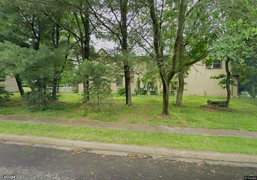
1520 Stuckert Rd Unit A Warrington, PA 18976
Estimated Value: $427,000 - $875,000
5
Beds
7
Baths
6,959
Sq Ft
$105/Sq Ft
Est. Value
About This Home
This home is located at 1520 Stuckert Rd Unit A, Warrington, PA 18976 and is currently estimated at $730,628, approximately $104 per square foot. 1520 Stuckert Rd Unit A is a home located in Bucks County with nearby schools including Jamison Elementary School, Tamanend Middle School, and Central Bucks High School - South.
Ownership History
Date
Name
Owned For
Owner Type
Purchase Details
Closed on
Feb 26, 2021
Sold by
Mtws Lp
Bought by
Studley Walter D
Current Estimated Value
Home Financials for this Owner
Home Financials are based on the most recent Mortgage that was taken out on this home.
Original Mortgage
$350,000
Outstanding Balance
$313,750
Interest Rate
2.7%
Mortgage Type
Future Advance Clause Open End Mortgage
Estimated Equity
$416,878
Purchase Details
Closed on
Jun 30, 2017
Sold by
Visco Anthony F and Visco Laura Lee
Bought by
Mtws Lp
Home Financials for this Owner
Home Financials are based on the most recent Mortgage that was taken out on this home.
Original Mortgage
$440,000
Interest Rate
3.88%
Mortgage Type
Commercial
Purchase Details
Closed on
Nov 22, 1971
Sold by
Lesley Robert F and Lesley Patricia K
Bought by
Visco Anthony F and Laura Lee
Create a Home Valuation Report for This Property
The Home Valuation Report is an in-depth analysis detailing your home's value as well as a comparison with similar homes in the area
Home Values in the Area
Average Home Value in this Area
Purchase History
| Date | Buyer | Sale Price | Title Company |
|---|---|---|---|
| Studley Walter D | $500,000 | Springfield Abstract Inc | |
| Mtws Lp | $550,000 | Main Street Title Abstract | |
| Visco Anthony F | -- | -- |
Source: Public Records
Mortgage History
| Date | Status | Borrower | Loan Amount |
|---|---|---|---|
| Open | Studley Walter D | $350,000 | |
| Previous Owner | Mtws Lp | $440,000 |
Source: Public Records
Tax History Compared to Growth
Tax History
| Year | Tax Paid | Tax Assessment Tax Assessment Total Assessment is a certain percentage of the fair market value that is determined by local assessors to be the total taxable value of land and additions on the property. | Land | Improvement |
|---|---|---|---|---|
| 2025 | $10,646 | $57,670 | $11,520 | $46,150 |
| 2024 | $10,646 | $57,670 | $11,520 | $46,150 |
| 2023 | $9,856 | $57,670 | $11,520 | $46,150 |
| 2022 | $9,661 | $57,670 | $11,520 | $46,150 |
| 2021 | $9,554 | $57,670 | $11,520 | $46,150 |
| 2020 | $9,554 | $57,670 | $11,520 | $46,150 |
| 2019 | $9,497 | $57,670 | $11,520 | $46,150 |
| 2018 | $13,438 | $82,520 | $11,520 | $71,000 |
| 2017 | $13,256 | $82,520 | $11,520 | $71,000 |
| 2016 | $13,215 | $82,520 | $11,520 | $71,000 |
| 2015 | -- | $82,520 | $11,520 | $71,000 |
| 2014 | -- | $82,520 | $11,520 | $71,000 |
Source: Public Records
Map
Nearby Homes
- 2226 Orchard Hill Cir
- 100 Ginko St Unit 303
- 100 Fiddleleaf Ln Unit 104
- 100 Claret Ct Unit 102
- 200 Beech Blvd Unit 202
- 200 Beech Blvd Unit 301
- 2234 Evin Dr
- 2302 MacIs Cir
- 1105 Madison Cir
- 902 Eagle Ln
- 983 Wilson Ct
- 2018 Buckingham Dr
- 2463 Pine Cone Rd
- 1877 Brook Ln
- 1656 S Ash Cir
- 1917 Brook Ln
- 612 Bethel Ln Unit THE ROOSEVELT PLAN
- 612 Bethel Ln Unit THE MONROE PLAN
- 871 Coolidge Ct
- 1992 Falabella Cir
- 1520 Stuckert Rd
- 2309 Deer Path Dr
- 2313 Deer Path Dr
- 2320 Deer Path Dr
- 2305 Deer Path Dr
- 2317 Deer Path Dr
- 2301 Deer Path Dr
- 2324 Deer Path Dr
- 2321 Deer Path Dr
- 1535 Deer Path Cir
- 1534 Deer Path Cir
- 2325 Deer Path Dr
- 2326 Deer Path Dr
- 1521 Stuckert Rd
- 1513 Stuckert Rd
- 2330 Deer Path Dr
- 1537 Deer Path Cir
- 1536 Stuckert Rd
- 2329 Deer Path Dr
- 1509 Stuckert Rd