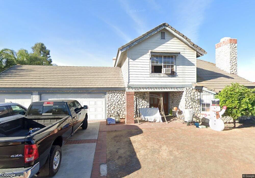
15203 Imperial Hwy La Mirada, CA 90638
East Whittier NeighborhoodEstimated Value: $1,385,000 - $2,067,000
3
Beds
3
Baths
3,797
Sq Ft
$419/Sq Ft
Est. Value
About This Home
This home is located at 15203 Imperial Hwy, La Mirada, CA 90638 and is currently estimated at $1,590,289, approximately $418 per square foot. 15203 Imperial Hwy is a home located in Los Angeles County with nearby schools including John Foster Dulles Elementary School, Reginald M. Benton Middle School, and La Mirada High School.
Ownership History
Date
Name
Owned For
Owner Type
Purchase Details
Closed on
Jun 19, 2009
Sold by
Land John H and Land Janell L
Bought by
Land Ii John H
Current Estimated Value
Purchase Details
Closed on
Nov 4, 1993
Sold by
Rogers David E and Rogers Terry L
Bought by
Land Ii John H
Home Financials for this Owner
Home Financials are based on the most recent Mortgage that was taken out on this home.
Original Mortgage
$283,725
Interest Rate
7.21%
Create a Home Valuation Report for This Property
The Home Valuation Report is an in-depth analysis detailing your home's value as well as a comparison with similar homes in the area
Home Values in the Area
Average Home Value in this Area
Purchase History
| Date | Buyer | Sale Price | Title Company |
|---|---|---|---|
| Land Ii John H | -- | None Available | |
| Land Ii John H | $378,300 | Orange Coast Title |
Source: Public Records
Mortgage History
| Date | Status | Borrower | Loan Amount |
|---|---|---|---|
| Previous Owner | Land Ii John H | $283,725 |
Source: Public Records
Tax History Compared to Growth
Tax History
| Year | Tax Paid | Tax Assessment Tax Assessment Total Assessment is a certain percentage of the fair market value that is determined by local assessors to be the total taxable value of land and additions on the property. | Land | Improvement |
|---|---|---|---|---|
| 2025 | $8,418 | $642,965 | $220,948 | $422,017 |
| 2024 | $8,418 | $630,359 | $216,616 | $413,743 |
| 2023 | $11,064 | $866,638 | $507,772 | $358,866 |
| 2022 | $10,957 | $849,646 | $497,816 | $351,830 |
| 2021 | $7,957 | $594,004 | $204,123 | $389,881 |
| 2020 | $7,764 | $587,914 | $202,030 | $385,884 |
| 2019 | $7,733 | $576,387 | $198,069 | $378,318 |
| 2018 | $7,297 | $565,086 | $194,186 | $370,900 |
| 2016 | $6,977 | $543,146 | $186,647 | $356,499 |
| 2015 | $6,921 | $534,989 | $183,844 | $351,145 |
| 2014 | $6,435 | $524,510 | $180,243 | $344,267 |
Source: Public Records
Map
Nearby Homes
- 15420 Olive Branch Dr
- 14943 Gagely Dr
- 15032 Olive Ln
- 15026 Olive Ln
- 15216 Mccann Place
- 13210 Avenida Socorro
- 13220 Fonseca Ave
- 13241 Oakwood Ln
- 15053 Granada Ave
- 12010 La Cima Dr
- 14908 Gardenhill Dr
- 12212 Hillwood Dr
- 12311 Moline Dr
- 15803 Silvergrove Dr
- 14839 Hardaway Dr
- 12108 Springview Dr
- 11518 Toerge Dr
- 11735 Gayview Dr
- 15856 Lawnhill Dr
- 14927 Leffingwell Rd Unit 17
- 15201 Imperial Hwy
- 15205 Imperial Hwy
- 15229 Imperial Hwy
- 15207 Imperial Hwy
- 15231 Imperial Hwy
- 15231 Imperial Hwy
- 12700 Barbata Rd
- 15234 Las Flores Ave
- 15249 Imperial Hwy
- 12703 Barbata Rd
- 0 Imperial Hwy Unit CC46604
- 0 Imperial Hwy Unit CC328350
- 0 Imperial Hwy Unit CC328349
- 15236 Las Flores Ave
- 12706 Barbata Rd
- 12709 Barbata Rd
- 15259 Imperial Hwy
- 15250 Quail Ln
- 15222 Las Flores Ave
- 15162 Cordova Rd