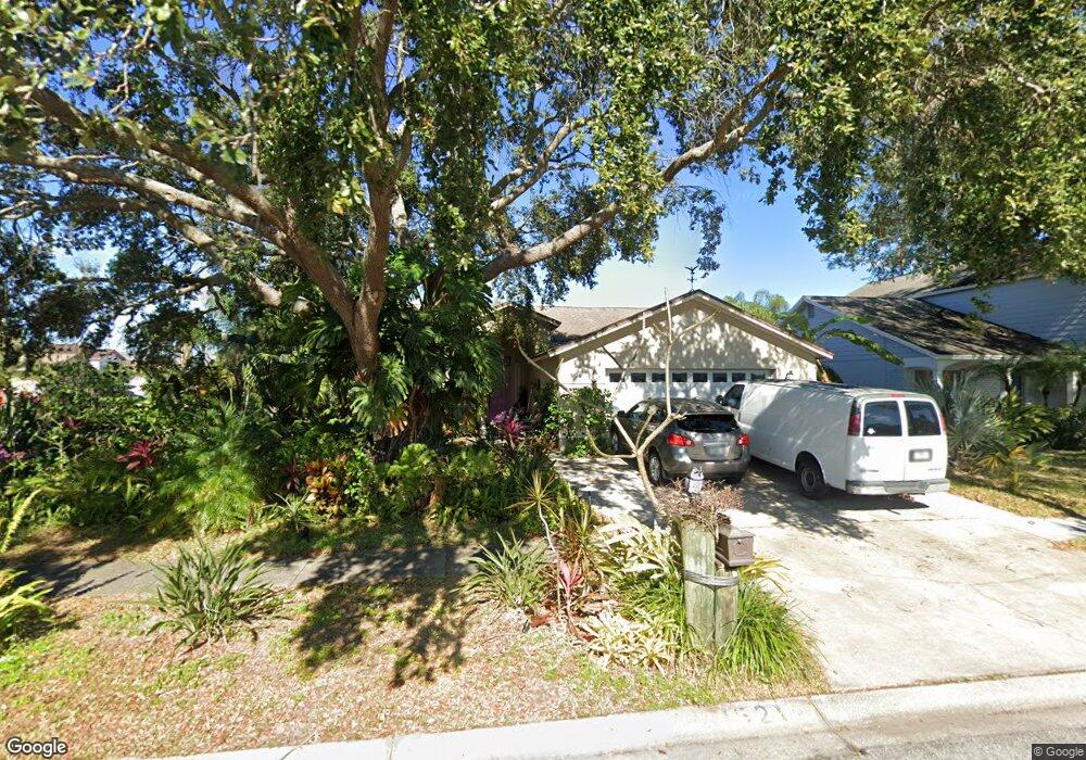
1521 Sakonnet Ct Brandon, FL 33511
Estimated Value: $389,000 - $418,000
4
Beds
2
Baths
1,930
Sq Ft
$209/Sq Ft
Est. Value
About This Home
This home is located at 1521 Sakonnet Ct, Brandon, FL 33511 and is currently estimated at $402,742, approximately $208 per square foot. 1521 Sakonnet Ct is a home located in Hillsborough County with nearby schools including Mintz Elementary School, Giunta Middle School, and Riverview High School.
Ownership History
Date
Name
Owned For
Owner Type
Purchase Details
Closed on
Sep 3, 1996
Sold by
Bostick Sandra L
Bought by
Farmer Donald M and Farmer Sabrina S
Current Estimated Value
Home Financials for this Owner
Home Financials are based on the most recent Mortgage that was taken out on this home.
Original Mortgage
$80,000
Interest Rate
8.2%
Mortgage Type
New Conventional
Create a Home Valuation Report for This Property
The Home Valuation Report is an in-depth analysis detailing your home's value as well as a comparison with similar homes in the area
Home Values in the Area
Average Home Value in this Area
Purchase History
| Date | Buyer | Sale Price | Title Company |
|---|---|---|---|
| Farmer Donald M | $106,000 | -- |
Source: Public Records
Mortgage History
| Date | Status | Borrower | Loan Amount |
|---|---|---|---|
| Open | Farmer Donald M | $27,000 | |
| Open | Farmer Donald M | $108,000 | |
| Closed | Farmer Donald M | $80,000 |
Source: Public Records
Tax History
| Year | Tax Paid | Tax Assessment Tax Assessment Total Assessment is a certain percentage of the fair market value that is determined by local assessors to be the total taxable value of land and additions on the property. | Land | Improvement |
|---|---|---|---|---|
| 2025 | $2,465 | $151,360 | -- | -- |
| 2024 | $2,465 | $147,094 | -- | -- |
| 2023 | $2,356 | $142,810 | $0 | $0 |
| 2022 | $2,193 | $138,650 | $0 | $0 |
| 2021 | $2,148 | $134,612 | $0 | $0 |
| 2020 | $2,066 | $132,753 | $0 | $0 |
| 2019 | $1,975 | $129,768 | $0 | $0 |
| 2018 | $1,923 | $127,348 | $0 | $0 |
| 2017 | $1,889 | $167,107 | $0 | $0 |
| 2016 | $1,853 | $122,164 | $0 | $0 |
| 2015 | $1,872 | $121,315 | $0 | $0 |
| 2014 | $1,847 | $120,352 | $0 | $0 |
| 2013 | -- | $118,573 | $0 | $0 |
Source: Public Records
Map
Nearby Homes
- 1510 Attleboro Ln
- 1516 Westerly Dr
- 1505 Lakehurst Way
- 2140 Fluorshire Dr
- 1641 Ledgestone Dr
- 2234 Fluorshire Dr
- 1341 Twilridge Place
- 2030 Fluorshire Dr
- 1335 Twilridge Place
- 1907 Fluorshire Dr
- 1421 Mohrlake Dr
- 1221 Franford Dr
- 1451 Mohrlake Dr
- 1030 Summer Breeze Dr
- 1610 Sanderling Ct Unit 1
- 2712 Conch Hollow Dr
- 2703 Breakwater Ct
- 1235 Alpine Lake Dr
- 5407 Chenault Place
- 1313 Coolmont Dr
- 1519 Sakonnet Ct
- 1614 Westerly Dr
- 1517 Sakonnet Ct
- 1615 Westerly Dr
- 1617 Westerly Dr
- 1612 Westerly Dr
- 1522 Sakonnet Ct
- 1613 Westerly Dr
- 1701 Westerly Dr
- 1515 Sakonnet Ct
- 1516 Dawley Ct
- 1520 Sakonnet Ct
- 1611 Westerly Dr
- 1703 Westerly Dr
- 1610 Westerly Dr
- 1518 Sakonnet Ct
- 1518 Dawley Ct
- 1513 Sakonnet Ct
- 1609 Westerly Dr
- 1516 Sakonnet Ct
Your Personal Tour Guide
Ask me questions while you tour the home.