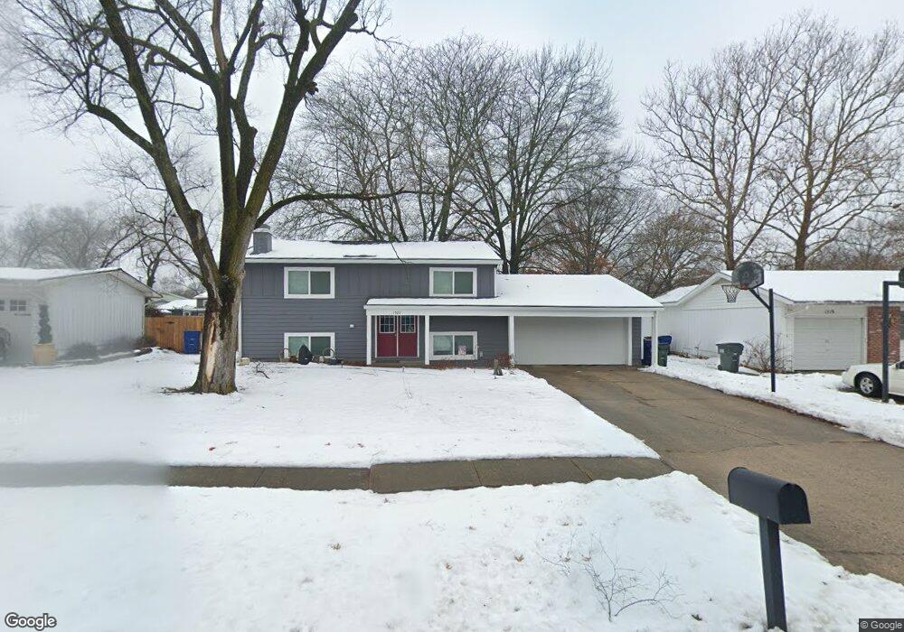
1523 Davis Rd Lawrence, KS 66046
Estimated Value: $205,000 - $258,000
4
Beds
2
Baths
825
Sq Ft
$283/Sq Ft
Est. Value
About This Home
This home is located at 1523 Davis Rd, Lawrence, KS 66046 and is currently estimated at $233,733, approximately $283 per square foot. 1523 Davis Rd is a home located in Douglas County with nearby schools including Kennedy Elementary School, Liberty Memorial Central Middle School, and Lawrence High School.
Ownership History
Date
Name
Owned For
Owner Type
Purchase Details
Closed on
May 24, 2023
Sold by
Phillip R Friedeman R and Phillip Patricia A
Bought by
Poison Heather
Current Estimated Value
Purchase Details
Closed on
Dec 13, 2012
Sold by
Walton Douglas Scott and Walton Linda Ann
Bought by
Walton Douglas Scott and Walton Linda A
Create a Home Valuation Report for This Property
The Home Valuation Report is an in-depth analysis detailing your home's value as well as a comparison with similar homes in the area
Purchase History
| Date | Buyer | Sale Price | Title Company |
|---|---|---|---|
| Poison Heather | -- | Continental Title Company | |
| Walton Douglas Scott | -- | None Available |
Source: Public Records
Tax History
| Year | Tax Paid | Tax Assessment Tax Assessment Total Assessment is a certain percentage of the fair market value that is determined by local assessors to be the total taxable value of land and additions on the property. | Land | Improvement |
|---|---|---|---|---|
| 2025 | $3,209 | $27,750 | $5,750 | $22,000 |
| 2024 | $3,109 | $26,358 | $5,405 | $20,953 |
| 2023 | $3,109 | $24,449 | $5,175 | $19,274 |
| 2022 | $3,021 | $23,587 | $4,600 | $18,987 |
| 2021 | $2,557 | $19,274 | $4,368 | $14,906 |
| 2020 | $2,447 | $18,550 | $4,368 | $14,182 |
| 2019 | $2,277 | $17,307 | $3,798 | $13,509 |
| 2018 | $2,192 | $16,549 | $3,571 | $12,978 |
| 2017 | $1,149 | $15,629 | $3,571 | $12,058 |
| 2016 | $1,885 | $14,743 | $3,450 | $11,293 |
| 2015 | -- | $14,536 | $3,450 | $11,086 |
| 2014 | -- | $15,376 | $3,450 | $11,926 |
Source: Public Records
Map
Nearby Homes
- 2014 Maple Ln
- 1708 E 21st Terrace
- 1605 E 21st Place
- 1618 E Glenn Dr
- 2200 Harper St Unit C24
- 2343 Surrey Dr
- 5701 Johnson Ave
- 5804 Johnson Ave
- 1909 E 25th Terrace
- 2604 Mayfair Dr
- 1950 Barker Ave
- 2132 E 26th St
- 1644 Barker Ave
- 2146 Rhode Island St
- 2127 Rhode Island St
- 1630 Barker Ave
- 2529 Arlene Place
- 1226 Delaware St Unit 12
- 2727 Rawhide Ln
- 2725 Ponderosa Dr
Your Personal Tour Guide
Ask me questions while you tour the home.