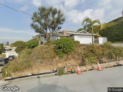
1526 Loring St San Diego, CA 92109
Pacific Beach NeighborhoodEstimated Value: $2,163,471 - $2,833,000
3
Beds
2
Baths
2,335
Sq Ft
$1,068/Sq Ft
Est. Value
About This Home
This home is located at 1526 Loring St, San Diego, CA 92109 and is currently estimated at $2,493,618, approximately $1,067 per square foot. 1526 Loring St is a home located in San Diego County with nearby schools including Pacific Beach Elementary School, Pacific Beach Middle, and Mission Bay High School.
Ownership History
Date
Name
Owned For
Owner Type
Purchase Details
Closed on
Mar 7, 2003
Sold by
Mcneil Maurice M and Mcneil Anne S
Bought by
Gwyn Joseph A and Gwyn Mary L
Current Estimated Value
Home Financials for this Owner
Home Financials are based on the most recent Mortgage that was taken out on this home.
Original Mortgage
$535,000
Interest Rate
4.56%
Mortgage Type
Unknown
Purchase Details
Closed on
Apr 2, 1993
Create a Home Valuation Report for This Property
The Home Valuation Report is an in-depth analysis detailing your home's value as well as a comparison with similar homes in the area
Home Values in the Area
Average Home Value in this Area
Purchase History
| Date | Buyer | Sale Price | Title Company |
|---|---|---|---|
| Gwyn Joseph A | $875,000 | First American Title Co | |
| -- | $437,500 | -- |
Source: Public Records
Mortgage History
| Date | Status | Borrower | Loan Amount |
|---|---|---|---|
| Previous Owner | Mcneil Maurice M | $535,000 | |
| Previous Owner | Mcneil Maurice M | $500,000 |
Source: Public Records
Tax History Compared to Growth
Tax History
| Year | Tax Paid | Tax Assessment Tax Assessment Total Assessment is a certain percentage of the fair market value that is determined by local assessors to be the total taxable value of land and additions on the property. | Land | Improvement |
|---|---|---|---|---|
| 2024 | $2,292 | $190,788 | $151,401 | $39,387 |
| 2023 | $2,239 | $187,048 | $148,433 | $38,615 |
| 2022 | $2,178 | $183,381 | $145,523 | $37,858 |
| 2021 | $2,162 | $179,786 | $142,670 | $37,116 |
| 2020 | $2,135 | $177,944 | $141,208 | $36,736 |
| 2019 | $2,096 | $174,456 | $138,440 | $36,016 |
| 2018 | $1,959 | $171,036 | $135,726 | $35,310 |
| 2017 | $1,911 | $167,683 | $133,065 | $34,618 |
| 2016 | $1,878 | $164,396 | $130,456 | $33,940 |
| 2015 | $1,849 | $161,928 | $128,497 | $33,431 |
| 2014 | $1,820 | $158,757 | $125,980 | $32,777 |
Source: Public Records
Map
Nearby Homes
- 1470 Wilbur Ave
- 5023 Windsor Dr
- 0000 Wilbur Ave Unit 1
- 1624 Malden St
- 1340 Loring St
- 5114 Gordon Ln
- 1437 Law St
- 1715 Malden St
- 4964 Kendall St
- 1235 Wilbur Ave
- 1669 Los Altos Rd
- 1777 Beryl St
- 4771 Jewell St Unit 2
- 5291 Vickie Dr
- 1792 Missouri St Unit 9
- 1367 Diamond St
- 4790 Everts St
- 1154 Sapphire St
- 1920 Beryl St
- 1161 Turquoise St
- 1526 Loring St
- 5008 Windsor Dr
- 1516 Loring St
- 5020 Windsor Dr
- 5024 Windsor Dr
- 4995 Foothill Blvd
- 1527 Loring St
- 1506 Loring St
- 4983 Foothill Blvd
- 1532 Loring St
- 1531 Loring St
- 5007 Foothill Blvd
- 5030 Windsor Dr
- 4975 Foothill Blvd
- 1535 Loring St
- 1505 Loring St
- 4969 Foothill Blvd
- 5034 Windsor Dr
- 5009 Foothill Blvd
- 1550 Loring St