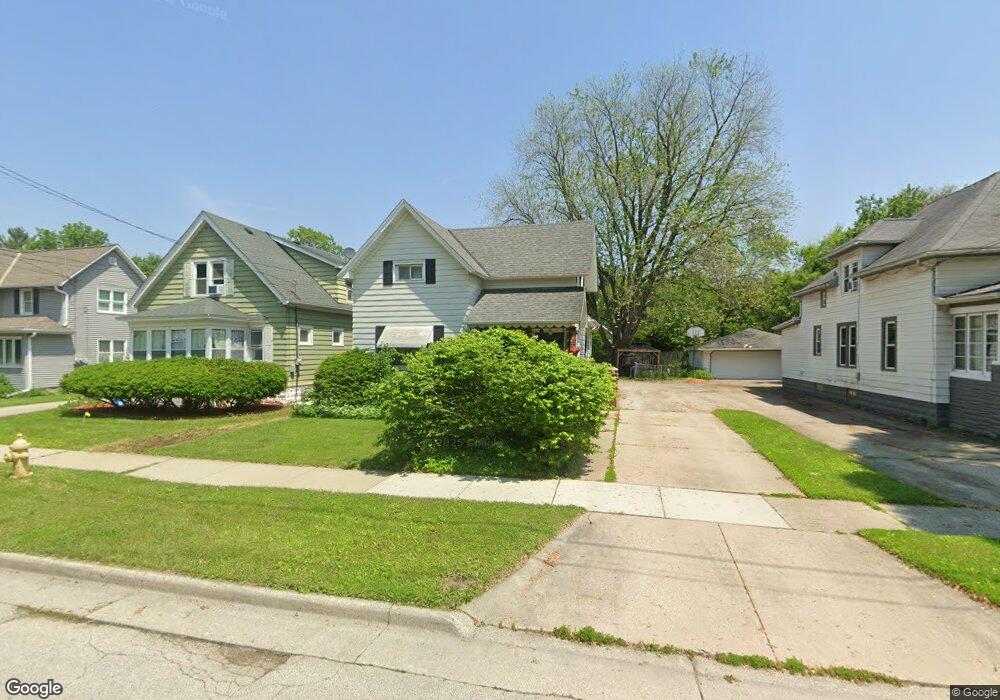
1527 Whiterock Ave Waukesha, WI 53186
Estimated Value: $297,000 - $331,525
3
Beds
2
Baths
1,672
Sq Ft
$188/Sq Ft
Est. Value
About This Home
This home is located at 1527 Whiterock Ave, Waukesha, WI 53186 and is currently estimated at $313,631, approximately $187 per square foot. 1527 Whiterock Ave is a home located in Waukesha County with nearby schools including Banting Elementary School, Horning Middle School, and South High School.
Ownership History
Date
Name
Owned For
Owner Type
Purchase Details
Closed on
Dec 10, 2001
Sold by
Oliver James M
Bought by
Mankowski Thomas O and Mankowski Kathleen A
Current Estimated Value
Home Financials for this Owner
Home Financials are based on the most recent Mortgage that was taken out on this home.
Original Mortgage
$96,900
Outstanding Balance
$37,752
Interest Rate
6.53%
Estimated Equity
$275,879
Purchase Details
Closed on
Oct 15, 1996
Sold by
Lincks Bernard H and Lincks Mary C
Bought by
Oliver James M
Home Financials for this Owner
Home Financials are based on the most recent Mortgage that was taken out on this home.
Original Mortgage
$80,750
Interest Rate
7.87%
Create a Home Valuation Report for This Property
The Home Valuation Report is an in-depth analysis detailing your home's value as well as a comparison with similar homes in the area
Home Values in the Area
Average Home Value in this Area
Purchase History
| Date | Buyer | Sale Price | Title Company |
|---|---|---|---|
| Mankowski Thomas O | $102,000 | -- | |
| Oliver James M | $95,000 | -- |
Source: Public Records
Mortgage History
| Date | Status | Borrower | Loan Amount |
|---|---|---|---|
| Open | Mankowski Thomas O | $96,900 | |
| Previous Owner | Oliver James M | $80,750 |
Source: Public Records
Tax History Compared to Growth
Tax History
| Year | Tax Paid | Tax Assessment Tax Assessment Total Assessment is a certain percentage of the fair market value that is determined by local assessors to be the total taxable value of land and additions on the property. | Land | Improvement |
|---|---|---|---|---|
| 2024 | $3,721 | $254,100 | $45,200 | $208,900 |
| 2023 | $3,608 | $254,100 | $45,200 | $208,900 |
| 2022 | $2,713 | $146,000 | $50,000 | $96,000 |
| 2021 | $2,764 | $146,000 | $50,000 | $96,000 |
| 2020 | $2,690 | $146,000 | $50,000 | $96,000 |
| 2019 | $2,595 | $146,000 | $50,000 | $96,000 |
| 2018 | $2,508 | $137,700 | $47,500 | $90,200 |
| 2017 | $2,514 | $137,700 | $47,500 | $90,200 |
| 2016 | $2,548 | $131,100 | $47,500 | $83,600 |
| 2015 | $2,537 | $131,100 | $47,500 | $83,600 |
| 2014 | $2,647 | $131,100 | $47,500 | $83,600 |
| 2013 | $2,647 | $131,100 | $47,500 | $83,600 |
Source: Public Records
Map
Nearby Homes
- 1234 E Moreland Blvd
- 1460 Paul Ln
- 1937 Jefferson Ave
- 1349 Rose Ct Unit 62
- 1333 Niagara St
- 1920 Cardinal Dr
- 502 Gascoigne Dr
- 512 E Main St
- 416 Riverview Ave
- 851 Perkins Ave
- 1623 Square Cir
- 818 Pleasant St
- 169 NW Barstow St
- 707 W Moreland Blvd
- 1715 Stardust Dr Unit A
- 137 Wisconsin Ave
- 1825 Paramount Dr Unit F
- 1823 Paramount Dr Unit D
- 1806 E Main St
- 403 Midland Ave
- 1531 Whiterock Ave
- 1531 White Rock Ave
- 1521 Whiterock Ave
- 1528 Whiterock Ave
- 1522 Whiterock Ave
- 1539 White Rock Ave
- 926 E Moreland Blvd
- 1535 Whiterock Ave
- 1516 Whiterock Ave
- 918 E Moreland Blvd
- 930 E Moreland Blvd
- 1543 White Rock Ave
- 934 E Moreland Blvd
- 1539 Whiterock Ave
- 1542 Whiterock Ave
- 915 E Moreland Blvd
- 922 E Moreland Blvd
- 938 E Moreland Blvd
- 1543 Whiterock Ave
- 1512 Whiterock Ave