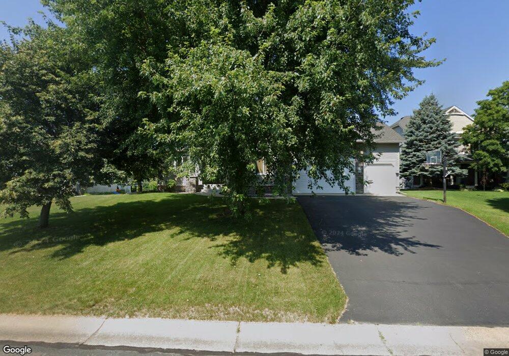
15270 Partridge St NW Andover, MN 55304
Estimated Value: $601,000 - $681,000
4
Beds
4
Baths
3,017
Sq Ft
$209/Sq Ft
Est. Value
About This Home
This home is located at 15270 Partridge St NW, Andover, MN 55304 and is currently estimated at $630,534, approximately $208 per square foot. 15270 Partridge St NW is a home located in Anoka County with nearby schools including Andover Elementary School, Oak View Middle School, and Andover Senior High School.
Ownership History
Date
Name
Owned For
Owner Type
Purchase Details
Closed on
Dec 12, 2003
Sold by
Woodland Development Corp
Bought by
B & W Parent Properties Llc
Current Estimated Value
Home Financials for this Owner
Home Financials are based on the most recent Mortgage that was taken out on this home.
Original Mortgage
$73,800
Interest Rate
7.5%
Mortgage Type
Land Contract Argmt. Of Sale
Create a Home Valuation Report for This Property
The Home Valuation Report is an in-depth analysis detailing your home's value as well as a comparison with similar homes in the area
Home Values in the Area
Average Home Value in this Area
Purchase History
| Date | Buyer | Sale Price | Title Company |
|---|---|---|---|
| B & W Parent Properties Llc | $82,000 | -- |
Source: Public Records
Mortgage History
| Date | Status | Borrower | Loan Amount |
|---|---|---|---|
| Previous Owner | B & W Parent Properties Llc | $73,800 |
Source: Public Records
Tax History Compared to Growth
Tax History
| Year | Tax Paid | Tax Assessment Tax Assessment Total Assessment is a certain percentage of the fair market value that is determined by local assessors to be the total taxable value of land and additions on the property. | Land | Improvement |
|---|---|---|---|---|
| 2025 | $6,092 | $610,400 | $130,000 | $480,400 |
| 2024 | $6,092 | $574,200 | $108,300 | $465,900 |
| 2023 | $5,433 | $565,600 | $105,100 | $460,500 |
| 2022 | $5,243 | $570,600 | $100,100 | $470,500 |
| 2021 | $5,113 | $485,800 | $64,500 | $421,300 |
| 2020 | $5,177 | $462,300 | $64,500 | $397,800 |
| 2019 | $4,975 | $453,100 | $56,300 | $396,800 |
| 2018 | $5,085 | $426,100 | $0 | $0 |
| 2017 | $4,564 | $426,200 | $0 | $0 |
| 2016 | $4,689 | $373,800 | $0 | $0 |
| 2015 | $4,426 | $373,800 | $68,000 | $305,800 |
| 2014 | -- | $332,500 | $65,000 | $267,500 |
Source: Public Records
Map
Nearby Homes
- 15285 Quinn St NW
- 2080 151st Ave NW
- 2066 151st Ave NW
- 2334 Veterans Memorial Blvd NW
- 15570 Linnet St NW Unit 2305
- 15570 Linnet St NW Unit 2205
- 1769 155th Ave NW
- 15631 Linnet St NW Unit 3210
- 15631 Linnet St NW Unit 109
- 15631 Linnet St NW Unit 3305
- 1684 155th Ave NW
- 14780 Jay St NW
- 1722 157th Ln NW
- 917 174th Ave NE
- 15832 Uplander St NW
- 14994 Crane St NW
- 15620 Eagle St NW
- 15988 Quinn St NW
- 14553 Ibis St NW
- 15801 Drake St NW
- 15262 Partridge St NW
- 15278 Partridge St NW
- 15271 Partridge St NW
- 15263 Partridge St NW
- 15286 Partridge St NW
- 15279 Partridge St NW
- 15269 Quinn St NW
- 15261 Quinn St NW
- 15277 Quinn St NW
- 15295 Partridge St NW
- 15287 Partridge St NW
- 2088 Veterans Memorial Blvd NW
- 2074 Veterans Memorial Blvd NW
- 15293 Quinn St NW
- 2045 Veterans Memorial Blvd NW
- 2060 Veterans Memorial Blvd NW
- 2118 Veterans Memorial Blvd NW
- 2046 Veterans Memorial Blvd NW
- 15268 Quinn St NW
- 15260 Quinn St NW