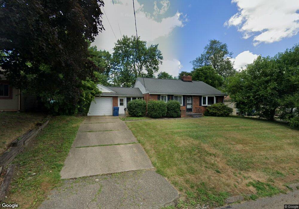
1529 Spangler Rd NE Canton, OH 44714
Colonial Heights NeighborhoodEstimated Value: $136,000 - $167,000
3
Beds
2
Baths
1,080
Sq Ft
$143/Sq Ft
Est. Value
About This Home
This home is located at 1529 Spangler Rd NE, Canton, OH 44714 and is currently estimated at $154,205, approximately $142 per square foot. 1529 Spangler Rd NE is a home located in Stark County with nearby schools including Frazer Elementary School, Glenwood Intermediate School, and GlenOak High School.
Ownership History
Date
Name
Owned For
Owner Type
Purchase Details
Closed on
Jun 28, 2016
Bought by
Julia L Toot
Current Estimated Value
Purchase Details
Closed on
May 29, 1998
Sold by
Mammone Daniel L
Bought by
Toot Patrick C and Wilson Julia L
Home Financials for this Owner
Home Financials are based on the most recent Mortgage that was taken out on this home.
Original Mortgage
$79,950
Interest Rate
7.27%
Mortgage Type
FHA
Purchase Details
Closed on
Jun 1, 1992
Purchase Details
Closed on
May 29, 1992
Create a Home Valuation Report for This Property
The Home Valuation Report is an in-depth analysis detailing your home's value as well as a comparison with similar homes in the area
Home Values in the Area
Average Home Value in this Area
Purchase History
| Date | Buyer | Sale Price | Title Company |
|---|---|---|---|
| Julia L Toot | -- | -- | |
| Toot Patrick C | $80,000 | -- | |
| -- | -- | -- | |
| -- | $51,500 | -- |
Source: Public Records
Mortgage History
| Date | Status | Borrower | Loan Amount |
|---|---|---|---|
| Previous Owner | Toot Patrick C | $79,950 |
Source: Public Records
Tax History Compared to Growth
Tax History
| Year | Tax Paid | Tax Assessment Tax Assessment Total Assessment is a certain percentage of the fair market value that is determined by local assessors to be the total taxable value of land and additions on the property. | Land | Improvement |
|---|---|---|---|---|
| 2025 | -- | $44,590 | $15,190 | $29,400 |
| 2024 | -- | $44,590 | $15,190 | $29,400 |
| 2023 | $1,495 | $32,070 | $7,740 | $24,330 |
| 2022 | $1,504 | $32,070 | $7,740 | $24,330 |
| 2021 | $1,511 | $32,070 | $7,740 | $24,330 |
| 2020 | $1,438 | $27,790 | $6,650 | $21,140 |
| 2019 | $1,426 | $27,790 | $6,650 | $21,140 |
| 2018 | $1,409 | $27,790 | $6,650 | $21,140 |
| 2017 | $1,340 | $24,260 | $6,720 | $17,540 |
| 2016 | $1,343 | $24,260 | $6,720 | $17,540 |
| 2015 | $1,298 | $24,260 | $6,720 | $17,540 |
| 2014 | $1,281 | $23,420 | $6,130 | $17,290 |
| 2013 | $627 | $23,420 | $6,130 | $17,290 |
Source: Public Records
Map
Nearby Homes
- 1306 Milford St NE
- 1233 29th St NE
- 000 Rowland Ave NE
- 1638 Warrick Place NE
- 1321 Warrick Place NE
- 1202 28th St NE
- 2510 Gross Ave NE
- 1624 34th St NE
- 1115 Colonial Blvd NE
- 1227 33rd St NE
- 1007 27th St NE
- 1220 25th St NE
- 1609 35th St NE
- 2310 Maple Ave NE
- 2315 Maple Ave NE
- 808 29th St NE
- 3321 Martindale Rd NE
- 708 29th St NE
- 2219 Rowland Ave NE
- 1513 22nd St NE
- 1523 Spangler Rd NE
- 1603 Spangler Rd NE
- 1519 Spangler Rd NE
- 1607 Spangler Rd NE
- 1606 Milford St NE
- 1530 Spangler Rd NE
- 1516 Milford St NE
- 1516 Milford St NE
- 1613 Spangler Rd NE
- 2930 Saint Elmo Ave NE
- 1600 Spangler Rd NE
- 2938 Saint Elmo Ave NE
- 2926 Saint Elmo Ave NE
- 1606 Spangler Rd NE
- 1522 Spangler Rd NE
- 2942 Saint Elmo Ave NE
- 1617 Spangler Rd NE
- 1612 Spangler Rd NE
- 1508 Spangler Rd NE
- 1616 Spangler Rd NE