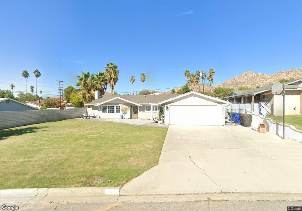
153 E Shady Grove Dr Riverside, CA 92507
University NeighborhoodEstimated Value: $663,617 - $1,072,000
4
Beds
3
Baths
2,342
Sq Ft
$329/Sq Ft
Est. Value
About This Home
This home is located at 153 E Shady Grove Dr, Riverside, CA 92507 and is currently estimated at $769,904, approximately $328 per square foot. 153 E Shady Grove Dr is a home located in Riverside County with nearby schools including Highland Elementary, University Heights Middle School, and John W. North High School.
Ownership History
Date
Name
Owned For
Owner Type
Purchase Details
Closed on
Oct 8, 2018
Sold by
Davis Richard E and Davis Lorna K
Bought by
Davis Richard E and Davis Lorna K
Current Estimated Value
Purchase Details
Closed on
Jun 14, 2018
Sold by
Davis Richard E and Davis Lorna K
Bought by
Davis Richard E and Davis Lorna K
Home Financials for this Owner
Home Financials are based on the most recent Mortgage that was taken out on this home.
Original Mortgage
$150,000
Interest Rate
4.5%
Mortgage Type
New Conventional
Create a Home Valuation Report for This Property
The Home Valuation Report is an in-depth analysis detailing your home's value as well as a comparison with similar homes in the area
Home Values in the Area
Average Home Value in this Area
Purchase History
| Date | Buyer | Sale Price | Title Company |
|---|---|---|---|
| Davis Richard E | -- | None Available | |
| Davis Richard E | -- | Stewart Title Of California |
Source: Public Records
Mortgage History
| Date | Status | Borrower | Loan Amount |
|---|---|---|---|
| Closed | Davis Richard E | $150,000 |
Source: Public Records
Tax History
| Year | Tax Paid | Tax Assessment Tax Assessment Total Assessment is a certain percentage of the fair market value that is determined by local assessors to be the total taxable value of land and additions on the property. | Land | Improvement |
|---|---|---|---|---|
| 2025 | $2,636 | $246,661 | $43,776 | $202,885 |
| 2023 | $2,636 | $237,084 | $42,077 | $195,007 |
| 2022 | $2,574 | $232,436 | $41,252 | $191,184 |
| 2021 | $2,548 | $227,880 | $40,444 | $187,436 |
| 2020 | $2,528 | $225,545 | $40,030 | $185,515 |
| 2019 | $2,480 | $221,124 | $39,246 | $181,878 |
| 2018 | $2,431 | $216,789 | $38,478 | $178,311 |
| 2017 | $2,387 | $212,539 | $37,724 | $174,815 |
| 2016 | $2,234 | $208,373 | $36,985 | $171,388 |
| 2015 | $2,201 | $205,245 | $36,431 | $168,814 |
| 2014 | $2,179 | $201,226 | $35,718 | $165,508 |
Source: Public Records
Map
Nearby Homes
- 138 Green Oaks Dr
- 208 Deborah Ct
- 3314 Celeste Dr
- 3000 Galaxie Rd
- 461 W Blaine St
- 587 W Blaine St
- 4360 Watkins Dr
- 658 Glenhill Dr
- 7 Gage
- 4495 Mt Vernon Ave
- 2891 Canyon Crest Dr Unit 32
- 2891 Canyon Crest Dr Unit 53
- 1050 Athena Ct
- 1025 Altura Dr
- 1110 W Blaine St Unit 102
- 1130 W Blaine St Unit 204
- 20682 Hill Top Dr
- 1168 Athena Ct
- 511 Athens St
- 5110 Caldera Ct
- 169 E Shady Grove Dr
- 137 E Shady Grove Dr
- 152 Green Oaks Dr
- 3363 Maricopa Dr
- 3384 Mount Vernon Ave
- 240 ROOM E Shady Grove
- 3364 Mount Vernon Ave
- 3396 Mount Vernon Ave
- 3396 Mt Vernon Ave
- 152 E Shady Grove Dr
- 3382 Maricopa Dr
- 3421 Maricopa Dr
- 3356 Mount Vernon Ave
- 138 E Shady Grove Dr
- 194 Green Oaks Dr
- 3420 Maricopa Dr
- 211 E Shady Grove Dr
- 118 E Shady Grove Dr
- 210 Green Oaks Dr
- 3385 Mount Vernon Ave
Your Personal Tour Guide
Ask me questions while you tour the home.