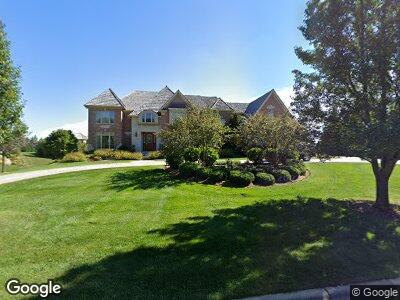
1530 Newport Ln Inverness, IL 60010
Inverness NeighborhoodEstimated Value: $1,681,000 - $2,655,000
5
Beds
7
Baths
6,495
Sq Ft
$318/Sq Ft
Est. Value
About This Home
This home is located at 1530 Newport Ln, Inverness, IL 60010 and is currently estimated at $2,066,908, approximately $318 per square foot. 1530 Newport Ln is a home located in Cook County with nearby schools including Grove Avenue Elementary School, Barrington Mdle School- Prairie Cmps, and Barrington High School.
Ownership History
Date
Name
Owned For
Owner Type
Purchase Details
Closed on
Jun 15, 2006
Sold by
Park National Bank
Bought by
Verone Mark and Hardy Rachelle
Current Estimated Value
Home Financials for this Owner
Home Financials are based on the most recent Mortgage that was taken out on this home.
Original Mortgage
$1,500,000
Interest Rate
6.87%
Mortgage Type
Unknown
Create a Home Valuation Report for This Property
The Home Valuation Report is an in-depth analysis detailing your home's value as well as a comparison with similar homes in the area
Home Values in the Area
Average Home Value in this Area
Purchase History
| Date | Buyer | Sale Price | Title Company |
|---|---|---|---|
| Verone Mark | $2,032,000 | Git |
Source: Public Records
Mortgage History
| Date | Status | Borrower | Loan Amount |
|---|---|---|---|
| Open | Verone Mark | $1,443,500 | |
| Closed | Verone Mark | $1,500,000 |
Source: Public Records
Tax History Compared to Growth
Tax History
| Year | Tax Paid | Tax Assessment Tax Assessment Total Assessment is a certain percentage of the fair market value that is determined by local assessors to be the total taxable value of land and additions on the property. | Land | Improvement |
|---|---|---|---|---|
| 2024 | $30,045 | $127,596 | $16,012 | $111,584 |
| 2023 | $30,045 | $127,596 | $16,012 | $111,584 |
| 2022 | $30,045 | $144,000 | $16,012 | $127,988 |
| 2021 | $24,290 | $104,044 | $12,009 | $92,035 |
| 2020 | $23,560 | $104,044 | $12,009 | $92,035 |
| 2019 | $23,061 | $115,734 | $12,009 | $103,725 |
| 2018 | $21,797 | $106,549 | $11,008 | $95,541 |
| 2017 | $21,192 | $106,549 | $11,008 | $95,541 |
| 2016 | $26,679 | $139,934 | $11,008 | $128,926 |
| 2015 | $21,609 | $105,808 | $10,007 | $95,801 |
| 2014 | $21,364 | $105,808 | $10,007 | $95,801 |
| 2013 | $23,972 | $123,500 | $10,007 | $113,493 |
Source: Public Records
Map
Nearby Homes
- 1410 W Newcastle Ct
- 518 Peterson Ct
- 1100 Glencrest Dr
- 1350 Macalpin Dr
- 1560 Macalpin Cir
- 1340 Macalpin Dr
- 423 Park Barrington Dr
- 404 Park Barrington Dr
- 1452 Somerset Place
- 1431 Somerset Place
- 401 Park Barrington Dr
- 1434 Somerset Place
- 1213 S Summit St
- 230 Knox Ct
- 6 S Barrington Rd
- 1211 S Cook St
- 1001-1003 S Barrington Rd
- 308 Summit St
- 2125 Harrow Gate Dr
- 705 Skye Ln
- 1530 Newport Ln
- 1520 Newport Ln
- 1540 Newport Ln
- 1415 W Newcastle Ct
- 1425 W Newcastle Ct
- 1525 Newport Ln Unit III
- 1405 W Newcastle Ct
- 1535 Newport Ln Unit III
- 1515 Newport Ln
- 1550 Newport Ln
- 137 Hillshire Ct
- 519 Pershing Ct
- 517 Pershing Ct
- 525 Pershing Ct
- 513 Pershing Ct
- 1420 W Newcastle Ct Unit III
- 511 Pershing Ct
- 509 Pershing Ct
- 527 Pershing Ct
- 139 Hillshire Ct