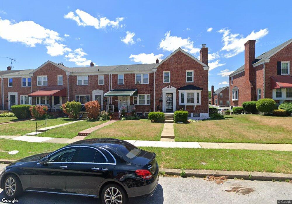
1531 Burnwood Rd Baltimore, MD 21239
Perring Loch NeighborhoodEstimated Value: $197,456 - $213,000
--
Bed
2
Baths
1,280
Sq Ft
$160/Sq Ft
Est. Value
About This Home
This home is located at 1531 Burnwood Rd, Baltimore, MD 21239 and is currently estimated at $205,228, approximately $160 per square foot. 1531 Burnwood Rd is a home located in Baltimore City with nearby schools including Northwood Elementary School, Booker T. Washington Middle School, and Paul Laurence Dunbar High School.
Ownership History
Date
Name
Owned For
Owner Type
Purchase Details
Closed on
Jul 26, 1999
Sold by
Secretary Of Veterans
Bought by
Goode Tanyeal M and Goode Cynthia
Current Estimated Value
Purchase Details
Closed on
May 11, 1998
Sold by
Scribner Kedrick H
Bought by
Secretary Of Veterans and Affairs , The
Create a Home Valuation Report for This Property
The Home Valuation Report is an in-depth analysis detailing your home's value as well as a comparison with similar homes in the area
Home Values in the Area
Average Home Value in this Area
Purchase History
| Date | Buyer | Sale Price | Title Company |
|---|---|---|---|
| Goode Tanyeal M | $87,000 | -- | |
| Secretary Of Veterans | $63,980 | -- |
Source: Public Records
Tax History Compared to Growth
Tax History
| Year | Tax Paid | Tax Assessment Tax Assessment Total Assessment is a certain percentage of the fair market value that is determined by local assessors to be the total taxable value of land and additions on the property. | Land | Improvement |
|---|---|---|---|---|
| 2025 | $3,021 | $150,367 | -- | -- |
| 2024 | $3,021 | $140,100 | $36,000 | $104,100 |
| 2023 | $2,979 | $138,633 | $0 | $0 |
| 2022 | $2,949 | $137,167 | $0 | $0 |
| 2021 | $3,203 | $135,700 | $36,000 | $99,700 |
| 2020 | $2,869 | $133,533 | $0 | $0 |
| 2019 | $2,804 | $131,367 | $0 | $0 |
| 2018 | $2,816 | $129,200 | $36,000 | $93,200 |
| 2017 | $2,822 | $128,167 | $0 | $0 |
| 2016 | $3,338 | $127,133 | $0 | $0 |
| 2015 | $3,338 | $126,100 | $0 | $0 |
| 2014 | $3,338 | $126,100 | $0 | $0 |
Source: Public Records
Map
Nearby Homes
- 1613 Winford Rd
- 1631 Woodbourne Ave
- 1402 Woodbourne Ave
- 1800 Burnwood Rd
- 1809 Northbourne Rd
- 1809 Hillenwood Rd
- 1814 Winford Rd
- 5515 Hillen Rd
- 1808 Swansea Rd
- 1537 Stonewood Rd
- 1656 Ramblewood Rd
- 1645 Gleneagle Rd
- 1645 Sherwood Ave
- 2045 Woodbourne Ave
- 1231 Sheridan Ave
- 1324 Winston Ave
- 1346 Pentwood Rd
- 1621 Walterswood Rd
- 1524 Gleneagle Rd
- 5716 Leith Walk
- 1533 Burnwood Rd
- 1529 Burnwood Rd
- 1535 Burnwood Rd
- 1527 Burnwood Rd
- 1537 Burnwood Rd
- 1539 Burnwood Rd
- 1525 Burnwood Rd
- 1523 Burnwood Rd
- 1541 Burnwood Rd
- 1521 Burnwood Rd
- 1534 Winford Rd
- 1536 Winford Rd
- 1532 Winford Rd
- 1538 Winford Rd
- 1530 Winford Rd
- 1540 Winford Rd
- 1543 Burnwood Rd
- 1519 Burnwood Rd
- 1542 Winford Rd
- 1528 Winford Rd