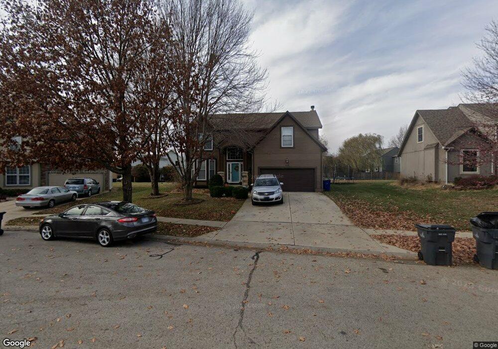
15318 S Foxridge St Olathe, KS 66062
Estimated Value: $453,213 - $502,000
4
Beds
3
Baths
2,249
Sq Ft
$213/Sq Ft
Est. Value
About This Home
This home is located at 15318 S Foxridge St, Olathe, KS 66062 and is currently estimated at $480,053, approximately $213 per square foot. 15318 S Foxridge St is a home located in Johnson County with nearby schools including Brougham Elementary School, Frontier Trail Middle School, and Olathe South Sr High School.
Ownership History
Date
Name
Owned For
Owner Type
Purchase Details
Closed on
Apr 13, 2016
Sold by
Thomason Kenneth W and Thomason Sarah A
Bought by
Ford Crystal and Ford Edward
Current Estimated Value
Purchase Details
Closed on
Aug 5, 2002
Sold by
Baker Rodney M and Baker Diane R
Bought by
Thomason Kenneth W
Home Financials for this Owner
Home Financials are based on the most recent Mortgage that was taken out on this home.
Original Mortgage
$158,400
Interest Rate
6.6%
Create a Home Valuation Report for This Property
The Home Valuation Report is an in-depth analysis detailing your home's value as well as a comparison with similar homes in the area
Home Values in the Area
Average Home Value in this Area
Purchase History
| Date | Buyer | Sale Price | Title Company |
|---|---|---|---|
| Ford Crystal | -- | Continental Title | |
| Ford Crystal | -- | Continental Title | |
| Thomason Kenneth W | -- | Multiple |
Source: Public Records
Mortgage History
| Date | Status | Borrower | Loan Amount |
|---|---|---|---|
| Previous Owner | Thomason Kenneth W | $158,400 | |
| Closed | Thomason Kenneth W | $39,600 |
Source: Public Records
Tax History Compared to Growth
Tax History
| Year | Tax Paid | Tax Assessment Tax Assessment Total Assessment is a certain percentage of the fair market value that is determined by local assessors to be the total taxable value of land and additions on the property. | Land | Improvement |
|---|---|---|---|---|
| 2024 | $5,619 | $49,737 | $8,611 | $41,126 |
| 2023 | $5,375 | $46,760 | $7,487 | $39,273 |
| 2022 | $4,803 | $40,687 | $6,514 | $34,173 |
| 2021 | $4,703 | $37,985 | $6,514 | $31,471 |
| 2020 | $4,469 | $35,788 | $5,917 | $29,871 |
| 2019 | $4,498 | $35,777 | $6,508 | $29,269 |
| 2018 | $0 | $34,166 | $5,912 | $28,254 |
| 2017 | $4,188 | $32,740 | $5,377 | $27,363 |
| 2016 | $3,669 | $29,452 | $4,889 | $24,563 |
| 2015 | $3,488 | $28,026 | $4,889 | $23,137 |
| 2013 | -- | $25,473 | $4,889 | $20,584 |
Source: Public Records
Map
Nearby Homes
- 15168 W 154th St
- 15221 W 153rd St
- 14990 W 154th St
- 0 133rd & S Blackfoot Dr Unit HMS2572444
- 15403 W 155th Terrace
- 15478 S Acuff Ln
- 15343 S Navaho Dr
- 15577 S Arapaho St
- 15643 W 149th Terrace
- 14296 W 153rd St
- 15375 W 147th Terrace
- 15129 S Locust St
- 15525 S Summertree Ln
- 15455 W 159th St
- 14031 W 152nd Terrace Unit 3703
- 15241 S Symphony Dr Unit 3402
- 14165 W 149th Terrace
- 14820 S Brougham Dr
- 16401 W 157th Terrace
- 15912 W 160th St
- 15312 S Foxridge St
- 15324 S Foxridge St
- 15150 W 154th St
- 15137 W 153rd Terrace
- 15154 W 154th St
- 15306 S Foxridge St
- 15330 S Foxridge St
- 15143 W 153rd Terrace
- 15319 S Foxridge St
- 15157 W 154th St
- 15313 S Foxridge St
- 15325 S Foxridge St
- 15149 W 153rd Terrace
- 15331 S Foxridge St
- 15162 W 154th St
- 15303 S Foxridge St
- 15114 W 154th Terrace
- 15108 W 154th Terrace
- 15165 W 154th St
- 15155 W 153rd Terrace