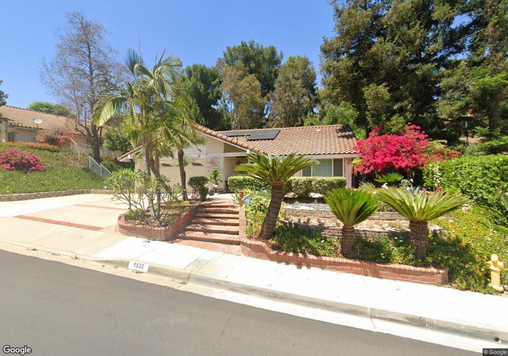
1532 Kiowa Crest Dr Diamond Bar, CA 91765
Estimated Value: $1,208,000 - $1,307,000
4
Beds
2
Baths
2,007
Sq Ft
$635/Sq Ft
Est. Value
About This Home
This home is located at 1532 Kiowa Crest Dr, Diamond Bar, CA 91765 and is currently estimated at $1,273,470, approximately $634 per square foot. 1532 Kiowa Crest Dr is a home located in Los Angeles County with nearby schools including Maple Hill Elementary School, Chaparral Middle School, and Diamond Bar High School.
Ownership History
Date
Name
Owned For
Owner Type
Purchase Details
Closed on
Mar 5, 2020
Sold by
Walters Alfred C and Walters Belinda
Bought by
Liu Guizeng and Liu Yiogxin
Current Estimated Value
Home Financials for this Owner
Home Financials are based on the most recent Mortgage that was taken out on this home.
Original Mortgage
$529,750
Outstanding Balance
$470,231
Interest Rate
3.62%
Mortgage Type
New Conventional
Estimated Equity
$803,239
Create a Home Valuation Report for This Property
The Home Valuation Report is an in-depth analysis detailing your home's value as well as a comparison with similar homes in the area
Home Values in the Area
Average Home Value in this Area
Purchase History
| Date | Buyer | Sale Price | Title Company |
|---|---|---|---|
| Liu Guizeng | $815,000 | Usa National Title Co Inc |
Source: Public Records
Mortgage History
| Date | Status | Borrower | Loan Amount |
|---|---|---|---|
| Open | Liu Guizeng | $529,750 |
Source: Public Records
Tax History Compared to Growth
Tax History
| Year | Tax Paid | Tax Assessment Tax Assessment Total Assessment is a certain percentage of the fair market value that is determined by local assessors to be the total taxable value of land and additions on the property. | Land | Improvement |
|---|---|---|---|---|
| 2025 | $10,844 | $891,316 | $599,863 | $291,453 |
| 2024 | $10,844 | $873,840 | $588,101 | $285,739 |
| 2023 | $10,536 | $856,707 | $576,570 | $280,137 |
| 2022 | $10,268 | $839,910 | $565,265 | $274,645 |
| 2021 | $10,079 | $823,442 | $554,182 | $269,260 |
| 2020 | $4,125 | $307,022 | $115,065 | $191,957 |
| 2019 | $4,049 | $301,003 | $112,809 | $188,194 |
| 2018 | $3,837 | $295,102 | $110,598 | $184,504 |
| 2016 | $3,552 | $283,645 | $106,304 | $177,341 |
| 2015 | $3,570 | $279,386 | $104,708 | $174,678 |
| 2014 | $3,581 | $273,914 | $102,657 | $171,257 |
Source: Public Records
Map
Nearby Homes
- 1521 Sunbluff Dr
- 1522 Deerfoot Dr
- 1739 Shadehill Place
- 22407 Birds Eye Dr
- 1714 Roundtree Cir
- 1721 Cliffbranch Dr
- 21833 Onawa Place
- 1826 Wellspring Dr
- 22511 Eddridge Dr
- 1748 Autumnglow Dr
- 2256 Shady Hills Dr
- 1923 White Star Dr
- 2282 Shady Hills Dr
- 2118 Tierra Loma Dr
- 2119 Dublin Ln Unit 3
- 1700 Fern Hollow Dr
- 893 Terrace Ln W Unit 1
- 21600 Laurelrim Dr Unit B
- 22455 Ridge Line Rd
- 21284 Lycoming St
- 1522 Kiowa Crest Dr
- 1536 Kiowa Crest Dr
- 1510 Kiowa Crest Dr
- 1538 Kiowa Crest Dr
- 22022 Cedardale Dr
- 21950 Birds Eye Dr
- 1531 Kiowa Crest Dr
- 1504 Kiowa Crest Dr
- 1535 Kiowa Crest Dr
- 1542 Kiowa Crest Dr
- 1523 Kiowa Crest Dr
- 21940 Birds Eye Dr
- 1519 Kiowa Crest Dr
- 1539 Kiowa Crest Dr
- 22016 Cedardale Dr
- 22030 Cedardale Dr
- 21910 Birds Eye Dr
- 22044 Cedardale Dr
- 1515 Kiowa Crest Dr
- 1527 Kiowa Crest Dr