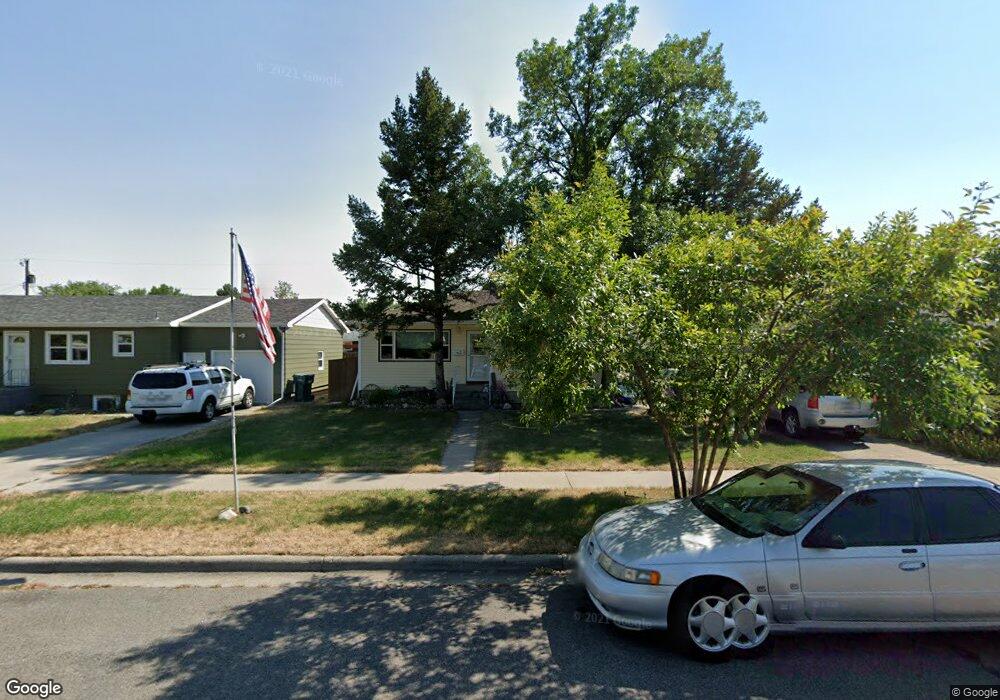
1536 Cook Ave Billings, MT 59102
East Central Billings NeighborhoodEstimated Value: $270,000 - $316,000
4
Beds
2
Baths
932
Sq Ft
$321/Sq Ft
Est. Value
About This Home
This home is located at 1536 Cook Ave, Billings, MT 59102 and is currently estimated at $299,065, approximately $320 per square foot. 1536 Cook Ave is a home located in Yellowstone County with nearby schools including Miles Avenue School, Lewis & Clark Junior High School, and Billings West High School.
Ownership History
Date
Name
Owned For
Owner Type
Purchase Details
Closed on
May 25, 2007
Sold by
Blomberg Joey R and Blomberg Kristy L
Bought by
Austin Leslie J
Current Estimated Value
Home Financials for this Owner
Home Financials are based on the most recent Mortgage that was taken out on this home.
Original Mortgage
$153,533
Outstanding Balance
$93,440
Interest Rate
6.18%
Mortgage Type
FHA
Estimated Equity
$205,625
Create a Home Valuation Report for This Property
The Home Valuation Report is an in-depth analysis detailing your home's value as well as a comparison with similar homes in the area
Home Values in the Area
Average Home Value in this Area
Purchase History
| Date | Buyer | Sale Price | Title Company |
|---|---|---|---|
| Austin Leslie J | -- | None Available |
Source: Public Records
Mortgage History
| Date | Status | Borrower | Loan Amount |
|---|---|---|---|
| Open | Austin Leslie J | $153,533 |
Source: Public Records
Tax History Compared to Growth
Tax History
| Year | Tax Paid | Tax Assessment Tax Assessment Total Assessment is a certain percentage of the fair market value that is determined by local assessors to be the total taxable value of land and additions on the property. | Land | Improvement |
|---|---|---|---|---|
| 2025 | $1,325 | $301,800 | $45,283 | $256,517 |
| 2024 | $1,325 | $260,400 | $42,362 | $218,038 |
| 2023 | $1,062 | $260,400 | $42,362 | $218,038 |
| 2022 | $2,055 | $217,700 | $0 | $0 |
| 2021 | $2,250 | $217,700 | $0 | $0 |
| 2020 | $2,095 | $192,300 | $0 | $0 |
| 2019 | $2,000 | $192,300 | $0 | $0 |
| 2018 | $1,905 | $179,300 | $0 | $0 |
| 2017 | $1,849 | $179,300 | $0 | $0 |
| 2016 | $1,697 | $165,900 | $0 | $0 |
| 2015 | $1,659 | $165,900 | $0 | $0 |
| 2014 | $1,580 | $84,058 | $0 | $0 |
Source: Public Records
Map
Nearby Homes
- 305 17th St W
- 1231 Saint Johns Ave
- 621 Nelson Dr
- 1604 Wyoming Ave
- 1346 Broadwater Ave
- 1304 Eldorado Dr
- 1541 Wyoming Ave Unit C
- 28 19th St W
- 1537 Wyoming Ave Unit D
- 16 19th St W
- 1540 Yellowstone Ave Unit D
- 1212 Concord Dr
- 1540 Clark Ave
- 1122 Howard Ave
- 1310 Yellowstone Ave Unit 6
- 1310 Yellowstone Ave Unit 11
- 1310 Yellowstone Ave Unit 16
- 1113 Lynn Ave
- 112 11th St W
- 141 S 12th St W
- 1532 Cook Ave
- 1540 Cook Ave
- 109 16th St W
- 1529 Saint Johns Ave
- 1528 Cook Ave
- 1525 Saint Johns Ave
- 1533 Saint Johns Ave
- 1521 Saint Johns Ave
- 1545 Saint Johns Ave
- 1522 Cook Ave
- 1533 Cook Ave
- 1535 Cook Ave
- 1531 Cook Ave
- 1517 Saint Johns Ave
- 1537 Cook Ave
- 1525 Cook Ave
- 1602 Cook Ave
- 1516 Cook Ave
- 1521 Cook Ave
- 1513 Saint Johns Ave