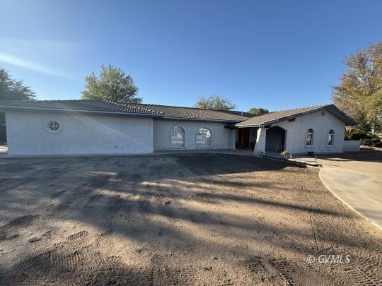
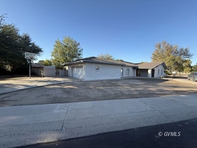
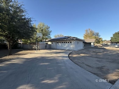
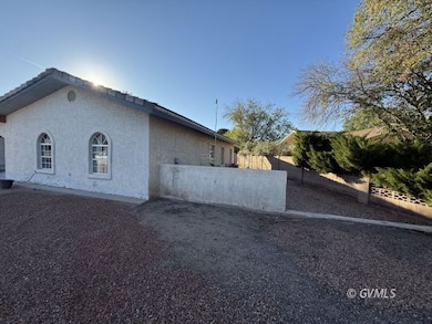
1536 W Cherokee Ln Safford, AZ 85546
Estimated payment $2,381/month
Highlights
- RV Access or Parking
- Lawn
- 2 Car Attached Garage
- Ranch Style House
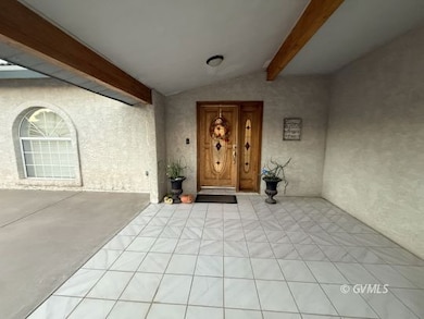
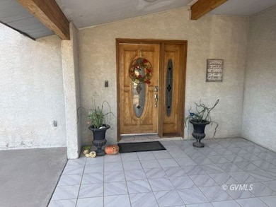
- Covered Patio or Porch
- Landscaped with Trees
About This Home
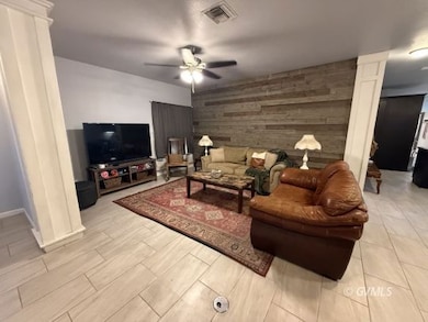
*Seller may consider contributing up to $4000.00 for a flooring allowance. This stunning 4-bedroom, 2 1/2 bath residence features a spacious, open-concept living area perfect for entertaining. The huge kitchen is a chef's delight, offering ample counter space and modern appliances.Outside, enjoy a large lot with an inviting backyard, complete with a fire pit and room for a BBQ ? ideal for outdoor gatherings. Benefit from solar panels that significantly reduce utility costs, along with mature trees providing shade and beauty. Additional features include a 2-car garage, two A/C units, and a secure block wall. Located in a desirable neighborhood with paved streets and sidewalks, this home is conveniently close to amenities and schools. Don't miss this opportunity to own a beautiful home with all the modern comfort!
Listing Agent
Alicia Hart
Tierra Antigua Realty (Safford) Brokerage Phone: (928) 322-4358 License #SA659396000 Listed on: 11/03/2025

Home Details
Home Type
- Single Family
Est. Annual Taxes
- $1,704
Year Built
- Built in 1992
Lot Details
- 0.36 Acre Lot
- Partially Fenced Property
- Landscaped with Trees
- Lawn
Parking
- 2 Car Attached Garage
- RV Access or Parking
Home Design
- Ranch Style House
- Slab Foundation
- Tile Roof
- Stucco Exterior
Interior Spaces
- 2,295 Sq Ft Home
- Ceiling Fan
- Gas Fireplace
- Washer and Dryer Hookup
Kitchen
- Oven or Range
- Microwave
- Dishwasher
- Disposal
Flooring
- Carpet
- Tile
Bedrooms and Bathrooms
- 4 Bedrooms
Outdoor Features
- Covered Patio or Porch
- Storage Shed
Schools
- Safford Elementary And Middle School
- Safford High School
Utilities
- Cooling System Powered By Gas
- Forced Air Heating System
- Natural Gas Connected
- Natural Gas Water Heater
- Phone Available
Community Details
- Cluff El Dorado Estates Subdivision
Listing and Financial Details
- Assessor Parcel Number 101-23-074B
Map
Home Values in the Area
Average Home Value in this Area
Tax History
| Year | Tax Paid | Tax Assessment Tax Assessment Total Assessment is a certain percentage of the fair market value that is determined by local assessors to be the total taxable value of land and additions on the property. | Land | Improvement |
|---|---|---|---|---|
| 2026 | $1,704 | -- | -- | -- |
| 2025 | $1,704 | $32,283 | $3,070 | $29,213 |
| 2024 | $1,771 | $30,495 | $3,070 | $27,425 |
| 2023 | $1,771 | $24,429 | $3,070 | $21,359 |
| 2022 | $1,739 | $21,621 | $3,070 | $18,551 |
| 2021 | $1,959 | $0 | $0 | $0 |
| 2020 | $1,884 | $0 | $0 | $0 |
| 2019 | $1,984 | $0 | $0 | $0 |
| 2018 | $1,920 | $0 | $0 | $0 |
| 2017 | $1,721 | $0 | $0 | $0 |
| 2016 | $1,580 | $0 | $0 | $0 |
| 2015 | $1,443 | $0 | $0 | $0 |
Property History
| Date | Event | Price | List to Sale | Price per Sq Ft |
|---|---|---|---|---|
| 11/03/2025 11/03/25 | For Sale | $424,000 | -- | $185 / Sq Ft |
Purchase History
| Date | Type | Sale Price | Title Company |
|---|---|---|---|
| Deed | -- | None Listed On Document | |
| Warranty Deed | $353,000 | Stewart Title & Trust Of Phoen | |
| Quit Claim Deed | -- | Stewart Title & Trust Of Phoen | |
| Warranty Deed | $205,500 | Safford Title Agency Inc |
Mortgage History
| Date | Status | Loan Amount | Loan Type |
|---|---|---|---|
| Open | $310,541 | FHA | |
| Previous Owner | $201,777 | FHA |
Source: Gila Valley Multiple Listing Service
MLS Number: 1721630
APN: 101-23-074B
Disclaimer: Certain information contained herein is derived from information provided by parties other than Homes.com. All information provided is deemed reliable, but is not guaranteed to be accurate and should be independently verified.
![]() IDX information is provided exclusively for personal, non-commercial use, and may not be used for any purpose other than to identify prospective properties consumers may be interested in purchasing. Information is deemed reliable but not guaranteed.
IDX information is provided exclusively for personal, non-commercial use, and may not be used for any purpose other than to identify prospective properties consumers may be interested in purchasing. Information is deemed reliable but not guaranteed.
- 1309 S Bingham Place
- 1115 W Relation St
- 1609 S 12th Ave
- 832 W Stirrup Dr
- 813 W 13th St
- 1302 S 7th Ave
- 603 W 16th St
- 1108 S 9th Place
- 514 W 15th St
- 1108 S 9th Ave
- 1217 S 7th Ave
- 1906 S Elm Ave
- 1313 S 6th Ave
- 411 W 16th St
- 1107 W Yuma Cir
- 1104 S Central Ave
- 120 Relation St Unit 2
- 115 W 15th St
- 1017 W Tucson St
- 1210 S 1st Ave