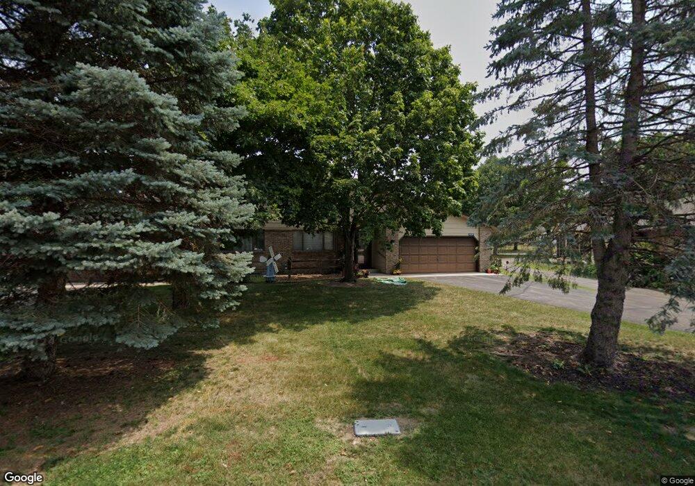
1539 Pheasantwood Trail Northfield, MN 55057
Estimated Value: $260,878 - $308,000
2
Beds
2
Baths
1,502
Sq Ft
$185/Sq Ft
Est. Value
About This Home
This home is located at 1539 Pheasantwood Trail, Northfield, MN 55057 and is currently estimated at $278,220, approximately $185 per square foot. 1539 Pheasantwood Trail is a home located in Rice County with nearby schools including Bridgewater Elementary School, Northfield Middle School, and Northfield Senior High School.
Ownership History
Date
Name
Owned For
Owner Type
Purchase Details
Closed on
Jun 18, 2015
Sold by
Drentlaw Evelyn Evelyn
Bought by
Wegner Walter Walter
Current Estimated Value
Home Financials for this Owner
Home Financials are based on the most recent Mortgage that was taken out on this home.
Original Mortgage
$126,800
Outstanding Balance
$99,078
Interest Rate
4%
Estimated Equity
$179,142
Purchase Details
Closed on
Aug 11, 2000
Sold by
Aadahl Ella M
Bought by
Drentlaw Earl F and Drentlaw Evelyn
Create a Home Valuation Report for This Property
The Home Valuation Report is an in-depth analysis detailing your home's value as well as a comparison with similar homes in the area
Home Values in the Area
Average Home Value in this Area
Purchase History
| Date | Buyer | Sale Price | Title Company |
|---|---|---|---|
| Wegner Walter Walter | $146,000 | -- | |
| Drentlaw Earl F | $129,900 | -- |
Source: Public Records
Mortgage History
| Date | Status | Borrower | Loan Amount |
|---|---|---|---|
| Open | Wegner Walter Walter | $126,800 |
Source: Public Records
Tax History Compared to Growth
Tax History
| Year | Tax Paid | Tax Assessment Tax Assessment Total Assessment is a certain percentage of the fair market value that is determined by local assessors to be the total taxable value of land and additions on the property. | Land | Improvement |
|---|---|---|---|---|
| 2025 | $3,962 | $257,200 | $48,600 | $208,600 |
| 2024 | $3,962 | $234,600 | $45,600 | $189,000 |
| 2023 | $3,038 | $234,600 | $45,600 | $189,000 |
| 2022 | $2,736 | $201,700 | $40,600 | $161,100 |
| 2021 | $2,666 | $179,000 | $36,000 | $143,000 |
| 2020 | $2,590 | $172,600 | $36,000 | $136,600 |
| 2019 | $2,496 | $165,300 | $36,000 | $129,300 |
| 2018 | $2,232 | $157,900 | $36,000 | $121,900 |
| 2017 | $1,942 | $141,500 | $29,000 | $112,500 |
| 2016 | $1,830 | $135,700 | $29,000 | $106,700 |
| 2015 | $1,740 | $124,000 | $29,000 | $95,000 |
| 2014 | -- | $119,600 | $23,500 | $96,100 |
Source: Public Records
Map
Nearby Homes
- 1707 Jackson Ct
- 1741 Roosevelt Dr
- 1513 Senate Ln
- 1819 Truman Ct
- 1301 Presidential Dr
- 2004 Lincoln St S
- 2206 Grant Ct
- 709 Carter Dr
- 2116 Park Pointe Dr
- 1011 Poplar St
- 2200 Greenfield Dr W
- 2220 Greenfield Dr E
- XXXX Division St S
- 1603 Washington St
- 119 Woodley St W
- 307 8th St W
- 917 Division St S
- Outlot Honeylocust Dr
- XXXX Harvest Hills Outlook
- 2620 Oak Lawn Dr
- 1537 Pheasantwood Trail
- 1535 Pheasantwood Trail
- 1543 Pheasantwood Trail
- 1533 Pheasantwood Trail
- 1541 Pheasantwood Trail
- 1529 Pheasantwood Trail
- 1547 Pheasantwood Trail
- 1539 Roosevelt Dr
- 1545 Pheasantwood Trail
- 1537 Roosevelt Dr
- 1525 Pheasantwood Trail
- 1527 Pheasantwood Trail
- 1506 Pheasantwood Trail
- 1601 Monroe Ct
- 1601 Pheasantwood Trail
- 1603 Pheasantwood Trail
- 1521 Pheasantwood Trail
- 1535 Eisenhower Ct
- 1523 Pheasantwood Trail
- 1548 Roosevelt Dr