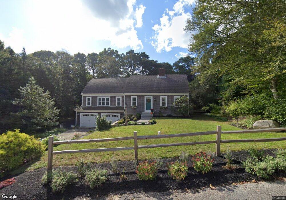
154 Mill Pond Dr Brewster, MA 02631
Estimated Value: $927,943 - $1,119,000
3
Beds
3
Baths
1,956
Sq Ft
$516/Sq Ft
Est. Value
About This Home
This home is located at 154 Mill Pond Dr, Brewster, MA 02631 and is currently estimated at $1,010,236, approximately $516 per square foot. 154 Mill Pond Dr is a home located in Barnstable County with nearby schools including Nauset Regional Middle School, Nauset Regional High School, and Latham School.
Ownership History
Date
Name
Owned For
Owner Type
Purchase Details
Closed on
Nov 19, 2010
Sold by
Skojec Lisa A
Bought by
Bernier Kevin M and Bernier Cynthia A
Current Estimated Value
Home Financials for this Owner
Home Financials are based on the most recent Mortgage that was taken out on this home.
Original Mortgage
$150,000
Outstanding Balance
$99,119
Interest Rate
4.3%
Mortgage Type
Purchase Money Mortgage
Estimated Equity
$911,117
Purchase Details
Closed on
Jun 28, 2010
Sold by
Skojec Daniel J and Skojec Lisa A
Bought by
Skojec Lisa A
Purchase Details
Closed on
Oct 31, 1997
Sold by
Fellows Teresa M
Bought by
Skojec Daniel J and Skojec Lisa A
Create a Home Valuation Report for This Property
The Home Valuation Report is an in-depth analysis detailing your home's value as well as a comparison with similar homes in the area
Home Values in the Area
Average Home Value in this Area
Purchase History
| Date | Buyer | Sale Price | Title Company |
|---|---|---|---|
| Bernier Kevin M | $489,500 | -- | |
| Skojec Lisa A | -- | -- | |
| Skojec Daniel J | $130,000 | -- |
Source: Public Records
Mortgage History
| Date | Status | Borrower | Loan Amount |
|---|---|---|---|
| Open | Bernier Kevin M | $150,000 | |
| Previous Owner | Skojec Daniel J | $249,000 | |
| Previous Owner | Skojec Daniel J | $216,800 |
Source: Public Records
Tax History Compared to Growth
Tax History
| Year | Tax Paid | Tax Assessment Tax Assessment Total Assessment is a certain percentage of the fair market value that is determined by local assessors to be the total taxable value of land and additions on the property. | Land | Improvement |
|---|---|---|---|---|
| 2025 | $6,202 | $901,500 | $237,400 | $664,100 |
| 2024 | $5,848 | $858,700 | $223,900 | $634,800 |
| 2023 | $5,369 | $768,100 | $199,900 | $568,200 |
| 2022 | $5,088 | $648,200 | $166,600 | $481,600 |
| 2021 | $4,854 | $565,700 | $144,800 | $420,900 |
| 2020 | $18,888 | $550,800 | $144,800 | $406,000 |
| 2019 | $19,699 | $531,000 | $139,300 | $391,700 |
| 2018 | $4,244 | $513,800 | $139,300 | $374,500 |
| 2017 | $4,151 | $494,800 | $139,300 | $355,500 |
| 2016 | $3,993 | $473,700 | $136,600 | $337,100 |
| 2015 | $3,825 | $463,100 | $133,800 | $329,300 |
Source: Public Records
Map
Nearby Homes
- 140 Mill Pond Dr
- 162 Mill Pond Dr
- 470 Run Hill Rd
- 155 Mill Pond Dr
- 131 Mill Pond Dr
- 128 Mill Pond Dr
- 165 Mill Pond Dr
- 0 Mill Pond Dr
- 37 Frank d Lawrence Rd
- 27 Frank d Lawrence Rd
- 37 George Darby Cartway
- 117 Mill Pond Dr
- 21 Mill Pond Dr
- 5 Mill Pond Dr
- 500 Run Hill Rd
- 108 Mill Pond Dr
- 9 Frank d Lawrence Rd
- 35 Mill Pond Dr
- 27 George Darby Cartway