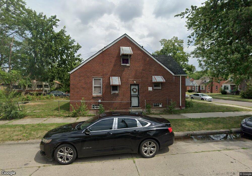
15403 Fordham St Detroit, MI 48205
Maple Ridge NeighborhoodEstimated Value: $61,000 - $98,791
3
Beds
1
Bath
1,251
Sq Ft
$62/Sq Ft
Est. Value
About This Home
This home is located at 15403 Fordham St, Detroit, MI 48205 and is currently estimated at $77,698, approximately $62 per square foot. 15403 Fordham St is a home located in Wayne County with nearby schools including Edward 'Duke' Ellington Conservatory of Music and Art, Charles L. Spain Elementary-Middle School, and Denby High School.
Ownership History
Date
Name
Owned For
Owner Type
Purchase Details
Closed on
Nov 13, 2014
Sold by
Wayne County Treasurer
Bought by
J & N Brothers Properties Llc
Current Estimated Value
Purchase Details
Closed on
May 13, 2011
Sold by
Fordham 15403 Llc
Bought by
Nsuk3 Llc
Purchase Details
Closed on
Feb 18, 2010
Sold by
Sheppard Joseph A and Sheppard Dina L
Bought by
Federal National Mortgage Association
Purchase Details
Closed on
Jan 1, 2004
Sold by
Sheppard Joseph A and Sheppard Dina L
Bought by
Stromco Investments Llc
Create a Home Valuation Report for This Property
The Home Valuation Report is an in-depth analysis detailing your home's value as well as a comparison with similar homes in the area
Home Values in the Area
Average Home Value in this Area
Purchase History
| Date | Buyer | Sale Price | Title Company |
|---|---|---|---|
| J & N Brothers Properties Llc | $700 | None Available | |
| Nsuk3 Llc | -- | Continental Title Agency | |
| Federal National Mortgage Association | $40,081 | None Available | |
| Stromco Investments Llc | -- | -- |
Source: Public Records
Tax History Compared to Growth
Tax History
| Year | Tax Paid | Tax Assessment Tax Assessment Total Assessment is a certain percentage of the fair market value that is determined by local assessors to be the total taxable value of land and additions on the property. | Land | Improvement |
|---|---|---|---|---|
| 2025 | $840 | $18,300 | $0 | $0 |
| 2024 | $840 | $17,000 | $0 | $0 |
| 2023 | $814 | $13,800 | $0 | $0 |
| 2022 | $861 | $12,700 | $0 | $0 |
| 2021 | $840 | $8,800 | $0 | $0 |
| 2020 | $840 | $7,800 | $0 | $0 |
| 2019 | $829 | $7,000 | $0 | $0 |
| 2018 | $740 | $6,500 | $0 | $0 |
| 2017 | $125 | $6,600 | $0 | $0 |
| 2016 | $961 | $3,800 | $0 | $0 |
| 2015 | $950 | $9,500 | $0 | $0 |
| 2013 | $2,104 | $21,035 | $0 | $0 |
| 2010 | -- | $30,840 | $935 | $29,905 |
Source: Public Records
Map
Nearby Homes
- 15243 Fordham St
- 15294 Saratoga St
- 15257 Faircrest St
- 15480 Saratoga St
- 18820 Morang Dr
- 18814 Morang Dr
- 15649 E 7 Mile Rd
- 15596 Eastwood St
- 15227 Linnhurst St
- 14253 Fordham St
- 15646 Saratoga St
- 14916 Maddelein St
- 15666 Eastwood St
- 15804 E 7 Mile Rd
- 15816 E 7 Mile Rd
- 15315 Park Grove St
- 15860 Fordham St
- 15309 Mapleridge St
- 15919 Eastwood St
- 15860 Faircrest St
- 15409 Fordham St
- 15415 Fordham St
- 15423 Fordham St
- 15311 Fordham St
- 15303 Fordham St
- 15400 E 7 Mile Rd
- 15431 Fordham St
- 15406 Fordham St
- 15412 Fordham St
- 15295 Fordham St
- 15422 Fordham St
- 15310 Fordham St
- 15300 Fordham St
- 15430 Fordham St
- 15285 Fordham St
- 19015 Morang Dr
- 15294 Fordham St
- 15279 Fordham St
- 19009 Morang Dr
- 15440 Fordham St