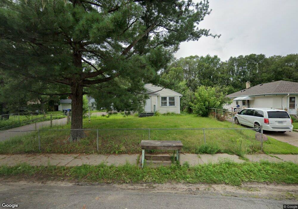
1541 Mcafee St Saint Paul, MN 55106
Estimated Value: $267,907 - $281,000
3
Beds
2
Baths
520
Sq Ft
$528/Sq Ft
Est. Value
About This Home
This home is located at 1541 Mcafee St, Saint Paul, MN 55106 and is currently estimated at $274,727, approximately $528 per square foot. 1541 Mcafee St is a home located in Ramsey County with nearby schools including Frost Lake Elementary School, Txuj Ci HMong Language and Culture Upper Campus, and Johnson Senior High School.
Ownership History
Date
Name
Owned For
Owner Type
Purchase Details
Closed on
Jul 8, 2025
Sold by
Estrada Manuel Enrique Rosales and Suniga Nancy Cuevas
Bought by
Estrada Manuel Enrique Rosa and Suniga Nancy Cuevas
Current Estimated Value
Purchase Details
Closed on
Jun 29, 2020
Sold by
Ramirez Javier Sanchez and Hernandez Erenaida Ayala
Bought by
Estrada Enrique Rosales
Home Financials for this Owner
Home Financials are based on the most recent Mortgage that was taken out on this home.
Original Mortgage
$160,000
Interest Rate
3.2%
Mortgage Type
Land Contract Argmt. Of Sale
Create a Home Valuation Report for This Property
The Home Valuation Report is an in-depth analysis detailing your home's value as well as a comparison with similar homes in the area
Home Values in the Area
Average Home Value in this Area
Purchase History
| Date | Buyer | Sale Price | Title Company |
|---|---|---|---|
| Estrada Manuel Enrique Rosa | $500 | None Listed On Document | |
| Estrada Enrique Rosales | $220,000 | None Available |
Source: Public Records
Mortgage History
| Date | Status | Borrower | Loan Amount |
|---|---|---|---|
| Previous Owner | Estrada Enrique Rosales | $160,000 |
Source: Public Records
Tax History Compared to Growth
Tax History
| Year | Tax Paid | Tax Assessment Tax Assessment Total Assessment is a certain percentage of the fair market value that is determined by local assessors to be the total taxable value of land and additions on the property. | Land | Improvement |
|---|---|---|---|---|
| 2025 | $3,952 | $273,700 | $30,000 | $243,700 |
| 2023 | $3,952 | $243,700 | $25,000 | $218,700 |
| 2022 | $3,242 | $256,300 | $25,000 | $231,300 |
| 2021 | $2,866 | $197,300 | $25,000 | $172,300 |
| 2020 | $2,778 | $174,700 | $11,300 | $163,400 |
| 2019 | $2,676 | $162,100 | $11,300 | $150,800 |
| 2018 | $2,722 | $153,600 | $11,300 | $142,300 |
| 2017 | $2,658 | $152,400 | $11,300 | $141,100 |
| 2016 | $2,344 | $0 | $0 | $0 |
| 2015 | $1,802 | $113,500 | $11,300 | $102,200 |
| 2014 | $1,778 | $0 | $0 | $0 |
Source: Public Records
Map
Nearby Homes
- 1567 Atlantic St
- 1639 Clarence St
- 1377 Clarence St
- 1450 Arlington Ave E
- 1672 Manton St
- 1357 Birmingham St
- 1714 Duluth St
- 1730 Atlantic St
- 1435 Price Ave
- 1751 Clarence St
- 1532 Larpenteur Ave E
- 1583 Nevada Ave E
- 866 Clear Ave E
- 1607 Hoyt Ave E
- 1229 Clarence St
- 1221 Clarence St
- 1637 Iowa Ave E
- 1343 Maryland Ave E
- 1870 Clarence St
- 1627 Christie Place
- 1533 Mcafee St
- 1551 Mcafee St
- 1540 English St
- 1530 N English St
- 1530 English St Unit 1
- 1521 Mcafee St
- 1540 Mcafee St
- 1513 Mcafee St
- 1536 Mcafee St
- 1536 1536 McAfee-street-
- 1542 Mcafee St
- 1532 Mcafee St
- 1528 Mcafee St
- 1552 Mcafee St
- 1524 Mcafee St
- 1558 Mcafee St
- 1563 Mcafee St
- 1510 English St
- 1537 English St
- 1520 Mcafee St