15421 Genito Rd Midlothian, VA 23112
Brandermill NeighborhoodEstimated Value: $720,000 - $1,783,774
4
Beds
4
Baths
4,598
Sq Ft
$259/Sq Ft
Est. Value
About This Home
This home is located at 15421 Genito Rd, Midlothian, VA 23112 and is currently estimated at $1,190,944, approximately $259 per square foot. 15421 Genito Rd is a home located in Chesterfield County with nearby schools including Tomahawk Creek Middle School, Cosby High School, and Millwood School.
Ownership History
Date
Name
Owned For
Owner Type
Purchase Details
Closed on
Feb 6, 1998
Bought by
Durnsirth Roy K and Durnsirth Susan A
Current Estimated Value
Home Financials for this Owner
Home Financials are based on the most recent Mortgage that was taken out on this home.
Original Mortgage
$60,000
Interest Rate
6.95%
Mortgage Type
New Conventional
Create a Home Valuation Report for This Property
The Home Valuation Report is an in-depth analysis detailing your home's value as well as a comparison with similar homes in the area
Home Values in the Area
Average Home Value in this Area
Purchase History
| Date | Buyer | Sale Price | Title Company |
|---|---|---|---|
| Durnsirth Roy K | $142,000 | -- |
Source: Public Records
Mortgage History
| Date | Status | Borrower | Loan Amount |
|---|---|---|---|
| Open | Durnwirth Roy Karl | $452,000 | |
| Closed | Durnwirth Roy Karl | $435,000 | |
| Closed | Durnwirth Roy Karl | $100,000 | |
| Closed | Durnwirth Roy Earl | $482,000 | |
| Closed | Durnwirth Roy Karl | $495,000 | |
| Closed | Durnsirth Roy K | $60,000 |
Source: Public Records
Tax History Compared to Growth
Tax History
| Year | Tax Paid | Tax Assessment Tax Assessment Total Assessment is a certain percentage of the fair market value that is determined by local assessors to be the total taxable value of land and additions on the property. | Land | Improvement |
|---|---|---|---|---|
| 2024 | $10,269 | $1,073,400 | $320,000 | $753,400 |
| 2023 | $9,382 | $1,031,000 | $315,000 | $716,000 |
| 2022 | $9,086 | $987,600 | $307,300 | $680,300 |
| 2021 | $9,100 | $955,300 | $305,300 | $650,000 |
| 2020 | $8,838 | $930,300 | $303,300 | $627,000 |
| 2019 | $8,688 | $914,500 | $297,300 | $617,200 |
| 2018 | $8,354 | $879,400 | $291,300 | $588,100 |
| 2017 | $8,205 | $854,700 | $290,300 | $564,400 |
| 2016 | $7,945 | $827,600 | $289,300 | $538,300 |
| 2015 | $7,767 | $806,500 | $288,300 | $518,200 |
| 2014 | $7,671 | $796,500 | $285,300 | $511,200 |
Source: Public Records
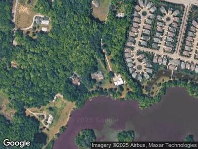
Map
Nearby Homes
- 4030 Water Overlook Blvd
- 4143 Cambrian Cir
- 16412 Inchcape Rd
- 5600 Grandin Ave Unit 19-2
- 15560 Fox Cove Cir
- 15555 Fox Cove Cir
- 14900 Crown Point Rd
- 000 Canoe Pointe Loop
- 00 Canoe Pointe Loop
- 0 Canoe Pointe Loop Unit 2503360
- 15730 Canoe Pointe Loop
- 15736 Canoe Pointe Loop
- 16524 Benmore Rd
- 15748 Canoe Pointe Loop Unit 10-3
- 15760 Canoe Pointe Loop Unit 8-3
- 15766 Canoe Pointe Loop Unit 11-3
- 5518 Riggs Dr
- 5524 Riggs Dr
- 3600 Brockhall Turn
- 5519 Riggs Dr
- 15421 Genito Rd
- 15411 Genito Rd
- 4311 Otterburn Rd
- 4264 Heron Pointe Terrace
- 4313 Otterburn Rd
- 4328 Heron Pointe Terrace
- 4322 Heron Pointe Terrace
- 4316 Heron Pointe Terrace
- 4310 Heron Pointe Terrace
- 4334 Heron Pointe Terrace
- 4304 Heron Pointe Terrace
- 4258 Heron Pointe Terrace
- 4340 Heron Pointe Terrace
- 4252 Heron Pointe Terrace
- 4319 Otterburn Rd
- 15513 Heron Pointe Way
- 4317 Heron Pointe Terrace
- 4346 Heron Pointe Terrace
- 4246 Heron Pointe Terrace
- 4323 Heron Pointe Terrace