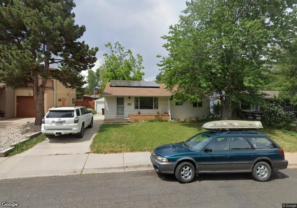
1545 Dellwood Ave Boulder, CO 80304
Central Boulder NeighborhoodEstimated Value: $810,000 - $1,187,000
3
Beds
1
Bath
1,040
Sq Ft
$910/Sq Ft
Est. Value
About This Home
This home is located at 1545 Dellwood Ave, Boulder, CO 80304 and is currently estimated at $946,565, approximately $910 per square foot. 1545 Dellwood Ave is a home located in Boulder County with nearby schools including Columbine Elementary School, Casey Middle School, and Boulder High School.
Ownership History
Date
Name
Owned For
Owner Type
Purchase Details
Closed on
Jun 25, 2014
Sold by
Weverka Robert T
Bought by
1545 Dellwood Llc
Current Estimated Value
Purchase Details
Closed on
Sep 26, 2003
Sold by
Mills Georgia A
Bought by
Weverka Robert T
Purchase Details
Closed on
Nov 16, 1998
Sold by
Mills Georgia A
Bought by
Clifford Georgia A
Home Financials for this Owner
Home Financials are based on the most recent Mortgage that was taken out on this home.
Original Mortgage
$41,000
Interest Rate
6.9%
Mortgage Type
Stand Alone First
Purchase Details
Closed on
Jun 4, 1985
Bought by
1545 Dellwood Llc
Purchase Details
Closed on
Aug 9, 1976
Bought by
1545 Dellwood Llc
Create a Home Valuation Report for This Property
The Home Valuation Report is an in-depth analysis detailing your home's value as well as a comparison with similar homes in the area
Home Values in the Area
Average Home Value in this Area
Purchase History
| Date | Buyer | Sale Price | Title Company |
|---|---|---|---|
| 1545 Dellwood Llc | -- | None Available | |
| Weverka Robert T | $303,000 | -- | |
| Clifford Georgia A | -- | -- | |
| 1545 Dellwood Llc | -- | -- | |
| 1545 Dellwood Llc | $39,000 | -- |
Source: Public Records
Mortgage History
| Date | Status | Borrower | Loan Amount |
|---|---|---|---|
| Previous Owner | Clifford Georgia A | $41,000 |
Source: Public Records
Tax History Compared to Growth
Tax History
| Year | Tax Paid | Tax Assessment Tax Assessment Total Assessment is a certain percentage of the fair market value that is determined by local assessors to be the total taxable value of land and additions on the property. | Land | Improvement |
|---|---|---|---|---|
| 2025 | $5,374 | $57,643 | $51,879 | $5,764 |
| 2024 | $5,374 | $57,643 | $51,879 | $5,764 |
| 2023 | $5,278 | $60,246 | $57,538 | $6,393 |
| 2022 | $4,666 | $49,436 | $44,119 | $5,317 |
| 2021 | $4,453 | $50,858 | $45,388 | $5,470 |
| 2020 | $4,007 | $46,039 | $36,823 | $9,216 |
| 2019 | $3,946 | $46,039 | $36,823 | $9,216 |
| 2018 | $3,589 | $41,400 | $33,120 | $8,280 |
| 2017 | $3,477 | $45,770 | $36,616 | $9,154 |
| 2016 | $3,409 | $39,378 | $29,372 | $10,006 |
| 2015 | $3,228 | $32,795 | $16,636 | $16,159 |
| 2014 | $2,757 | $32,795 | $16,636 | $16,159 |
Source: Public Records
Map
Nearby Homes
- 2935 19th St
- 2870 18th St
- 3010 14th St
- 1895 Alpine Ave Unit G21
- 1895 Alpine Ave Unit E18
- 2941 21st St
- 2917 13th St
- 1267 Balsam Ave
- 1265 Balsam Ave
- 1303 Alpine Ave Unit 24A
- 3000 Broadway St Unit 10
- 3000 Broadway St Unit 10 & 11
- 1237 Elder Ave Unit 1
- 1201 Balsam Ave Unit 203
- 1201 Balsam Ave Unit 201
- 1526 Sunset Blvd
- 3025 Broadway St Unit 7
- 2283 Nicholl St E
- 2085 Balsam Dr
- 780 Alpine Ave