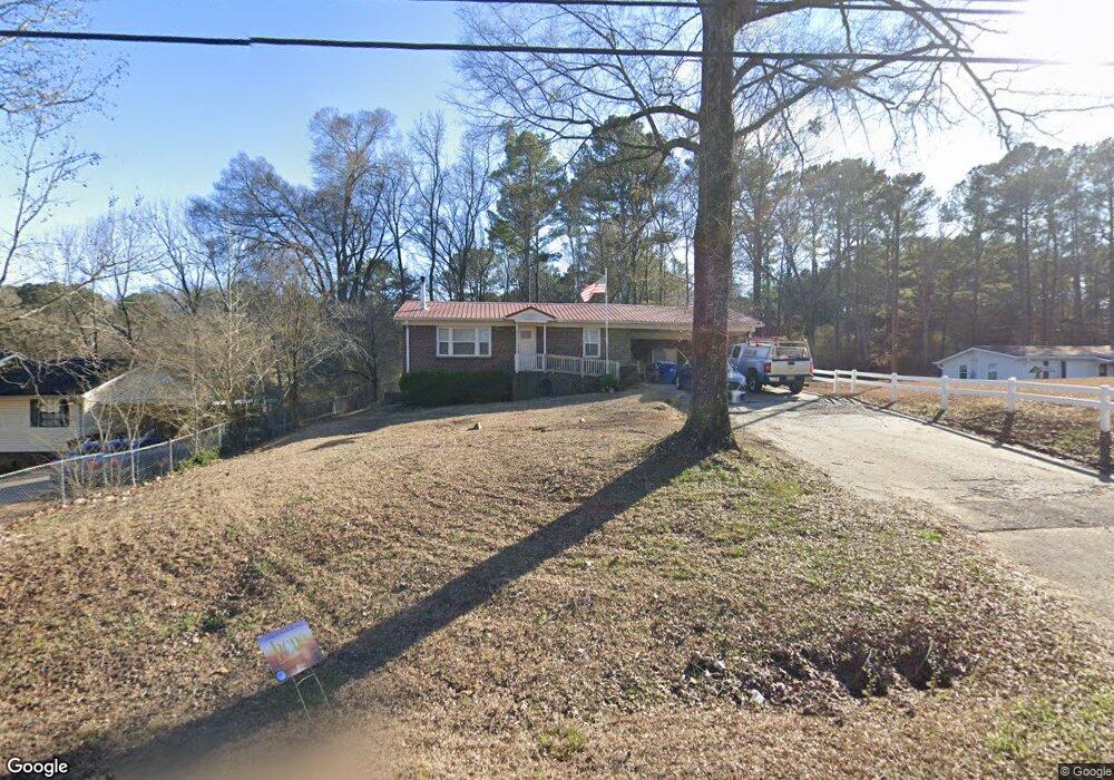
1545 Fieldstown Rd Gardendale, AL 35071
Estimated Value: $153,000 - $187,000
2
Beds
1
Bath
900
Sq Ft
$191/Sq Ft
Est. Value
About This Home
This home is located at 1545 Fieldstown Rd, Gardendale, AL 35071 and is currently estimated at $171,647, approximately $190 per square foot. 1545 Fieldstown Rd is a home located in Jefferson County with nearby schools including Gardendale Elementary School, Bragg Middle School, and Gardendale High School.
Ownership History
Date
Name
Owned For
Owner Type
Purchase Details
Closed on
Aug 4, 2014
Sold by
Chapple Kevin
Bought by
Mcpherson Michael Gilbert
Current Estimated Value
Purchase Details
Closed on
Jan 17, 2006
Sold by
Coleman Christie R Bland and Coleman Jimmy D
Bought by
Smith Adam and Smith Hollie
Home Financials for this Owner
Home Financials are based on the most recent Mortgage that was taken out on this home.
Original Mortgage
$82,620
Interest Rate
9.9%
Mortgage Type
Purchase Money Mortgage
Create a Home Valuation Report for This Property
The Home Valuation Report is an in-depth analysis detailing your home's value as well as a comparison with similar homes in the area
Home Values in the Area
Average Home Value in this Area
Purchase History
| Date | Buyer | Sale Price | Title Company |
|---|---|---|---|
| Mcpherson Michael Gilbert | $68,500 | -- | |
| Smith Adam | $91,800 | None Available |
Source: Public Records
Mortgage History
| Date | Status | Borrower | Loan Amount |
|---|---|---|---|
| Previous Owner | Smith Adam | $82,620 |
Source: Public Records
Tax History Compared to Growth
Tax History
| Year | Tax Paid | Tax Assessment Tax Assessment Total Assessment is a certain percentage of the fair market value that is determined by local assessors to be the total taxable value of land and additions on the property. | Land | Improvement |
|---|---|---|---|---|
| 2024 | $758 | $14,460 | -- | -- |
| 2022 | $582 | $10,550 | $2,730 | $7,820 |
| 2021 | $498 | $9,160 | $2,730 | $6,430 |
| 2020 | $494 | $9,100 | $2,730 | $6,370 |
| 2019 | $459 | $8,520 | $0 | $0 |
| 2018 | $461 | $8,560 | $0 | $0 |
| 2017 | $454 | $8,440 | $0 | $0 |
| 2016 | $447 | $8,320 | $0 | $0 |
| 2015 | $430 | $8,040 | $0 | $0 |
| 2014 | $350 | $8,040 | $0 | $0 |
| 2013 | $350 | $8,040 | $0 | $0 |
Source: Public Records
Map
Nearby Homes
- 4555 Eldorado Dr
- 4848 Cornelius Dr
- 4515 Shady Grove Ln Unit 2
- 4674 Northridge Dr
- 4681 Northridge Dr
- 4723 Crestview Dr
- 4507 Shady Grove Rd
- 890 Fieldstown Cir
- 873 Fieldstown Cir
- 1355 Woodridge Place
- 1255 Mountain Ln
- 4436 Shady Grove Rd Unit 16n
- 1328 Easterwood Blvd
- 4375 Sierra Dr
- 1310 Mountain Ln
- 4309 Springbrook Ln
- 277 Springdale Dr
- 1447 Woodridge Place
- 1327 Mountain Ln
- 1457 Woodridge Place
- 1537 Fieldstown Rd
- 1561 Fieldstown Rd
- 1558 Fieldstown Rd
- 1511 Fieldstown Rd
- 4532 Eldorado Dr
- 4528 Eldorado Dr
- 4536 Eldorado Dr
- 4524 Eldorado Dr
- 1578 Fieldstown Rd
- 1508 Fieldstown Rd
- 4533 Eldorado Dr
- 1495 Fieldstown Rd
- 4520 Eldorado Dr
- 1598 Fieldstown Rd
- 1606 Fieldstown Rd Unit 1
- 4523 Eldorado Dr
- 1496 Fieldstown Rd
- 1496 Fieldstown Rd Unit 1
- 1491 Fieldstown Rd
- 4830 Phillips Dr