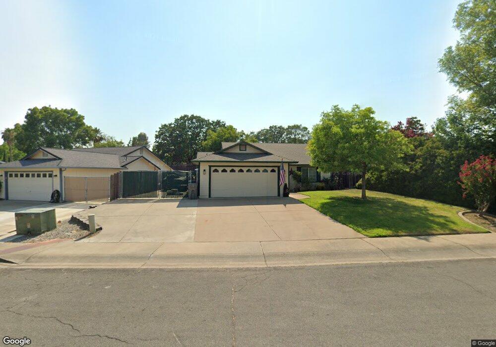
1549 Wingsetter Way Redding, CA 96003
Boulder Creek NeighborhoodEstimated Value: $330,000 - $365,000
3
Beds
2
Baths
1,326
Sq Ft
$263/Sq Ft
Est. Value
About This Home
This home is located at 1549 Wingsetter Way, Redding, CA 96003 and is currently estimated at $349,042, approximately $263 per square foot. 1549 Wingsetter Way is a home located in Shasta County with nearby schools including Boulder Creek Elementary School, Enterprise High School, and Country Christian School.
Ownership History
Date
Name
Owned For
Owner Type
Purchase Details
Closed on
Apr 29, 2016
Sold by
Lee Rena L
Bought by
Lee Rena L
Current Estimated Value
Purchase Details
Closed on
Dec 2, 2003
Sold by
Cafourek Linda A
Bought by
Lee Warren Dean and Lee Rena L
Home Financials for this Owner
Home Financials are based on the most recent Mortgage that was taken out on this home.
Original Mortgage
$133,000
Outstanding Balance
$61,802
Interest Rate
5.92%
Mortgage Type
Purchase Money Mortgage
Estimated Equity
$287,240
Purchase Details
Closed on
Apr 28, 1997
Sold by
Shearing Donald
Bought by
Cafourek Linda A
Home Financials for this Owner
Home Financials are based on the most recent Mortgage that was taken out on this home.
Original Mortgage
$87,718
Interest Rate
7.96%
Mortgage Type
FHA
Create a Home Valuation Report for This Property
The Home Valuation Report is an in-depth analysis detailing your home's value as well as a comparison with similar homes in the area
Home Values in the Area
Average Home Value in this Area
Purchase History
| Date | Buyer | Sale Price | Title Company |
|---|---|---|---|
| Lee Rena L | -- | None Available | |
| Lee Warren Dean | $190,000 | Alliance Title Company | |
| Cafourek Linda A | $88,000 | Redding Title Company |
Source: Public Records
Mortgage History
| Date | Status | Borrower | Loan Amount |
|---|---|---|---|
| Open | Lee Warren Dean | $133,000 | |
| Previous Owner | Cafourek Linda A | $87,718 | |
| Closed | Cafourek Linda A | $857 |
Source: Public Records
Tax History Compared to Growth
Tax History
| Year | Tax Paid | Tax Assessment Tax Assessment Total Assessment is a certain percentage of the fair market value that is determined by local assessors to be the total taxable value of land and additions on the property. | Land | Improvement |
|---|---|---|---|---|
| 2025 | $3,196 | $270,119 | $71,078 | $199,041 |
| 2024 | $3,150 | $264,824 | $69,685 | $195,139 |
| 2023 | $3,150 | $259,632 | $68,319 | $191,313 |
| 2022 | $3,049 | $254,542 | $66,980 | $187,562 |
| 2021 | $2,961 | $249,552 | $65,667 | $183,885 |
| 2020 | $2,764 | $235,000 | $50,000 | $185,000 |
| 2019 | $2,793 | $235,000 | $50,000 | $185,000 |
| 2018 | $2,684 | $225,000 | $45,000 | $180,000 |
| 2017 | $2,723 | $220,000 | $45,000 | $175,000 |
| 2016 | $2,441 | $205,000 | $45,000 | $160,000 |
| 2015 | $2,347 | $195,000 | $45,000 | $150,000 |
| 2014 | $2,055 | $170,000 | $35,000 | $135,000 |
Source: Public Records
Map
Nearby Homes
- 1285 Lancers Ln
- 774 Springer Dr
- 953 Tanglewood Dr
- 667 Reddington Dr
- 825 Mission Sierra Ct
- 823 Mission Sierra Ct
- 1187 Kirkwood Cir
- 866 Fountain Cir
- 856 Mission de Oro Dr
- 1891 Edgewood Dr
- 790 Volcano View Trail
- 1261 Woodside Meadows Dr
- 654 Rogue River Way
- 1401 Casa Vereda Way
- 624 Volcano View Trail
- 592 Mill Valley Pkwy
- 1026 Palisades Ave
- 738 Stonebriar Trail
- 732 Stonebriar Trail
- 726 Stonebriar Trail
- 1537 Wingsetter Way
- 1573 Wingsetter Way
- 875 Jantail Ct
- 1554 Wingsetter Way
- 1531 Wingsetter Way
- 963 Partridge Dr
- 1566 Wingsetter Way
- 969 Partridge Dr
- 975 Partridge Dr
- 845 Jantail Ct
- 0 Jantail Ct
- 957 Partridge Dr
- 1580 Wingsetter Way
- 1521 Wingsetter Way
- 1015 Partridge Dr
- 951 Partridge Dr
- 890 Jantail Ct
- 815 Jantail Ct
- 815 Jantail Ct
- 1033 Partridge Dr