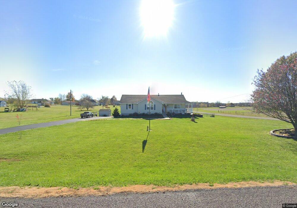
15495 Roger Rd Leavenworth, KS 66048
Estimated Value: $411,960 - $427,000
4
Beds
3
Baths
1,524
Sq Ft
$277/Sq Ft
Est. Value
About This Home
This home is located at 15495 Roger Rd, Leavenworth, KS 66048 and is currently estimated at $421,490, approximately $276 per square foot. 15495 Roger Rd is a home located in Leavenworth County with nearby schools including Lansing Elementary School, Lansing Middle 6-8, and Lansing High 9-12.
Ownership History
Date
Name
Owned For
Owner Type
Purchase Details
Closed on
Jun 9, 2023
Sold by
Lillard Steven R
Bought by
Lillard Steven R and Lillard Susan K
Current Estimated Value
Home Financials for this Owner
Home Financials are based on the most recent Mortgage that was taken out on this home.
Original Mortgage
$65,900
Outstanding Balance
$64,138
Interest Rate
6.39%
Mortgage Type
New Conventional
Estimated Equity
$357,352
Purchase Details
Closed on
May 1, 1996
Bought by
Lillard Steven R and Lillard Susan K
Home Financials for this Owner
Home Financials are based on the most recent Mortgage that was taken out on this home.
Original Mortgage
$239,499
Interest Rate
7.92%
Mortgage Type
FHA
Create a Home Valuation Report for This Property
The Home Valuation Report is an in-depth analysis detailing your home's value as well as a comparison with similar homes in the area
Home Values in the Area
Average Home Value in this Area
Purchase History
| Date | Buyer | Sale Price | Title Company |
|---|---|---|---|
| Lillard Steven R | -- | Stewart Title Guaranty Company | |
| Lillard Steven R | $123,000 | -- |
Source: Public Records
Mortgage History
| Date | Status | Borrower | Loan Amount |
|---|---|---|---|
| Open | Lillard Steven R | $65,900 | |
| Previous Owner | Lillard Steven R | $239,499 | |
| Closed | Lillard Steven R | $43,273 |
Source: Public Records
Tax History Compared to Growth
Tax History
| Year | Tax Paid | Tax Assessment Tax Assessment Total Assessment is a certain percentage of the fair market value that is determined by local assessors to be the total taxable value of land and additions on the property. | Land | Improvement |
|---|---|---|---|---|
| 2025 | $4,705 | $44,531 | $6,843 | $37,688 |
| 2024 | $4,370 | $42,488 | $6,411 | $36,077 |
| 2023 | $4,370 | $41,250 | $6,411 | $34,839 |
| 2022 | $4,026 | $36,651 | $5,495 | $31,156 |
| 2021 | $3,423 | $30,914 | $4,609 | $26,305 |
| 2020 | $3,282 | $29,164 | $4,437 | $24,727 |
| 2019 | $2,983 | $26,715 | $4,092 | $22,623 |
| 2018 | $2,926 | $26,235 | $3,172 | $23,063 |
| 2017 | $2,693 | $24,115 | $2,970 | $21,145 |
| 2016 | $2,597 | $23,380 | $2,942 | $20,438 |
| 2015 | $2,471 | $22,293 | $2,942 | $19,351 |
| 2014 | $2,354 | $21,643 | $2,942 | $18,701 |
Source: Public Records
Map
Nearby Homes
- 15280 Roger Rd
- 15038 Fairmount Rd
- 14934 Fairmount Rd
- 22617 155th St
- 23802 140th St
- 14165 Ashbury Ct
- 5025 146th St
- 6508 141st St
- 5023 146th St
- Lot 2 139th St
- 5005 146th St
- 5020 146th St
- 5018 146th St
- 5001 N 145th St
- 4551 N 145th St
- 833 Rock Creek Dr
- 13965 Mc Intyre Rd
- 705 Rock Creek Dr
- 1221 S Desoto Rd
- 00000 Gilman Rd
- 15447 Roger Rd
- 15494 Brandt Rd
- 15478 Roger Rd
- 15478 Brandt Rd
- 15431 Roger Rd
- 15468 Roger Rd
- 15456 Brandt Rd
- 15446 Roger Rd
- 15415 Roger Rd
- 15424 Roger Rd
- 15424 Brandt Rd
- 15481 Brandt Rd
- 15477 Brandt Rd
- 15451 Brandt Rd
- 15251 Roger Rd
- 15380 Roger Rd
- 15441 Brandt Rd
- 15439 Brandt Rd
- 15473 Dempsey Rd
- 15351 Roger Rd