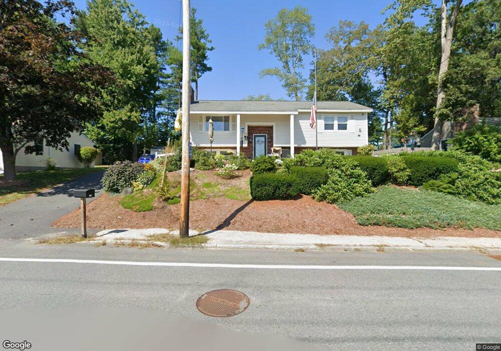
155 Harris Rd Nashua, NH 03062
Southwest Nashua NeighborhoodEstimated Value: $511,000 - $586,000
4
Beds
5
Baths
1,132
Sq Ft
$481/Sq Ft
Est. Value
About This Home
This home is located at 155 Harris Rd, Nashua, NH 03062 and is currently estimated at $544,831, approximately $481 per square foot. 155 Harris Rd is a home located in Hillsborough County with nearby schools including New Searles School, Fairgrounds Middle School, and Nashua High School South.
Ownership History
Date
Name
Owned For
Owner Type
Purchase Details
Closed on
Mar 1, 2022
Sold by
Sousa John E and Sousa Shirley M
Bought by
Sousa 2022 T and Sousa S
Current Estimated Value
Purchase Details
Closed on
Dec 3, 1984
Bought by
Sousa John E and Sousa Shirley M
Create a Home Valuation Report for This Property
The Home Valuation Report is an in-depth analysis detailing your home's value as well as a comparison with similar homes in the area
Home Values in the Area
Average Home Value in this Area
Purchase History
| Date | Buyer | Sale Price | Title Company |
|---|---|---|---|
| Sousa 2022 T | -- | None Available | |
| Sousa John E | $82,900 | -- |
Source: Public Records
Mortgage History
| Date | Status | Borrower | Loan Amount |
|---|---|---|---|
| Previous Owner | Sousa John E | $158,000 | |
| Previous Owner | Sousa John E | $151,000 | |
| Previous Owner | Sousa John E | $183,100 | |
| Previous Owner | Sousa John E | $10,000 |
Source: Public Records
Tax History Compared to Growth
Tax History
| Year | Tax Paid | Tax Assessment Tax Assessment Total Assessment is a certain percentage of the fair market value that is determined by local assessors to be the total taxable value of land and additions on the property. | Land | Improvement |
|---|---|---|---|---|
| 2024 | $7,813 | $491,400 | $160,100 | $331,300 |
| 2023 | $7,489 | $410,800 | $128,100 | $282,700 |
| 2022 | $7,423 | $410,800 | $128,100 | $282,700 |
| 2021 | $6,725 | $289,600 | $85,400 | $204,200 |
| 2020 | $6,548 | $289,600 | $85,400 | $204,200 |
| 2019 | $6,302 | $289,600 | $85,400 | $204,200 |
| 2018 | $5,879 | $277,200 | $85,400 | $191,800 |
| 2017 | $5,867 | $227,500 | $66,400 | $161,100 |
| 2016 | $5,703 | $227,500 | $66,400 | $161,100 |
| 2015 | $5,581 | $227,500 | $66,400 | $161,100 |
| 2014 | $5,471 | $227,500 | $66,400 | $161,100 |
Source: Public Records
Map
Nearby Homes
- 5 Wilderness Dr
- 15 Westray Dr
- 23 Glen Dr
- 2 Wakefield Dr
- 31 Tenby Dr
- 4 Henry David Dr Unit 203
- 5 Appaloosa Place
- 9 Michelle Dr
- 29 Dickens St
- 375 Main Dunstable Rd
- 285 E Dunstable Rd
- 10 Lamb Rd
- 51 Legacy Dr
- 25 Cortez Dr Unit U57
- 125 Lille Rd
- 9 Byron Dr
- 16 Laurel Ct Unit U320
- 30 Gendron St
- 247 Main Dunstable Rd
- 7 Doucet Ave
- 153 Harris Rd
- 157 Harris Rd
- 6 Saint Andrews Cir Unit U3
- 8 Saint Andrews Cir Unit U4
- 174 Harris Rd
- 4 Saint Andrews Cir Unit U2
- 4 Killian Dr Unit U1
- 176 Harris Rd
- 172 Harris Rd
- 159 Harris Rd
- 10 Saint Andrews Cir Unit U5
- 151 Harris Rd
- 5 Saint Andrews Cir Unit U12
- 12 Saint Andrews Cir Unit U6
- 18 Custom St
- 178 Harris Rd
- 7 Saint Andrews Cir Unit U11
- 16 Custom St
- 7 Killian Dr Unit U14
- 161 Harris Rd