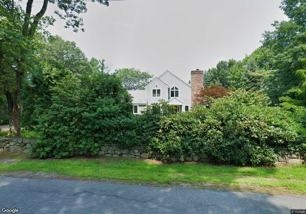
155 Old Littleton Rd Harvard, MA 01451
Estimated Value: $830,000 - $1,002,000
3
Beds
3
Baths
2,430
Sq Ft
$382/Sq Ft
Est. Value
About This Home
This home is located at 155 Old Littleton Rd, Harvard, MA 01451 and is currently estimated at $928,807, approximately $382 per square foot. 155 Old Littleton Rd is a home located in Worcester County.
Ownership History
Date
Name
Owned For
Owner Type
Purchase Details
Closed on
Aug 23, 1993
Sold by
Est Briggs Pauline C and Briggs Charles V
Bought by
Anelons Terry E
Current Estimated Value
Home Financials for this Owner
Home Financials are based on the most recent Mortgage that was taken out on this home.
Original Mortgage
$200,000
Interest Rate
7.11%
Mortgage Type
Purchase Money Mortgage
Create a Home Valuation Report for This Property
The Home Valuation Report is an in-depth analysis detailing your home's value as well as a comparison with similar homes in the area
Home Values in the Area
Average Home Value in this Area
Purchase History
| Date | Buyer | Sale Price | Title Company |
|---|---|---|---|
| Anelons Terry E | $107,000 | -- |
Source: Public Records
Mortgage History
| Date | Status | Borrower | Loan Amount |
|---|---|---|---|
| Open | Anelons Terry E | $200,000 | |
| Closed | Anelons Terry E | $227,000 | |
| Closed | Anelons Terry E | $200,000 |
Source: Public Records
Tax History Compared to Growth
Tax History
| Year | Tax Paid | Tax Assessment Tax Assessment Total Assessment is a certain percentage of the fair market value that is determined by local assessors to be the total taxable value of land and additions on the property. | Land | Improvement |
|---|---|---|---|---|
| 2025 | $13,440 | $858,800 | $269,000 | $589,800 |
| 2024 | $13,246 | $889,000 | $269,000 | $620,000 |
| 2023 | $12,592 | $758,100 | $249,100 | $509,000 |
| 2022 | $11,584 | $646,800 | $258,500 | $388,300 |
| 2021 | $11,901 | $633,700 | $258,500 | $375,200 |
| 2020 | $11,440 | $619,400 | $263,200 | $356,200 |
| 2019 | $10,605 | $608,800 | $263,200 | $345,600 |
| 2018 | $13,077 | $762,500 | $263,200 | $499,300 |
| 2017 | $12,127 | $670,000 | $224,200 | $445,800 |
| 2016 | $11,918 | $660,300 | $214,500 | $445,800 |
| 2015 | $13,220 | $743,100 | $210,100 | $533,000 |
| 2014 | $12,700 | $743,100 | $210,100 | $533,000 |
Source: Public Records
Map
Nearby Homes
- 166 Littleton Rd Unit 3
- 220 Swanson Rd Unit 605
- 220 Swanson Rd Unit 606
- 220 Swanson Rd Unit 604
- 176 Swanson Rd Unit 309
- 87 Ayer Rd
- 50 Spencer Rd Unit 36
- 42 Swanson Ct Unit 14A
- 24 Fairbanks St
- 11 Fairbanks St Unit 2
- 5 Fairbank St
- 58 Spencer Rd Unit 18K
- 53 Swanson Ct Unit 36C
- 332 Old Littleton Rd
- 4 Bolton Rd
- 18A S Shaker Rd
- 45 S Shaker Rd
- 78 Shaker Rd
- 310 Codman Hill Rd Unit 35D
- 0 Ayer & Old Mill Rd
- 161 Old Littleton Rd
- 72 Pinnacle Rd
- Lot 3 Pinnacle Rd
- Lot 2 Pinnacle Rd
- 76 Pinnacle Rd
- 170 Pinnacle Rd
- 77 Pinnacle Rd
- 170 Old Littleton Rd
- 86 Pinnacle Rd
- 140 Old Littleton Rd
- 88 Pinnacle Rd
- 12 Old Meadow Ln
- 12 Old Meadow Ln
- 49 Pinnacle Rd
- 2 Old Meadow Ln
- 134 Old Littleton Rd
- 131 Old Littleton Rd
- 90 Pinnacle Rd
- 8 Park Ln
- 95 Pinnacle Rd