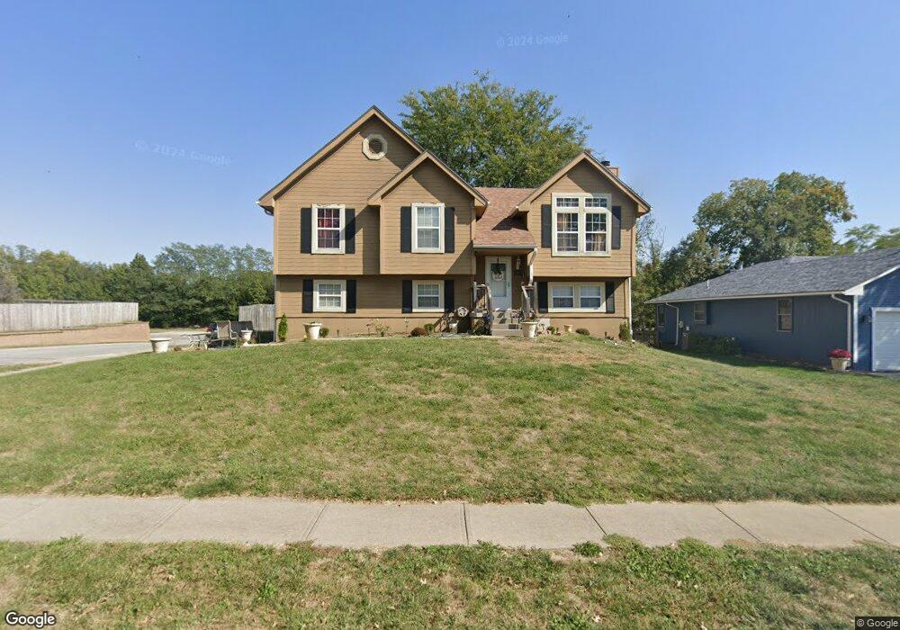
1555 NE Stonewood Dr Lees Summit, MO 64086
Estimated Value: $301,381 - $328,000
3
Beds
2
Baths
1,270
Sq Ft
$247/Sq Ft
Est. Value
About This Home
This home is located at 1555 NE Stonewood Dr, Lees Summit, MO 64086 and is currently estimated at $313,845, approximately $247 per square foot. 1555 NE Stonewood Dr is a home located in Jackson County with nearby schools including Underwood Elementary School, Bernard C. Campbell Middle School, and Lee's Summit North High School.
Ownership History
Date
Name
Owned For
Owner Type
Purchase Details
Closed on
Jan 25, 2024
Sold by
Owens Timothy R
Bought by
Owens Susan
Current Estimated Value
Purchase Details
Closed on
Oct 8, 1997
Sold by
Neal Kevin R and Neal Patricia A
Bought by
Owens Timothy R and Owens Susan L
Purchase Details
Closed on
Oct 11, 1996
Sold by
George Linda G
Bought by
Neal Kevin R and Neal Patricia A
Home Financials for this Owner
Home Financials are based on the most recent Mortgage that was taken out on this home.
Original Mortgage
$97,444
Interest Rate
8.33%
Mortgage Type
FHA
Create a Home Valuation Report for This Property
The Home Valuation Report is an in-depth analysis detailing your home's value as well as a comparison with similar homes in the area
Home Values in the Area
Average Home Value in this Area
Purchase History
| Date | Buyer | Sale Price | Title Company |
|---|---|---|---|
| Owens Susan | $79,141 | None Listed On Document | |
| Owens Timothy R | -- | -- | |
| Neal Kevin R | -- | Old Republic Title Company |
Source: Public Records
Mortgage History
| Date | Status | Borrower | Loan Amount |
|---|---|---|---|
| Previous Owner | Neal Kevin R | $97,444 |
Source: Public Records
Tax History Compared to Growth
Tax History
| Year | Tax Paid | Tax Assessment Tax Assessment Total Assessment is a certain percentage of the fair market value that is determined by local assessors to be the total taxable value of land and additions on the property. | Land | Improvement |
|---|---|---|---|---|
| 2025 | $3,027 | $45,230 | $7,735 | $37,495 |
| 2024 | $3,005 | $41,916 | $6,105 | $35,811 |
| 2023 | $3,005 | $41,916 | $5,991 | $35,925 |
| 2022 | $2,761 | $34,200 | $6,622 | $27,578 |
| 2021 | $2,818 | $34,200 | $6,622 | $27,578 |
| 2020 | $2,654 | $31,901 | $6,622 | $25,279 |
| 2019 | $2,582 | $31,901 | $6,622 | $25,279 |
| 2018 | $985,167 | $29,486 | $4,312 | $25,174 |
| 2017 | $2,572 | $29,486 | $4,312 | $25,174 |
| 2016 | $2,533 | $28,747 | $4,807 | $23,940 |
| 2014 | $2,459 | $27,359 | $4,492 | $22,867 |
Source: Public Records
Map
Nearby Homes
- 1632 NE Stonewood Dr
- 1425 NE Stonewood Dr
- 1424 NE Stonewood Dr
- 1817 NE Burgandy Cir
- 1408 NE Whitestone Dr
- 1717 NE Luther Rd
- 1400 NE Colbern Rd
- 27008 E Olive Dr
- 27104 E Cedar Grove Dr
- 1637 NE Westwind Dr
- 1220 NE Hendrix Dr
- 1676 NE Ozark Dr
- 1809 NE Griffin Dr
- 1121 NE Ridgeview Dr
- 1345 NE Foxwood Dr
- 808 NE Mulberry St
- 809 NE Mulberry St
- 801 NE Bryant Dr
- 1708 NE Balboa St
- 13507 Woodland Ranch Dr
- 1551 NE Stonewood Dr
- 1554 NE Stonewood Dr
- 1550 NE Stonewood Dr
- 1601 NE Stonewood Dr
- 1547 NE Stonewood Dr
- 1600 NE Stonewood Dr
- 1546 NE Stonewood Dr
- 1605 NE Stonewood Dr
- 1543 NE Stonewood Dr
- 1604 NE Stonewood Dr
- 1542 NE Stonewood Dr
- 1533 NE Whitestone Dr
- 1609 NE Stonewood Dr
- 1529 NE Whitestone Dr
- 1539 NE Stonewood Dr
- 1608 NE Stonewood Dr
- 1601 NE Whitestone Dr
- 1525 NE Whitestone Dr
- 1538 NE Stonewood Dr
- 1605 NE Whitestone Dr