Estimated Value: $524,217 - $690,000
--
Bed
2
Baths
1,154
Sq Ft
$526/Sq Ft
Est. Value
About This Home
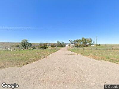
This home is located at 1556 State Highway 213, Burns, WY 82053 and is currently estimated at $607,109, approximately $526 per square foot. 1556 State Highway 213 is a home.
Ownership History
Date
Name
Owned For
Owner Type
Purchase Details
Closed on
Mar 17, 2016
Sold by
Bressler Larry K and Bressler Marlene R
Bought by
Rryor Dick J and Rryor Linda F
Current Estimated Value
Home Financials for this Owner
Home Financials are based on the most recent Mortgage that was taken out on this home.
Original Mortgage
$252,000
Outstanding Balance
$171,910
Interest Rate
3.72%
Mortgage Type
Stand Alone Refi Refinance Of Original Loan
Purchase Details
Closed on
May 27, 2009
Sold by
Bressler Larry K and Bressler Marlene R
Bought by
Bressler Larry K and Bressler Marlene R
Create a Home Valuation Report for This Property
The Home Valuation Report is an in-depth analysis detailing your home's value as well as a comparison with similar homes in the area
Home Values in the Area
Average Home Value in this Area
Purchase History
| Date | Buyer | Sale Price | Title Company |
|---|---|---|---|
| Rryor Dick J | -- | Prepared For Summit Title Se | |
| Bressler Larry K | -- | None Available |
Source: Public Records
Mortgage History
| Date | Status | Borrower | Loan Amount |
|---|---|---|---|
| Open | Pryor Dick J | $252,000 |
Source: Public Records
Tax History Compared to Growth
Tax History
| Year | Tax Paid | Tax Assessment Tax Assessment Total Assessment is a certain percentage of the fair market value that is determined by local assessors to be the total taxable value of land and additions on the property. | Land | Improvement |
|---|---|---|---|---|
| 2024 | $2,651 | $38,585 | $23,516 | $15,069 |
| 2023 | $2,540 | $36,974 | $21,975 | $14,999 |
| 2022 | $2,127 | $30,308 | $18,849 | $11,459 |
| 2021 | $1,926 | $27,384 | $17,546 | $9,838 |
| 2020 | $1,929 | $27,506 | $17,668 | $9,838 |
| 2019 | $1,929 | $27,474 | $17,483 | $9,991 |
| 2018 | $1,850 | $26,609 | $17,104 | $9,505 |
| 2017 | $1,826 | $26,022 | $17,739 | $8,283 |
| 2016 | $1,751 | $24,948 | $18,020 | $6,928 |
| 2015 | $1,703 | $24,244 | $17,301 | $6,943 |
| 2014 | $1,603 | $22,679 | $15,781 | $6,898 |
Source: Public Records
Map
Nearby Homes
- 1630 Wyoming 213
- 4866 Rising Sun Way
- TBD Teal Ln
- TBD Burns Ave
- 415 E 2nd St
- 512 Horseshoe Rd
- 4676 Road 218
- 1482 Road 154
- 1679 Road 143
- 1226 Road 142
- TBD Willow Brook Ln
- Tract 7 Willow Brook Ln
- TBD Road 215
- 1547 Road 215
- 4296 Jake Spoon Trail
- Tract 9 Jake Spoon Trail
- Tract 8 Jake Spoon Trail
- Tract 7 Blue Duck Trail
- Tract 21 Lonesome Dove Trail
- Tr 4 Derek Ct
