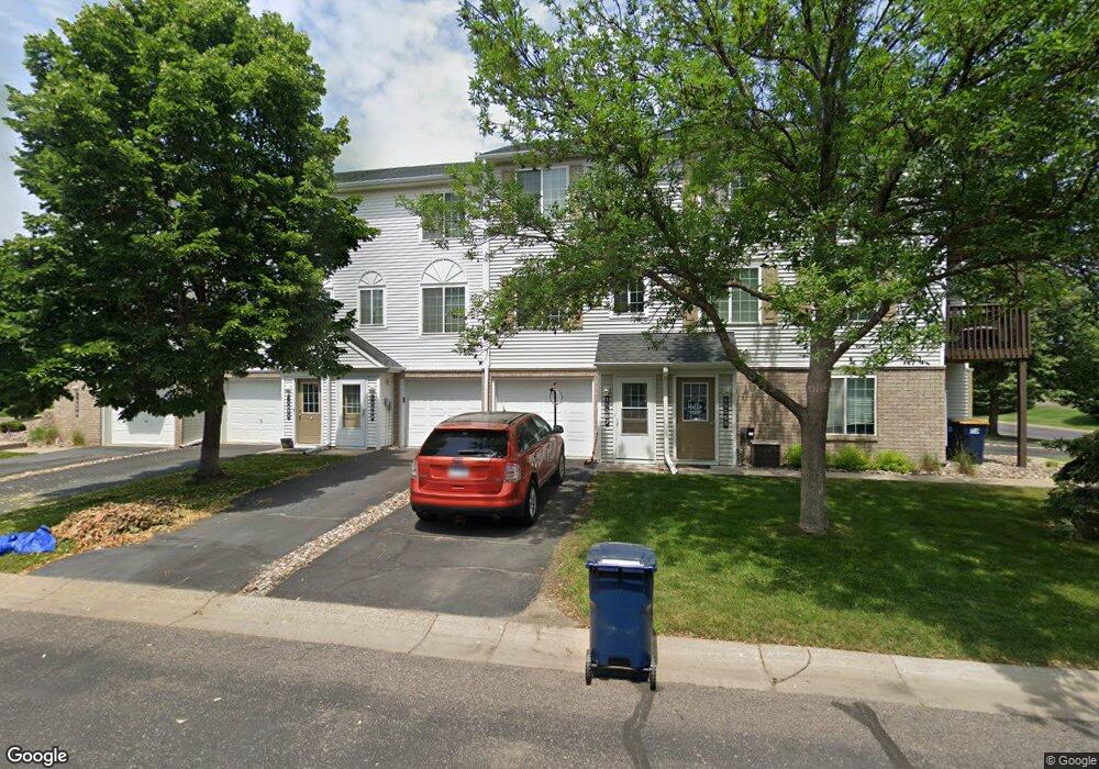
15567 Flight Way Unit 129 Saint Paul, MN 55124
Downtown Apple Valley NeighborhoodEstimated Value: $207,536 - $241,000
2
Beds
2
Baths
926
Sq Ft
$237/Sq Ft
Est. Value
About This Home
This home is located at 15567 Flight Way Unit 129, Saint Paul, MN 55124 and is currently estimated at $219,634, approximately $237 per square foot. 15567 Flight Way Unit 129 is a home located in Dakota County with nearby schools including Parkview Elementary School, Scott Highlands Middle School, and Rosemount Senior High School.
Ownership History
Date
Name
Owned For
Owner Type
Purchase Details
Closed on
Jun 15, 2020
Sold by
Elander Nicholas Nicholas
Bought by
Christl Travis Travis
Current Estimated Value
Home Financials for this Owner
Home Financials are based on the most recent Mortgage that was taken out on this home.
Original Mortgage
$120,750
Outstanding Balance
$107,056
Interest Rate
3.21%
Estimated Equity
$112,578
Purchase Details
Closed on
Jun 24, 2004
Sold by
Rogers Timothy J and Roger Tara
Bought by
Elander Nicholas
Create a Home Valuation Report for This Property
The Home Valuation Report is an in-depth analysis detailing your home's value as well as a comparison with similar homes in the area
Home Values in the Area
Average Home Value in this Area
Purchase History
| Date | Buyer | Sale Price | Title Company |
|---|---|---|---|
| Christl Travis Travis | $161,000 | -- | |
| Elander Nicholas | $148,217 | -- |
Source: Public Records
Mortgage History
| Date | Status | Borrower | Loan Amount |
|---|---|---|---|
| Open | Christl Travis Travis | $120,750 | |
| Closed | Christl Travis Travis | -- |
Source: Public Records
Tax History Compared to Growth
Tax History
| Year | Tax Paid | Tax Assessment Tax Assessment Total Assessment is a certain percentage of the fair market value that is determined by local assessors to be the total taxable value of land and additions on the property. | Land | Improvement |
|---|---|---|---|---|
| 2024 | $2,204 | $194,200 | $28,800 | $165,400 |
| 2023 | $2,204 | $194,200 | $28,800 | $165,400 |
| 2022 | $1,908 | $185,600 | $27,500 | $158,100 |
| 2021 | $1,662 | $163,900 | $24,700 | $139,200 |
| 2020 | $1,586 | $156,000 | $23,500 | $132,500 |
| 2019 | $1,323 | $146,100 | $22,000 | $124,100 |
| 2018 | $1,225 | $131,800 | $19,800 | $112,000 |
| 2017 | $1,217 | $119,800 | $18,000 | $101,800 |
| 2016 | $1,106 | $114,400 | $17,200 | $97,200 |
| 2015 | $798 | $77,864 | $11,724 | $66,140 |
| 2014 | -- | $54,756 | $8,239 | $46,517 |
| 2013 | -- | $39,540 | $5,940 | $33,600 |
Source: Public Records
Map
Nearby Homes
- 6524 154th St W Unit 107
- 15537 Foghorn Ln Unit 45
- 15521 Foghorn Ln
- 15681 Flackwood Way
- 6406 157th St W
- 15649 Flackwood Way
- 15312 Flower Way Unit 196
- 15316 Founders Ln Unit 304
- 15263 Florist Cir Unit 26
- 15687 Finewood Ct
- 15386 Founders Ln Unit 805
- 15749 Fjord Ave Unit 141
- 15684 Finewood Ct
- 6414 158th St W Unit 201
- 15973 Flotilla Trail Unit 300
- 6869 Folkestone Rd Unit 614
- 15767 Finch Ave
- 6760 158th St W
- 6887 Folkestone Rd Unit 712
- 7070 153rd St W Unit 211
- 15567 Flight Way
- 15569 Flight Way Unit 130
- 15565 Flight Way
- 15565 Flight Way
- 15563 Flight Way
- 15563 Flight Way Unit 127
- 15571 Flight Way Unit 131
- 15571 Flight Way Unit 131
- 15571 Flight Way
- 15571 Flight Way
- 15561 Flight Way Unit 126
- 15557 15557 Flight-Way-
- 15557 15557 Flight Way
- 15573 Flight Way Unit 132
- 15573 Flight Way
- 15559 Flight Way
- 15559 Flight Way
- 15559 Flight Way Unit 125
- 15557 Flight Way
- 15557 Flight Way Unit 124