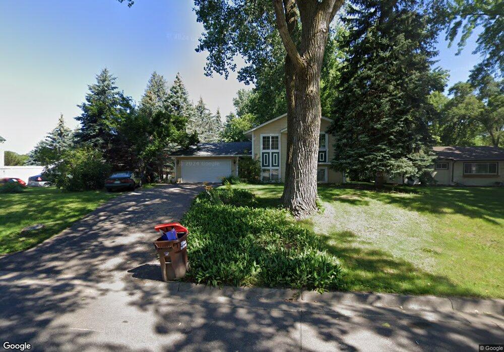
1557 Sextant Ave E Saint Paul, MN 55109
Hazelwood NeighborhoodEstimated Value: $360,000 - $414,000
3
Beds
2
Baths
2,028
Sq Ft
$186/Sq Ft
Est. Value
About This Home
This home is located at 1557 Sextant Ave E, Saint Paul, MN 55109 and is currently estimated at $378,038, approximately $186 per square foot. 1557 Sextant Ave E is a home located in Ramsey County with nearby schools including Richardson Elementary School and John Glenn Middle School.
Ownership History
Date
Name
Owned For
Owner Type
Purchase Details
Closed on
Nov 20, 2020
Sold by
Dimond Daniel A and Dimond Laurie J
Bought by
Thao Bao and Vue Kuright
Current Estimated Value
Home Financials for this Owner
Home Financials are based on the most recent Mortgage that was taken out on this home.
Original Mortgage
$274,928
Interest Rate
2.7%
Mortgage Type
FHA
Create a Home Valuation Report for This Property
The Home Valuation Report is an in-depth analysis detailing your home's value as well as a comparison with similar homes in the area
Home Values in the Area
Average Home Value in this Area
Purchase History
| Date | Buyer | Sale Price | Title Company |
|---|---|---|---|
| Thao Bao | $280,000 | None Available | |
| Thao Bao Bao | $280,000 | -- |
Source: Public Records
Mortgage History
| Date | Status | Borrower | Loan Amount |
|---|---|---|---|
| Previous Owner | Thao Bao | $274,928 | |
| Closed | Thao Bao Bao | $274,928 |
Source: Public Records
Tax History
| Year | Tax Paid | Tax Assessment Tax Assessment Total Assessment is a certain percentage of the fair market value that is determined by local assessors to be the total taxable value of land and additions on the property. | Land | Improvement |
|---|---|---|---|---|
| 2025 | $4,672 | $367,500 | $59,900 | $307,600 |
| 2023 | $4,672 | $333,700 | $59,900 | $273,800 |
| 2022 | $3,882 | $313,300 | $59,900 | $253,400 |
| 2021 | $3,808 | $269,600 | $59,900 | $209,700 |
| 2020 | $3,504 | $270,100 | $59,900 | $210,200 |
| 2019 | $3,434 | $235,600 | $59,900 | $175,700 |
| 2018 | $3,138 | $216,600 | $59,900 | $156,700 |
| 2017 | $3,548 | $193,300 | $59,900 | $133,400 |
| 2016 | $3,486 | $0 | $0 | $0 |
| 2015 | $3,432 | $194,300 | $51,800 | $142,500 |
| 2014 | $2,942 | $0 | $0 | $0 |
Source: Public Records
Map
Nearby Homes
- 1515 Viking Dr E
- 1705 Lark Ave
- 1442 Sandhurst Ave E
- 1281 Edgehill Ct
- 1995 11th Ave E Unit 2
- 1995 11th Ave E Unit 1
- 1984 Prosperity Rd
- 1290 Belmont Ln E
- 1261 Skillman Ave E
- 2445 Crestwood Dr
- 2022 English St
- 2212 Ariel St N
- 1884 Flandrau St
- 1855 Birmingham St
- 2053 Mesabi Ave
- 1632 Legacy Pkwy E Unit 4
- 3029 Hemingway Trail N Unit 2
- 1201 Frost Ave
- 1856 Flandrau St
- 1245 Terrace Ave Unit 412
- 1565 Sextant Ave E
- 2430 Hazelwood St
- 2434 Hazelwood St
- 2440 Hazelwood St
- 1573 Sextant Ave E
- 1554 Sextant Ave E
- 1562 Sextant Ave E
- 2458 Hazelwood St
- 1570 Sextant Ave E
- 1581 Sextant Ave E
- 1530 Sextant Ave E
- 1578 Sextant Ave E
- 2460 Hazelwood St
- 1555 Gervais Ave
- 1563 Gervais Ave
- 1587 Sextant Ave E
- 1531 Sextant Ave E
- 2410 Hazelwood St
- 2425 Hazelwood St
- 1571 Gervais Ave
Your Personal Tour Guide
Ask me questions while you tour the home.