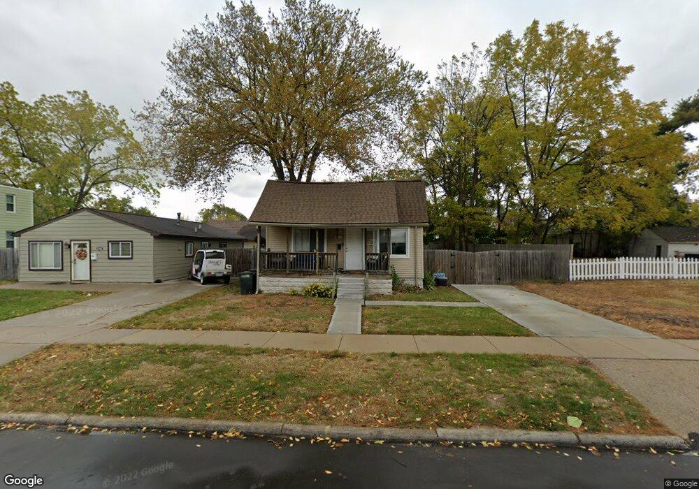
1558 W Hazelhurst St Unit Bldg-Unit Ferndale, MI 48220
Estimated Value: $143,000 - $220,000
2
Beds
1
Bath
779
Sq Ft
$230/Sq Ft
Est. Value
About This Home
This home is located at 1558 W Hazelhurst St Unit Bldg-Unit, Ferndale, MI 48220 and is currently estimated at $179,290, approximately $230 per square foot. 1558 W Hazelhurst St Unit Bldg-Unit is a home located in Oakland County with nearby schools including Ferndale Lower Elementary Campus, Ferndale Upper Elementary Campus, and Ferndale Middle School.
Ownership History
Date
Name
Owned For
Owner Type
Purchase Details
Closed on
Nov 20, 2020
Sold by
Ahmad Monir and Ahmad Annie
Bought by
White Brandon M
Current Estimated Value
Home Financials for this Owner
Home Financials are based on the most recent Mortgage that was taken out on this home.
Original Mortgage
$99,170
Outstanding Balance
$88,247
Interest Rate
2.8%
Mortgage Type
FHA
Estimated Equity
$91,043
Purchase Details
Closed on
Dec 19, 2017
Sold by
Gutowski Christopher
Bought by
Ahmad Monir and Ahmad Annie
Purchase Details
Closed on
Jun 14, 2011
Sold by
Nahat Donald F and Nahat Sheri L
Bought by
Federal Home Loan Mortgage Corporation
Purchase Details
Closed on
Oct 30, 2002
Sold by
Simpson Grace
Bought by
Lim Randall
Create a Home Valuation Report for This Property
The Home Valuation Report is an in-depth analysis detailing your home's value as well as a comparison with similar homes in the area
Home Values in the Area
Average Home Value in this Area
Purchase History
| Date | Buyer | Sale Price | Title Company |
|---|---|---|---|
| White Brandon M | $101,000 | Devon Title Agency | |
| Ahmad Monir | $90,000 | Fidelity National Title | |
| Federal Home Loan Mortgage Corporation | $78,229 | None Available | |
| Lim Randall | $46,750 | -- |
Source: Public Records
Mortgage History
| Date | Status | Borrower | Loan Amount |
|---|---|---|---|
| Open | White Brandon M | $99,170 |
Source: Public Records
Tax History Compared to Growth
Tax History
| Year | Tax Paid | Tax Assessment Tax Assessment Total Assessment is a certain percentage of the fair market value that is determined by local assessors to be the total taxable value of land and additions on the property. | Land | Improvement |
|---|---|---|---|---|
| 2024 | $4,247 | $85,180 | $0 | $0 |
| 2023 | $3,994 | $75,910 | $0 | $0 |
| 2022 | $3,506 | $68,380 | $0 | $0 |
| 2021 | $3,527 | $61,790 | $0 | $0 |
| 2020 | $3,393 | $56,350 | $0 | $0 |
| 2019 | $3,418 | $51,970 | $0 | $0 |
| 2018 | $3,609 | $43,990 | $0 | $0 |
| 2017 | $2,228 | $42,390 | $0 | $0 |
| 2016 | $2,198 | $34,500 | $0 | $0 |
| 2015 | -- | $30,090 | $0 | $0 |
| 2014 | -- | $27,070 | $0 | $0 |
| 2011 | -- | $36,040 | $0 | $0 |
Source: Public Records
Map
Nearby Homes
- 1437 Pearson St
- 1676 Pearson St
- 1416 Leroy St
- 1526 Albany St
- 1517 W Saratoga St
- 1668 Albany St
- 21392 Bethlawn Blvd
- 21376 Mitchelldale Ave
- 1406 W Saratoga St
- 1386 W Saratoga St
- 1364 W Saratoga St
- 21395 Westview Ave
- 8530 Saratoga St
- 964 W Marshall St
- 21078 Mitchelldale Ave
- 8610 Saratoga St
- 8710 Albany St
- 768 Pinecrest Dr
- 21304 Glen Lodge Rd
- 21059 Westview Ave
- 1558 W Hazelhurst St
- 1568 W Hazelhurst St
- 1538 W Hazelhurst St
- 1578 W Hazelhurst St
- 1528 W Hazelhurst St
- 1567 Pearson St
- 1557 Pearson St
- 1537 Pearson St
- 1547 Pearson St
- 1518 W Hazelhurst St
- 1588 W Hazelhurst St
- 1547 W Hazelhurst St
- 1557 W Hazelhurst St
- 1575 Pearson St
- 1567 W Hazelhurst St
- 1527 Pearson St
- 1535 W Hazelhurst St
- 1517 Pearson St
- 1525 W Hazelhurst St
- 1577 W Hazelhurst St