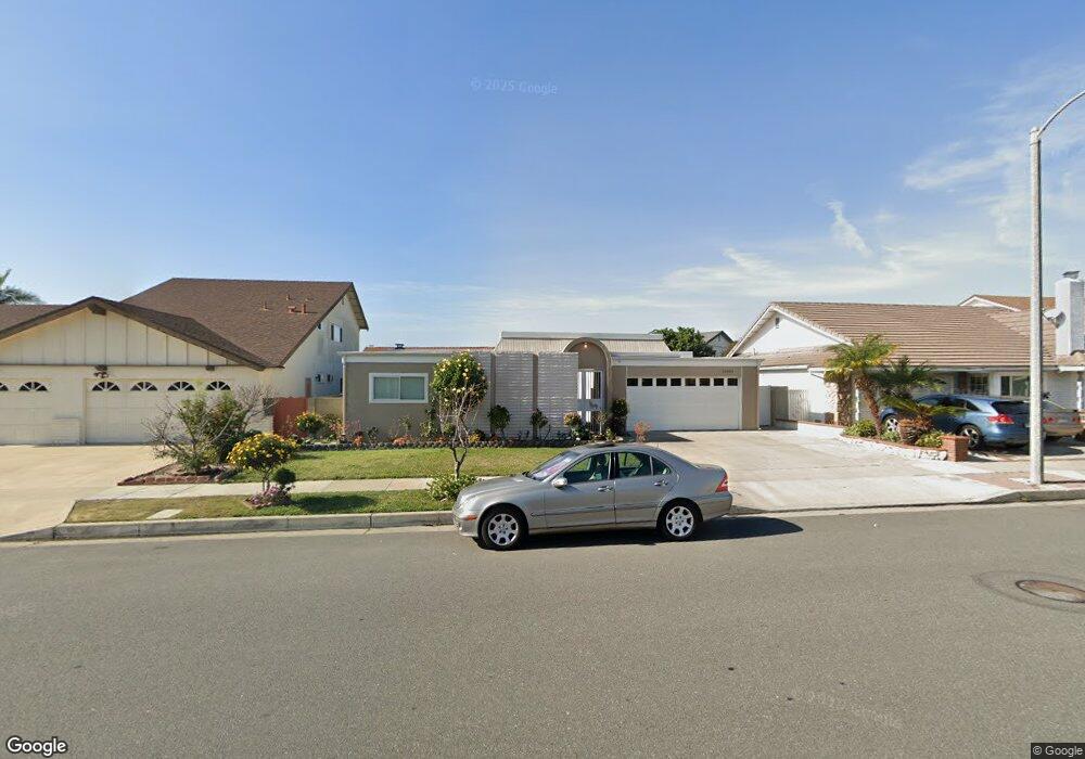
15581 Burning Tree St Westminster, CA 92683
Star View NeighborhoodEstimated Value: $1,148,000 - $1,332,000
4
Beds
3
Baths
1,932
Sq Ft
$641/Sq Ft
Est. Value
About This Home
This home is located at 15581 Burning Tree St, Westminster, CA 92683 and is currently estimated at $1,238,195, approximately $640 per square foot. 15581 Burning Tree St is a home located in Orange County with nearby schools including Star View Elementary, Vista View Middle School, and Ocean View High.
Ownership History
Date
Name
Owned For
Owner Type
Purchase Details
Closed on
Apr 25, 2021
Sold by
Nguyen Tracy
Bought by
Tan Andrea Tansil and Tan Chloe Yen
Current Estimated Value
Purchase Details
Closed on
Aug 18, 2011
Sold by
Pham Derrick Tung
Bought by
Nguyen Tracy Kogan
Purchase Details
Closed on
Aug 8, 2011
Sold by
Smoot Robert J and Smoot Patricia K
Bought by
Nguyen Tracy
Create a Home Valuation Report for This Property
The Home Valuation Report is an in-depth analysis detailing your home's value as well as a comparison with similar homes in the area
Home Values in the Area
Average Home Value in this Area
Purchase History
| Date | Buyer | Sale Price | Title Company |
|---|---|---|---|
| Tan Andrea Tansil | $550,000 | Landwood Title Company | |
| Nguyen Tracy Kogan | -- | None Available | |
| Nguyen Tracy | $501,000 | None Available |
Source: Public Records
Tax History
| Year | Tax Paid | Tax Assessment Tax Assessment Total Assessment is a certain percentage of the fair market value that is determined by local assessors to be the total taxable value of land and additions on the property. | Land | Improvement |
|---|---|---|---|---|
| 2025 | $10,325 | $909,242 | $773,015 | $136,227 |
| 2024 | $10,325 | $891,414 | $757,858 | $133,556 |
| 2023 | $10,092 | $873,936 | $742,998 | $130,938 |
| 2022 | $9,943 | $856,800 | $728,429 | $128,371 |
| 2021 | $6,936 | $581,359 | $452,304 | $129,055 |
| 2020 | $6,862 | $575,398 | $447,666 | $127,732 |
| 2019 | $6,748 | $564,116 | $438,888 | $125,228 |
| 2018 | $6,602 | $553,055 | $430,282 | $122,773 |
| 2017 | $6,502 | $542,211 | $421,845 | $120,366 |
| 2016 | $6,245 | $531,580 | $413,574 | $118,006 |
| 2015 | $6,154 | $523,596 | $407,362 | $116,234 |
| 2014 | $6,039 | $513,340 | $399,382 | $113,958 |
Source: Public Records
Map
Nearby Homes
- 15300 Magnolia St Unit 82
- 15300 Magnolia St
- 9132 Dickens Cir
- 15942 Topaz St
- 9202 Dickens Cir
- 9172 Chelsea Cir
- 15110 Henley Dr Unit 51
- 15065 Henley Dr Unit 1
- 15281 Dogwood St
- 9442 Sean Way
- 8200 Bolsa Ave Unit 166
- 8200 Bolsa Ave Unit 42
- 8200 Bolsa Ave Unit 103
- 16082 Cache St
- 9561 Cardinal Ave
- 8200 Bolsa Ave Spc#146
- 9031 Washington Ave
- 15121 Van Buren St
- 15081 Van Buren St
- 15731 Grey Oaks St
- 15571 Burning Tree St
- 15591 Burning Tree St
- 8852 Carmel Cir
- 8851 Carmel Cir
- 15561 Burning Tree St
- 15601 Burning Tree St
- 8842 Carmel Cir
- 8892 Gleneagles Cir
- 8841 Carmel Cir
- 8891 Gleneagles Cir
- 15551 Burning Tree St
- 15621 Burning Tree St
- 8841 Tamarisk Cir
- 8851 Tamarisk Cir
- 8902 Gleneagles Cir
- 8891 Pebble Beach Cir
- 8842 Monterey Cir
- 8822 Carmel Cir
- 8901 Gleneagles Cir
- 8821 Carmel Cir
Your Personal Tour Guide
Ask me questions while you tour the home.