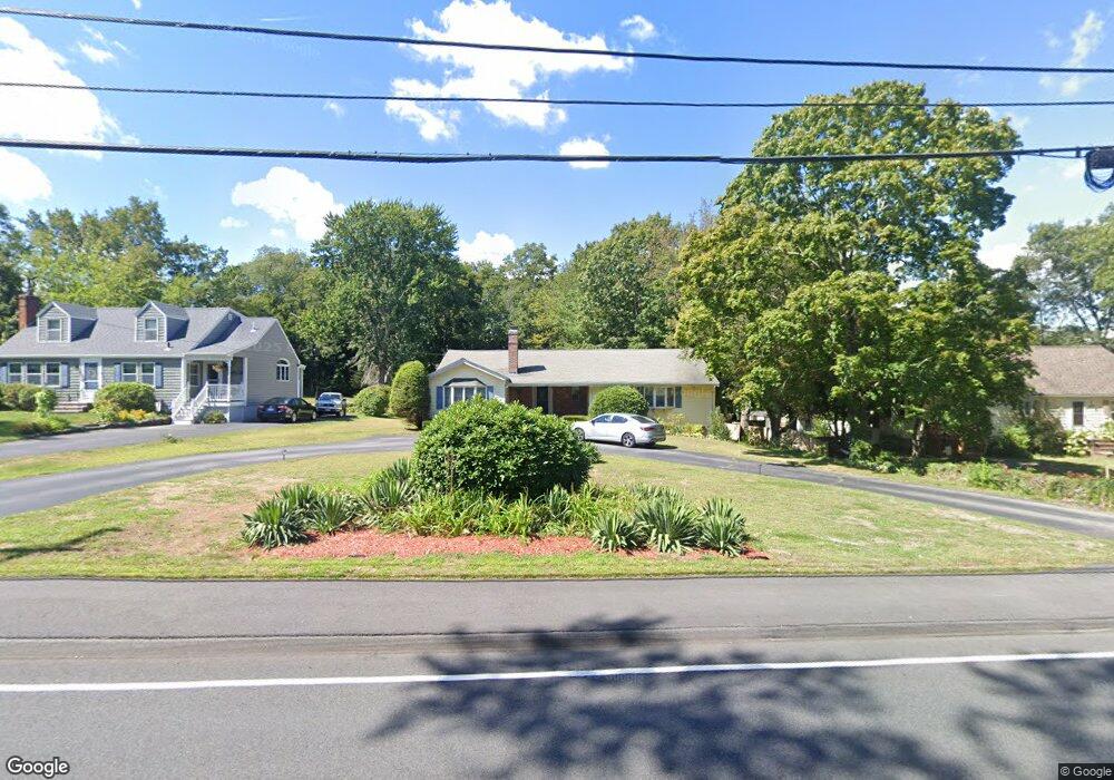
1559 Liberty St Braintree, MA 02184
Braintree Highlands NeighborhoodEstimated Value: $792,245 - $884,000
3
Beds
2
Baths
2,032
Sq Ft
$414/Sq Ft
Est. Value
About This Home
This home is located at 1559 Liberty St, Braintree, MA 02184 and is currently estimated at $840,811, approximately $413 per square foot. 1559 Liberty St is a home located in Norfolk County with nearby schools including Boston Higashi School, Lighthouse Baptist Christian Academy, and CATS Academy Boston.
Ownership History
Date
Name
Owned For
Owner Type
Purchase Details
Closed on
May 23, 2016
Sold by
Arnstein John H
Bought by
Arnstein Ft
Current Estimated Value
Purchase Details
Closed on
Jun 17, 1992
Sold by
Johnson Beatrice T
Bought by
Arnstein John H
Create a Home Valuation Report for This Property
The Home Valuation Report is an in-depth analysis detailing your home's value as well as a comparison with similar homes in the area
Home Values in the Area
Average Home Value in this Area
Purchase History
| Date | Buyer | Sale Price | Title Company |
|---|---|---|---|
| Arnstein Ft | -- | -- | |
| Arnstein John H | $182,000 | -- |
Source: Public Records
Mortgage History
| Date | Status | Borrower | Loan Amount |
|---|---|---|---|
| Previous Owner | Arnstein John H | $10,000 | |
| Previous Owner | Arnstein John H | $20,000 | |
| Previous Owner | Arnstein John H | $95,000 |
Source: Public Records
Tax History Compared to Growth
Tax History
| Year | Tax Paid | Tax Assessment Tax Assessment Total Assessment is a certain percentage of the fair market value that is determined by local assessors to be the total taxable value of land and additions on the property. | Land | Improvement |
|---|---|---|---|---|
| 2025 | $7,126 | $714,000 | $412,800 | $301,200 |
| 2024 | $6,477 | $683,200 | $387,700 | $295,500 |
| 2023 | $6,126 | $627,700 | $350,200 | $277,500 |
| 2022 | $5,997 | $602,700 | $325,200 | $277,500 |
| 2021 | $5,569 | $559,700 | $300,200 | $259,500 |
| 2020 | $5,272 | $534,700 | $275,200 | $259,500 |
| 2019 | $5,104 | $505,800 | $275,200 | $230,600 |
| 2018 | $4,973 | $471,800 | $250,200 | $221,600 |
| 2017 | $4,796 | $446,600 | $225,200 | $221,400 |
| 2016 | $4,569 | $416,100 | $200,200 | $215,900 |
| 2015 | $4,482 | $404,900 | $189,000 | $215,900 |
| 2014 | $4,195 | $367,300 | $180,200 | $187,100 |
Source: Public Records
Map
Nearby Homes
- 1501 Liberty St
- 104 Milton Rd
- 6 E Division St
- 29 Woodedge Ave
- 373 N Franklin St
- 16 Winthrop Ave
- 44 Arlington Ave
- 115 Richard Rd
- 61 Woodside Ave
- 184 Richard Rd
- 16 Woodcliff Rd
- 1579 Washington St
- 30 Bradford Commons Ln
- 117 Amherst Rd
- 256 Evergreen Ave
- 134 Tyson Commons Ln
- 175 Tyson Commons Ln
- 187 Belcher St
- 354 Tilden Commons Ln
- 26 Highland Ave
- 1565 Liberty St
- 1553 Liberty St
- 1573 Liberty St
- 16 Ashworth Ave
- 2 Ashworth Ave
- 1547 Liberty St
- 1547 Liberty St
- 1547 Liberty St
- 20 Ashworth Ave
- 1543 Liberty St
- 1564 Liberty St
- 1577 Liberty St
- 1572 Liberty St
- 1542 Liberty St
- 3 Ashworth Ave
- 1533 Liberty St
- 1584 Liberty St
- 30 Ashworth Ave
- 15 Aspinwall Rd
- 16 Aspinwall Rd