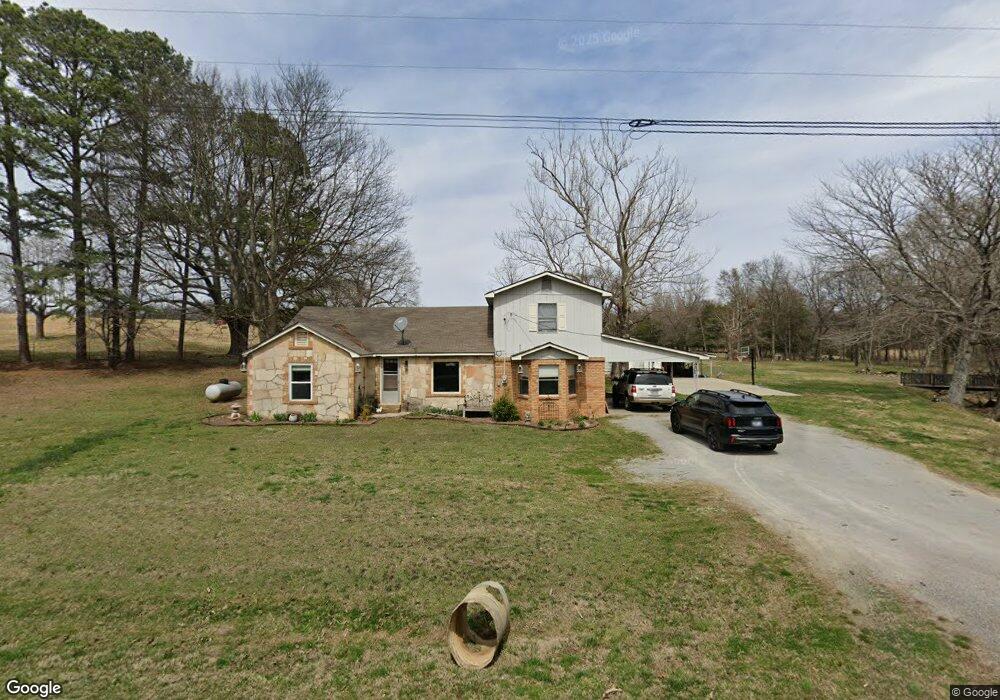
1560 Middlebrook Rd Maynard, AR 72444
Estimated Value: $125,000 - $313,000
Studio
3
Baths
2,785
Sq Ft
$64/Sq Ft
Est. Value
About This Home
This home is located at 1560 Middlebrook Rd, Maynard, AR 72444 and is currently estimated at $178,932, approximately $64 per square foot. 1560 Middlebrook Rd is a home located in Randolph County with nearby schools including Maynard Elementary School and Maynard High School.
Ownership History
Date
Name
Owned For
Owner Type
Purchase Details
Closed on
Dec 30, 2016
Sold by
Steele Jacque and Steele Donald
Bought by
Ulmer Dustin and Ulmer Myranda
Current Estimated Value
Home Financials for this Owner
Home Financials are based on the most recent Mortgage that was taken out on this home.
Original Mortgage
$48,000
Interest Rate
4.08%
Mortgage Type
Closed End Mortgage
Purchase Details
Closed on
Jun 17, 2003
Bought by
Rapert To Steele Drollinger and Rapert To Steele Ulmer
Create a Home Valuation Report for This Property
The Home Valuation Report is an in-depth analysis detailing your home's value as well as a comparison with similar homes in the area
Purchase History
| Date | Buyer | Sale Price | Title Company |
|---|---|---|---|
| Ulmer Dustin | $60,000 | None Available | |
| Rapert To Steele Drollinger | -- | -- |
Source: Public Records
Mortgage History
| Date | Status | Borrower | Loan Amount |
|---|---|---|---|
| Closed | Ulmer Dustin | $48,000 |
Source: Public Records
Tax History
| Year | Tax Paid | Tax Assessment Tax Assessment Total Assessment is a certain percentage of the fair market value that is determined by local assessors to be the total taxable value of land and additions on the property. | Land | Improvement |
|---|---|---|---|---|
| 2025 | $91 | $16,990 | $410 | $16,580 |
| 2024 | $191 | $16,990 | $410 | $16,580 |
| 2023 | $291 | $17,595 | $410 | $17,185 |
| 2022 | $341 | $17,595 | $410 | $17,185 |
| 2021 | $341 | $17,595 | $410 | $17,185 |
| 2020 | $395 | $18,955 | $435 | $18,520 |
| 2019 | $396 | $18,955 | $435 | $18,520 |
| 2018 | $421 | $18,955 | $435 | $18,520 |
| 2017 | $677 | $16,630 | $220 | $16,410 |
| 2016 | $711 | $19,385 | $2,975 | $16,410 |
| 2015 | $711 | $19,385 | $2,975 | $16,410 |
| 2014 | $673 | $19,385 | $2,975 | $16,410 |
Source: Public Records
Map
Nearby Homes
- 13322 Arkansas 115
- 77 Mock St
- TBD Minorca Rd
- Tbd Minorca Rd Unit LotWP001
- 152 Lentz St
- 831 Ripley Ff-1
- 917 Hummingbird Trail
- 538 Fowler Rd
- 449 Thompson Rd
- 000 Carmickle Rd
- 8771 Arkansas 115
- 70 Kenzie Trail
- 2814 Ripley N-2
- 0 Spring Bay Rd
- 380 Current River Trail
- 190 Current River Trail
- 8673 Highway 251
- 41 County Road 1851
- 64 Trails End Ln
- 38 Ripley E Unit U4-B
- 1307 Middlebrook Rd
- 1878 Middlebrook Rd
- 2041 Middlebrook Rd
- 1107 Middlebrook Rd
- 1104 Middlebrook Rd
- 1081 Middlebrook Rd
- 1728 Northside Rd
- 2064 Middlebrook Rd
- 311 Siloam Rd
- 1042 Middlebrook Rd
- 1542 Northside Rd
- 1043 Middlebrook Rd Unit M-L
- 2120 Middlebrook Rd
- 458 Mile Rd
- 1707 Northside Rd
- 271 Mile Rd
- 89 Mile Rd
- 393 Mile Rd
- 2251 Middlebrook Rd
- 301 Mile Rd
Your Personal Tour Guide
Ask me questions while you tour the home.