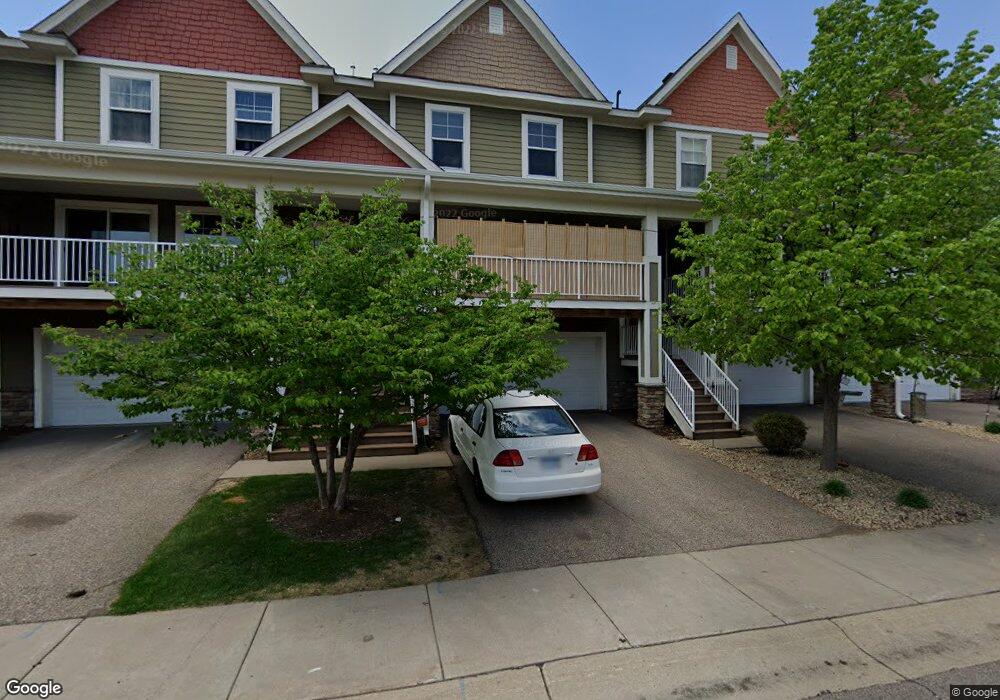
1561 Crawford Dr Unit 12 Saint Paul, MN 55118
Estimated Value: $229,000 - $293,450
2
Beds
2
Baths
1,568
Sq Ft
$162/Sq Ft
Est. Value
About This Home
This home is located at 1561 Crawford Dr Unit 12, Saint Paul, MN 55118 and is currently estimated at $253,613, approximately $161 per square foot. 1561 Crawford Dr Unit 12 is a home located in Dakota County with nearby schools including Garlough Environmental Magnet, Heritage E-STEM Magnet School, and Two Rivers High School.
Ownership History
Date
Name
Owned For
Owner Type
Purchase Details
Closed on
Dec 30, 2020
Sold by
Zagrzebski Jason C and Zagrzebski Nicole
Bought by
Carter Latishia
Current Estimated Value
Home Financials for this Owner
Home Financials are based on the most recent Mortgage that was taken out on this home.
Original Mortgage
$199,500
Outstanding Balance
$177,615
Interest Rate
2.7%
Mortgage Type
New Conventional
Estimated Equity
$75,999
Create a Home Valuation Report for This Property
The Home Valuation Report is an in-depth analysis detailing your home's value as well as a comparison with similar homes in the area
Home Values in the Area
Average Home Value in this Area
Purchase History
| Date | Buyer | Sale Price | Title Company |
|---|---|---|---|
| Carter Latishia | $210,000 | Legacy Title | |
| Carter Latishia Latishia | $210,000 | -- |
Source: Public Records
Mortgage History
| Date | Status | Borrower | Loan Amount |
|---|---|---|---|
| Open | Carter Latishia | $199,500 | |
| Closed | Carter Latishia Latishia | $207,900 |
Source: Public Records
Tax History Compared to Growth
Tax History
| Year | Tax Paid | Tax Assessment Tax Assessment Total Assessment is a certain percentage of the fair market value that is determined by local assessors to be the total taxable value of land and additions on the property. | Land | Improvement |
|---|---|---|---|---|
| 2024 | $2,780 | $234,300 | $28,200 | $206,100 |
| 2023 | $2,780 | $237,900 | $29,900 | $208,000 |
| 2022 | $2,438 | $227,600 | $29,800 | $197,800 |
| 2021 | $2,374 | $201,700 | $25,900 | $175,800 |
| 2020 | $2,352 | $195,900 | $24,700 | $171,200 |
| 2019 | $2,174 | $189,400 | $23,500 | $165,900 |
| 2018 | $1,872 | $170,000 | $21,900 | $148,100 |
| 2017 | $1,912 | $155,800 | $20,300 | $135,500 |
| 2016 | $2,134 | $152,900 | $18,500 | $134,400 |
| 2015 | $2,062 | $147,600 | $18,100 | $129,500 |
| 2014 | -- | $138,300 | $16,900 | $121,400 |
| 2013 | -- | $110,200 | $16,100 | $94,100 |
Source: Public Records
Map
Nearby Homes
- 186 Emerson Ave E
- 1694 Humboldt Ave
- 48 Thompson Ave W Unit 40
- Capri Plan at Thompson Square East
- Barcelona Plan at Thompson Square East
- Athens Plan at Thompson Square East
- Athens II Plan at Thompson Square East
- Bayfield Plan at Thompson Square East
- Hayward Plan at Thompson Square East
- 1531 Traverse Ln
- 362 Trenton Ln
- 366 Trenton Ln
- 1518 Traverse Ln
- 364 Trenton Ln
- 1523 Traverse Ln
- 360 Trenton Ln
- 1541 Traverse Ln
- 358 Trenton Ln
- 1522 Traverse Ln
- 1520 Traverse Ln
- 1563 Crawford Dr Unit 13
- 1565 Crawford Dr
- 1563 Crawford Dr
- 1561 Crawford Dr
- 1559 Crawford Dr
- 1555 Crawford Dr
- 1555 Crawford Dr Unit 10
- 1565 Crawford Dr Unit 14
- 1556 W James Ave
- 1559 1559 Crawford Dr
- 1561 1561 Crawford Dr
- 1563 1563 Crawford-Drive-
- 1563 1563 Crawford Dr
- 1563 1563 Crawford Ave
- 1562 1562 Crawford Dr
- 1560 James Ave
- 1560 James Ave
- 1562 James Ave
- 1562 James Ave
- 1562 James Ave