Estimated Value: $240,000 - $301,000
4
Beds
2
Baths
1,824
Sq Ft
$150/Sq Ft
Est. Value
About This Home
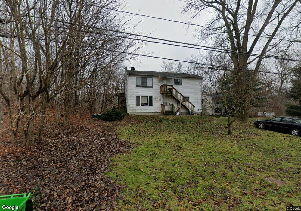
This home is located at 1562 Mac Dr Unit 1566, Stow, OH 44224 and is currently estimated at $273,524, approximately $149 per square foot. 1562 Mac Dr Unit 1566 is a home located in Summit County with nearby schools including Stow-Munroe Falls High School, Primrose School of Hudson, and Holy Family Elementary School.
Ownership History
Date
Name
Owned For
Owner Type
Purchase Details
Closed on
Oct 8, 2025
Sold by
Collins Mark F
Bought by
Sigma Square Enterprises Llc
Current Estimated Value
Purchase Details
Closed on
Sep 27, 1996
Sold by
Grote William
Bought by
Mohan Chander and Mohan Jatinder
Home Financials for this Owner
Home Financials are based on the most recent Mortgage that was taken out on this home.
Original Mortgage
$93,600
Interest Rate
7.97%
Mortgage Type
New Conventional
Create a Home Valuation Report for This Property
The Home Valuation Report is an in-depth analysis detailing your home's value as well as a comparison with similar homes in the area
Home Values in the Area
Average Home Value in this Area
Purchase History
| Date | Buyer | Sale Price | Title Company |
|---|---|---|---|
| Sigma Square Enterprises Llc | $105,000 | None Listed On Document | |
| Mohan Chander | $117,000 | -- |
Source: Public Records
Mortgage History
| Date | Status | Borrower | Loan Amount |
|---|---|---|---|
| Previous Owner | Mohan Chander | $93,600 |
Source: Public Records
Tax History Compared to Growth
Tax History
| Year | Tax Paid | Tax Assessment Tax Assessment Total Assessment is a certain percentage of the fair market value that is determined by local assessors to be the total taxable value of land and additions on the property. | Land | Improvement |
|---|---|---|---|---|
| 2025 | $3,927 | $67,193 | $10,661 | $56,532 |
| 2024 | $3,927 | $67,193 | $10,661 | $56,532 |
| 2023 | $3,927 | $67,193 | $10,661 | $56,532 |
| 2022 | $3,455 | $52,088 | $8,264 | $43,824 |
| 2021 | $3,107 | $52,088 | $8,264 | $43,824 |
| 2020 | $3,207 | $52,080 | $8,260 | $43,820 |
| 2019 | $2,670 | $42,360 | $7,760 | $34,600 |
| 2018 | $2,629 | $42,360 | $7,760 | $34,600 |
| 2017 | $2,617 | $42,360 | $7,760 | $34,600 |
| 2016 | $2,664 | $40,970 | $7,760 | $33,210 |
| 2015 | $2,617 | $40,970 | $7,760 | $33,210 |
| 2014 | $2,730 | $40,970 | $7,760 | $33,210 |
| 2013 | $2,813 | $44,400 | $7,760 | $36,640 |
Source: Public Records
Map
Nearby Homes
- 1470 Mac Dr
- 4877 Cedar Crest Ln
- 4891 Cedar Crest Ln
- 0 Hibbard Dr
- 1664 Cypress Ct
- 1808 Higby Dr Unit A
- V/L Lawnmark Dr
- 1627 Cypress Ct
- 1938 Higby Dr
- 4630 Red Willow Rd
- 1620 Sapphire Dr
- 1511 Apollo Dr
- 1759 E Sapphire Dr
- 1884 Village Ct Unit X66
- V/L Norton Rd
- 2327 Crockett Cir
- 5217 Beckett Ridge
- V/L Housley Rd
- 0 Stow Rd Unit 5102979
- 2140 Woodlawn Cir Unit 2144
- 1556 Mac Dr
- 1552 Mac Dr Unit 1556
- 1552 1556 Mac Dr
- 1552 1556 Stow Dr
- 1578 Mac Dr
- 1542 Mac Dr Unit 1546
- 4870 Darrow Rd
- 4824 Darrow Rd
- 4834 Darrow Rd
- 4872 Darrow Rd
- 1553 Meadowbrook Blvd
- 4812 Darrow Rd
- 4901 Mctaggart Ct
- 4886 Darrow Rd
- 1493 Mac Dr
- 1563 Meadowbrook Blvd
- 0 Tbd Darrow Rd
- 1247 Cypress Ct
- 1547 Meadowbrook Blvd
- 4814 Darrow Rd