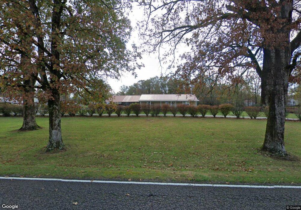
1562 Monroe Floyd Rd Decherd, TN 37324
Estimated Value: $251,318 - $367,000
--
Bed
1
Bath
1,456
Sq Ft
$217/Sq Ft
Est. Value
About This Home
This home is located at 1562 Monroe Floyd Rd, Decherd, TN 37324 and is currently estimated at $316,080, approximately $217 per square foot. 1562 Monroe Floyd Rd is a home located in Franklin County with nearby schools including North Middle School and Franklin County High School.
Ownership History
Date
Name
Owned For
Owner Type
Purchase Details
Closed on
Aug 20, 2020
Sold by
Anderson Edward and Anderson Patricia
Bought by
Sons Lori L and Sons Jamie R
Current Estimated Value
Purchase Details
Closed on
Aug 13, 2018
Sold by
Hall Christopher D
Bought by
Anderson Edward and Anderson Patricia
Purchase Details
Closed on
Mar 20, 2008
Sold by
Vanderbilt Mtg And Finance
Bought by
Anderson Edward W
Purchase Details
Closed on
Aug 24, 1990
Bought by
Anderson Edward and Patricia Ann
Purchase Details
Closed on
Aug 23, 1990
Purchase Details
Closed on
Aug 22, 1990
Bought by
Anderson Edward and Patricia Ann
Purchase Details
Closed on
Aug 9, 1990
Sold by
Patricia Anderson
Bought by
Anderson James Woodroe
Purchase Details
Closed on
May 20, 1980
Bought by
Anderson Edward
Create a Home Valuation Report for This Property
The Home Valuation Report is an in-depth analysis detailing your home's value as well as a comparison with similar homes in the area
Home Values in the Area
Average Home Value in this Area
Purchase History
| Date | Buyer | Sale Price | Title Company |
|---|---|---|---|
| Sons Lori L | -- | None Available | |
| Anderson Edward | -- | None Available | |
| Anderson Edward W | $30,000 | -- | |
| Anderson Edward | -- | -- | |
| -- | -- | -- | |
| Anderson Edward | -- | -- | |
| Anderson James Woodroe | -- | -- | |
| Anderson Edward | $8,700 | -- |
Source: Public Records
Tax History Compared to Growth
Tax History
| Year | Tax Paid | Tax Assessment Tax Assessment Total Assessment is a certain percentage of the fair market value that is determined by local assessors to be the total taxable value of land and additions on the property. | Land | Improvement |
|---|---|---|---|---|
| 2024 | $1,218 | $61,025 | $10,850 | $50,175 |
| 2023 | $951 | $61,025 | $10,850 | $50,175 |
| 2022 | $1,048 | $55,875 | $10,850 | $45,025 |
| 2021 | $962 | $55,875 | $10,850 | $45,025 |
| 2020 | $1,499 | $40,350 | $13,150 | $27,200 |
| 2019 | $1,534 | $53,300 | $20,175 | $33,125 |
| 2018 | $977 | $55,950 | $20,175 | $35,775 |
| 2017 | $977 | $36,525 | $6,225 | $30,300 |
| 2016 | $886 | $33,150 | $5,425 | $27,725 |
| 2015 | $886 | $33,150 | $5,425 | $27,725 |
| 2014 | $887 | $33,158 | $0 | $0 |
Source: Public Records
Map
Nearby Homes
- 999 Sherrill Rd
- 392 Sherrill Rd
- 0 Finney Rd
- 0 Aedc Rd Unit RTC2974914
- 0 Aedc Rd Unit RTC2974915
- 511 Woods Lake Rd
- 3211 Gum Creek Rd
- 1510 Penile Hill Rd
- 8246 Aedc Rd
- 56 Lightfoot Ln
- 134 Lightfoot Ln
- 0 Lightfoot Ln
- 0 Duliba Dr
- 90 Duliba Dr
- 4352 Knights Church Rd
- 296 Penile Dr
- 0 Old Brick Church Rd
- 66 Wilder Chapel Rd
- 106 Wilder Chapel Rd
- 0 Spur Rd Unit RTC3013804
- 3 Monroe Floyd Rd
- 0 Monroe Floyd Rd
- 1620 Monroe Floyd Rd
- 1436 Monroe Floyd Rd
- 1582 Monroe Floyd Rd
- 1456 Monroe Floyd Rd
- 971 Sherrill Rd
- 931 Sherrill Rd
- 1392 Monroe Floyd Rd
- 897 Sherrill Rd
- 1697 Monroe Floyd Rd
- 894 Sherrill Rd
- 842 Sherrill Rd
- 694 Sherrill Rd
- 639 Sherrill Rd
- 654 Sherrill Rd
- 2024 Monroe Floyd Rd
- 2066 Monroe Floyd Rd
- 570 Sherrill Rd
- 1023 Monroe Ln