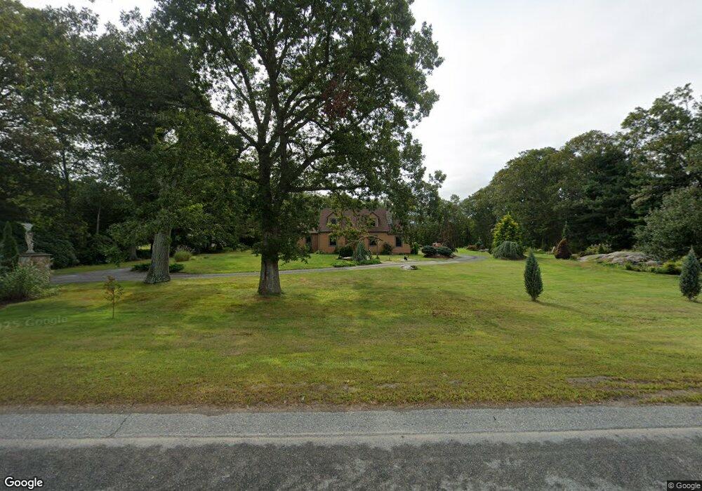
1566 Scituate Ave Cranston, RI 02921
Western Cranston NeighborhoodEstimated Value: $455,000 - $538,000
2
Beds
2
Baths
1,398
Sq Ft
$362/Sq Ft
Est. Value
About This Home
This home is located at 1566 Scituate Ave, Cranston, RI 02921 and is currently estimated at $506,330, approximately $362 per square foot. 1566 Scituate Ave is a home located in Providence County with nearby schools including Orchard Farms El. School, Western Hills Middle School, and Cranston High School West.
Ownership History
Date
Name
Owned For
Owner Type
Purchase Details
Closed on
Dec 10, 2012
Sold by
Eleanor A Judge T
Bought by
Defazio Charlotte
Current Estimated Value
Home Financials for this Owner
Home Financials are based on the most recent Mortgage that was taken out on this home.
Original Mortgage
$162,000
Outstanding Balance
$109,316
Interest Rate
3.46%
Estimated Equity
$397,014
Create a Home Valuation Report for This Property
The Home Valuation Report is an in-depth analysis detailing your home's value as well as a comparison with similar homes in the area
Home Values in the Area
Average Home Value in this Area
Purchase History
| Date | Buyer | Sale Price | Title Company |
|---|---|---|---|
| Defazio Charlotte | $155,000 | -- |
Source: Public Records
Mortgage History
| Date | Status | Borrower | Loan Amount |
|---|---|---|---|
| Open | Defazio Charlotte | $162,000 |
Source: Public Records
Tax History Compared to Growth
Tax History
| Year | Tax Paid | Tax Assessment Tax Assessment Total Assessment is a certain percentage of the fair market value that is determined by local assessors to be the total taxable value of land and additions on the property. | Land | Improvement |
|---|---|---|---|---|
| 2025 | $5,397 | $388,800 | $179,200 | $209,600 |
| 2024 | $5,292 | $388,800 | $179,200 | $209,600 |
| 2023 | $5,315 | $281,200 | $118,000 | $163,200 |
| 2022 | $5,205 | $281,200 | $118,000 | $163,200 |
| 2021 | $5,062 | $281,200 | $118,000 | $163,200 |
| 2020 | $4,991 | $240,300 | $112,400 | $127,900 |
| 2019 | $4,991 | $240,300 | $112,400 | $127,900 |
| 2018 | $4,876 | $240,300 | $112,400 | $127,900 |
| 2017 | $4,735 | $206,400 | $101,100 | $105,300 |
| 2016 | $4,634 | $206,400 | $101,100 | $105,300 |
| 2015 | $4,634 | $206,400 | $101,100 | $105,300 |
| 2014 | $4,522 | $198,000 | $101,100 | $96,900 |
Source: Public Records
Map
Nearby Homes
- 02 Paula Ln
- 01 Paula Ln
- 121 Ashbrook Dr
- 12 Beechwood Dr
- 9 Gray Coach E
- 11 Raven Cir
- 2 Mulberry Dr
- 129 Valerie Ct
- 2202 Scituate Ave
- 80 Tomahawk Trail
- 10 Honey Lou Ct
- 2073 Plainfield Pike
- 7 Taylor Rd
- 0 W Bluebird Ln
- 3 Equestrian Ln
- 53 Charcalee Dr
- 18 Quail Ridge Rd
- 0 Anthony Dr Unit 1394338
- 191 Pippin Orchard Rd
- 321 Laten Knight Rd
- 1584 Scituate Ave
- 1536 Scituate Ave
- 132 Cranberry Terrace
- 1626 Scituate Ave
- 1616 Scituate Ave
- 4 Alpine Estates Dr
- 0 Alpine Estates Dr
- 125 Cranberry Terrace
- 1636 Scituate Ave
- 1476 Scituate Ave
- 8 Alpine Estates Dr
- 20 Alpine Estates Dr
- 1656 Scituate Ave
- 10 Thyme Dr
- 15 Alpine Estates Dr
- 114 Cranberry Terrace
- 30 Alpine Estates Dr
- 111 Cranberry Terrace
- 15 Thyme Dr
- 1418 Scituate Ave