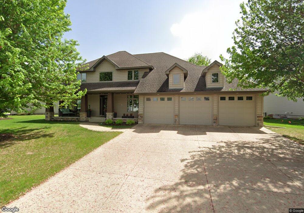
1567 Sandbar Cir Waconia, MN 55387
Estimated Value: $683,693 - $753,000
4
Beds
3
Baths
2,684
Sq Ft
$266/Sq Ft
Est. Value
About This Home
This home is located at 1567 Sandbar Cir, Waconia, MN 55387 and is currently estimated at $714,423, approximately $266 per square foot. 1567 Sandbar Cir is a home located in Carver County with nearby schools including Bayview Elementary School, Waconia Middle School, and Waconia High School.
Ownership History
Date
Name
Owned For
Owner Type
Purchase Details
Closed on
Sep 22, 2005
Sold by
Lenzen Kenneth D
Bought by
Rakos Kip R and Rakos Rebecca L
Current Estimated Value
Purchase Details
Closed on
Apr 21, 2005
Sold by
Weinzierl Leone and Weinzierl Andrew
Bought by
Lenzen Kenneth D
Purchase Details
Closed on
Aug 21, 2002
Sold by
B&H Land Llc
Bought by
Weinzierl Leone
Purchase Details
Closed on
Aug 15, 2001
Sold by
B & H Land Llc
Bought by
Weinzierl Leone
Create a Home Valuation Report for This Property
The Home Valuation Report is an in-depth analysis detailing your home's value as well as a comparison with similar homes in the area
Home Values in the Area
Average Home Value in this Area
Purchase History
| Date | Buyer | Sale Price | Title Company |
|---|---|---|---|
| Rakos Kip R | $499,442 | -- | |
| Lenzen Kenneth D | $125,000 | -- | |
| Weinzierl Leone | $58,500 | -- | |
| Weinzierl Leone | $58,000 | -- |
Source: Public Records
Mortgage History
| Date | Status | Borrower | Loan Amount |
|---|---|---|---|
| Closed | Weinzierl Leone | -- |
Source: Public Records
Tax History Compared to Growth
Tax History
| Year | Tax Paid | Tax Assessment Tax Assessment Total Assessment is a certain percentage of the fair market value that is determined by local assessors to be the total taxable value of land and additions on the property. | Land | Improvement |
|---|---|---|---|---|
| 2025 | $8,666 | $660,900 | $115,000 | $545,900 |
| 2024 | $8,362 | $654,800 | $115,000 | $539,800 |
| 2023 | $8,440 | $654,800 | $115,000 | $539,800 |
| 2022 | $7,438 | $675,200 | $99,000 | $576,200 |
| 2021 | $7,482 | $523,000 | $82,600 | $440,400 |
| 2020 | $7,232 | $522,300 | $82,600 | $439,700 |
| 2019 | $7,342 | $496,900 | $78,600 | $418,300 |
| 2018 | $6,702 | $496,900 | $78,600 | $418,300 |
| 2017 | $5,820 | $477,900 | $76,400 | $401,500 |
| 2016 | $5,820 | $419,800 | $0 | $0 |
| 2015 | $5,162 | $411,300 | $0 | $0 |
| 2014 | $5,162 | $343,900 | $0 | $0 |
Source: Public Records
Map
Nearby Homes
- 1740 Sandbar Cir
- 144 Stacy Cir
- 830 Foxglove Terrace
- 926 Foxglove Terrace
- 930 Foxglove Terrace
- 1036 Goldenrod Trail
- 1034 Goldenrod Trail
- 911 Foxglove Terrace
- 811 Foxglove Terrace
- 157 Snowdrop Trail
- 720 Winterberry Ln
- 716 Winterberry Ln
- 718 Winterberry Ln
- 714 Winterberry Ln
- 712 Winterberry Ln
- 722 Winterberry Ln
- 726 Winterberry Ln
- 201 Snowdrop Trail
- 203 Snowdrop Trail
- The Henry Plan at The Fields of Waconia - Tradition
- 1563 Sandbar Cir
- 1671 Sandbar Cir
- 1675 Sandbar Cir
- 1562 Sandbar Cir
- 1568 Sandbar Cir
- 1564 Sandbar Cir
- 1560 Sandbar Cir
- 1672 Sandbar Cir
- 1636 Seashell Ln
- 1640 Seashell Ln
- 1558 Sandbar Cir
- 1679 Sandbar Cir
- 1676 Sandbar Cir
- 1644 Seashell Ln
- 1559 Sandbar Cir
- 1554 Sandbar Cir
- 1555 Sandbar Cir
- 1648 Seashell Ln
- 1550 Sandbar Cir
- 1683 Sandbar Cir