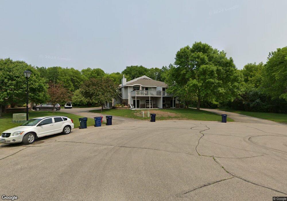
1569 Baylor Ct Unit A Saint Paul, MN 55122
Estimated Value: $280,000 - $297,000
1
Bed
2
Baths
1,073
Sq Ft
$269/Sq Ft
Est. Value
About This Home
This home is located at 1569 Baylor Ct Unit A, Saint Paul, MN 55122 and is currently estimated at $288,260, approximately $268 per square foot. 1569 Baylor Ct Unit A is a home located in Dakota County with nearby schools including Thomas Lake Elementary School, Black Hawk Middle School, and Eastview Senior High School.
Ownership History
Date
Name
Owned For
Owner Type
Purchase Details
Closed on
Aug 3, 2021
Sold by
Noblet Kenneth and Noblet Cathy
Bought by
Devon Bank
Current Estimated Value
Purchase Details
Closed on
Dec 1, 2012
Sold by
Blomgren James K and Blomgren Deanna S
Bought by
Blomgren James K and Blomgren Deanna S
Purchase Details
Closed on
Nov 17, 2004
Sold by
Anderson Deborah J
Bought by
Blomgren James K and Blomgren Deanna S
Purchase Details
Closed on
Aug 23, 2002
Sold by
Rohde Michael C
Bought by
Anderson Deborah J
Purchase Details
Closed on
Sep 5, 1996
Sold by
Hud
Bought by
Mackey Leslie A and Kaye Robert A
Purchase Details
Closed on
May 30, 1996
Sold by
Kachel Warner E
Bought by
Rohde Michael C
Create a Home Valuation Report for This Property
The Home Valuation Report is an in-depth analysis detailing your home's value as well as a comparison with similar homes in the area
Home Values in the Area
Average Home Value in this Area
Purchase History
| Date | Buyer | Sale Price | Title Company |
|---|---|---|---|
| Devon Bank | -- | Gcs Title | |
| Blomgren James K | -- | None Available | |
| Blomgren James K | $201,400 | -- | |
| Anderson Deborah J | $177,800 | -- | |
| Mackey Leslie A | $101,847 | -- | |
| Rohde Michael C | $103,000 | -- |
Source: Public Records
Tax History Compared to Growth
Tax History
| Year | Tax Paid | Tax Assessment Tax Assessment Total Assessment is a certain percentage of the fair market value that is determined by local assessors to be the total taxable value of land and additions on the property. | Land | Improvement |
|---|---|---|---|---|
| 2024 | $2,940 | $282,000 | $56,700 | $225,300 |
| 2023 | $2,668 | $279,400 | $56,300 | $223,100 |
| 2022 | $2,540 | $268,400 | $56,200 | $212,200 |
| 2021 | $2,352 | $237,400 | $48,800 | $188,600 |
| 2020 | $2,236 | $216,700 | $46,500 | $170,200 |
| 2019 | $1,880 | $202,200 | $44,300 | $157,900 |
| 2018 | $1,913 | $182,900 | $41,000 | $141,900 |
| 2017 | $1,875 | $180,500 | $37,300 | $143,200 |
| 2016 | $1,836 | $170,400 | $35,500 | $134,900 |
| 2015 | $1,561 | $144,027 | $29,533 | $114,494 |
| 2014 | -- | $123,644 | $26,806 | $96,838 |
| 2013 | -- | $114,052 | $23,583 | $90,469 |
Source: Public Records
Map
Nearby Homes
- 1605 Clemson Dr Unit A
- 4234 Boulder Ridge Point
- 1617 Clemson Dr Unit B
- 4168 Arbor Ln
- 1656 Oakbrooke Way
- 4199 Knob Cir Unit 102
- 1645 Hickory Hill Dr
- 1650 Hickory Hill Dr
- 1669 Walnut Ln
- 1569 Lancaster Ln
- 4143 Meadowlark Point
- 4156 Hilltop Ln
- 1536 Stonewood Ln
- 1381 Berry Ridge Rd Unit 403
- 4100 Meadowlark Ln
- 4613 1/2 Penkwe Way
- 1780 Talon Trail
- 1511 Deerwood Bend
- 4290 Blackhawk Rd
- 1630 Murphy Pkwy
- 1569 Baylor Ct Unit B
- 1571 Baylor Ct Unit B
- 1571 Baylor Ct Unit A
- 1575 Baylor Ct Unit A
- 1575 Baylor Ct Unit B
- 1577 Baylor Ct Unit B
- 1577 Baylor Ct Unit A
- 1566 Wexford Ct
- 1562 Wexford Ct
- 1568 Baylor Ct Unit A
- 1568 Baylor Ct Unit B
- 1570 Wexford Ct
- 1566 Baylor Ct Unit B
- 1566 Baylor Ct Unit A
- 1564 Baylor Ct Unit A
- 1564 Baylor Ct Unit B
- 1564 Baylor Ct
- 4242 Wexford Way
- 1560 Baylor Ct Unit B
- 1560 Baylor Ct Unit A